@ABJ_LFC Spanish lad next to me in Annie Road kept videoing the crowd around us each time we conceded. Asked him why and he said ‘I’m just a premier league fan’ grounds finished
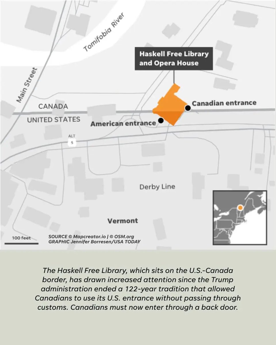
The Haskell Opera House is built directly on the US-Canada border. The line cuts right across the theater stage, meaning actors can start a monologue standing in Vermont and finish the sentence while walking into Quebec, Canada
The Pan-American Highway is an engineering marvel that stretches almost continuously across two continents. But it completely falls apart at the Darien Gap. Environmental concerns, thick swamp terrain, and lawless jungle made crossing this 60-mile stretch impossible
Svalbard has the most relaxed immigration laws on earth because of an international treaty. You don't need permission from the Norwegian government to live there, regardless of your passport. The only catch is you have to survive the extreme Arctic elements #Geography
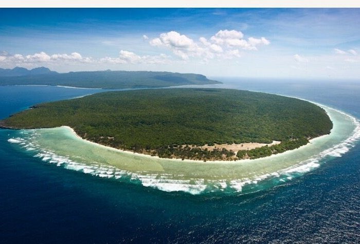
Jaco Island is a tiny patch of land in East Timor that was completely omitted from official Dutch colonial maps for generations. Because the local indigenous people considered the island sacred and refused to step foot on it, mapmakers simply assumed nothing was there
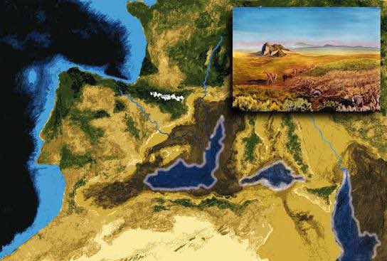
The Mediterranean Sea is slowly disappearing. Because the African tectonic plate is moving northward at a rate of about one inch every year, it is slowly crashing into Europe. Millions of years from now, the sea will be squeezed shut, creating a massive mountain range #Geography
Before Angola existed, Cabinda was home to kingdoms including Ngoyo, Kakongo and Loango.
So how did this region end up as part of Angola, separated by the DRC?
The full story 👇
https://t.co/pMztsJ5HSK
Due to a faulty map used during the Treaty of Paris in 1783, surveyors drew a border line that accidentally cut off a tiny chunk of Minnesota. Known as the Northwest Angle, it is the only place in the contiguous US that sits north of the 49th parallel #Geography
Cabinda is only 7,200 km², yet it produces around 55% of Angola’s oil.
So why is this tiny, oil-rich part of Angola separated from the rest of the country?
I explain the story 👇
https://t.co/pMztsJ5HSK
#Angola#Cabinda#Geography
There’s a piece of Angola that isn’t connected to the rest of the country.
Cabinda sits across the DRC, creating one of the strangest borders in Africa.
But why does this bizarre border exist?
Full video 👇
https://t.co/pMztsJ5HSK
#Angola#Geography
There’s a part of Angola that isn’t connected to the rest of the country.
Cabinda is separated from Angola by a tiny strip of the DRC. Yet it produces a huge share of Angola’s oil.
So why does this bizarre border exist? 👇
https://t.co/pMztsJ5HSK
#Angola#Geography
In 1578, a sailor on a British expedition claimed he found a large, fertile island near Greenland and named it Buss Island. It stayed on official maritime maps for years before explorers realized the sailor had just misidentified a massive ice sheet shrouded in fog #Geography
There is no single "correct" way to look at a world map. Maps printed in Europe put Europe in the center, while maps printed in East Asia split the Atlantic Ocean to put Asia in the middle. The way we view global geography depends entirely on where the map was printed #Geography
When European powers drew the borders of the modern Middle East after WWI, they literally used rulers to draw straight lines across the desert. These lines completely ignored the actual geographic landmarks and traditional tribal boundaries, splitting communities in half
The Great Green Wall project in Africa isn't just about planting trees, it's a massive geographic intervention. By planting a wall of vegetation across the width of the continent, nations are physically altering the local wind and moisture patterns to push back the desert
Wake Island is a tiny coral atoll in the absolute middle of the Pacific Ocean, thousands of miles from any continent. It serves as one of the most strategic geographic outposts for the US military, acting as an unsinkable concrete runway in the middle of deep water #Geography
In 1955, Britain sent Royal Marines to claim a tiny rock in the middle of the Atlantic. 🇬🇧
They arrived aboard HMS Vidal, landed on Rockall and planted the Union Jack.
It sounds bizarre, but there was a reason Britain wanted it.
🎥 Full video: https://t.co/FVo1Thkqct
#Rockall
In 1828, the captain of a ship called the Nimrod reported seeing a cluster of islands south of New Zealand. Mapmakers dutifully added them to world charts, where they stayed for 80 years until a dedicated exploration ship went to the exact spot and found empty ocean