I had a fantastic day today at the @NI_AGI geospatial conference with @PhelimBirch!
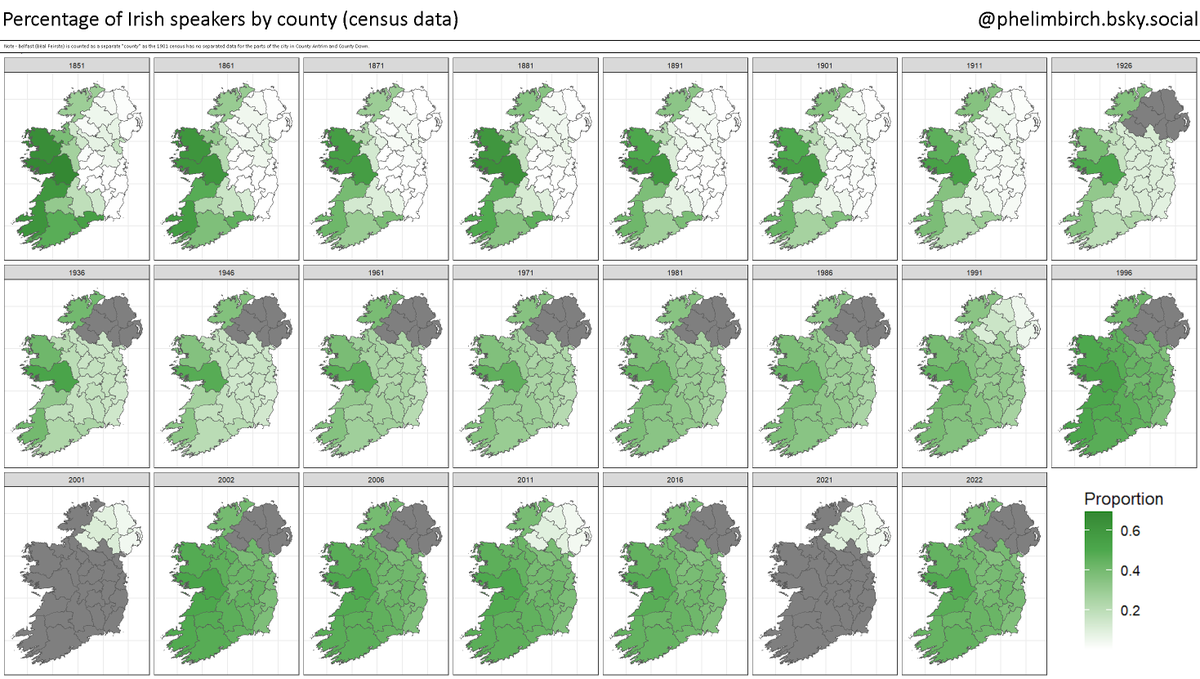
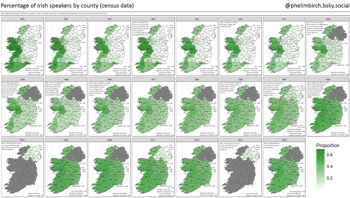
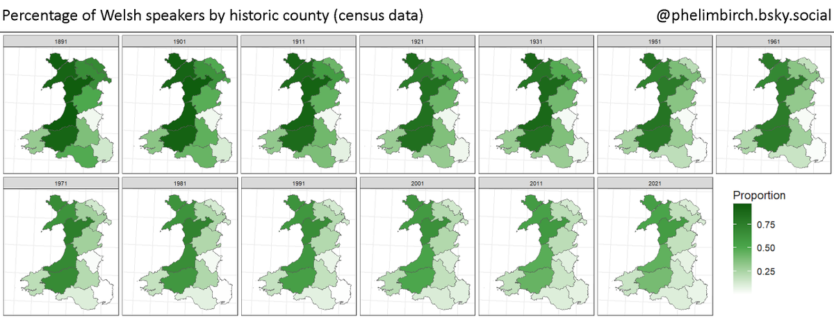
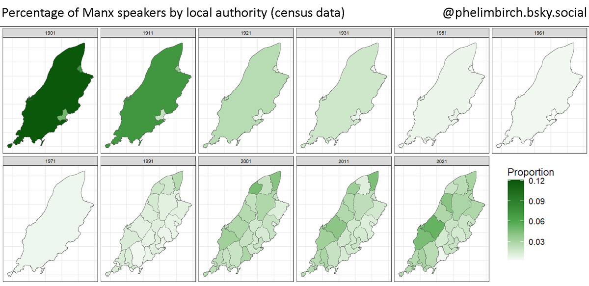
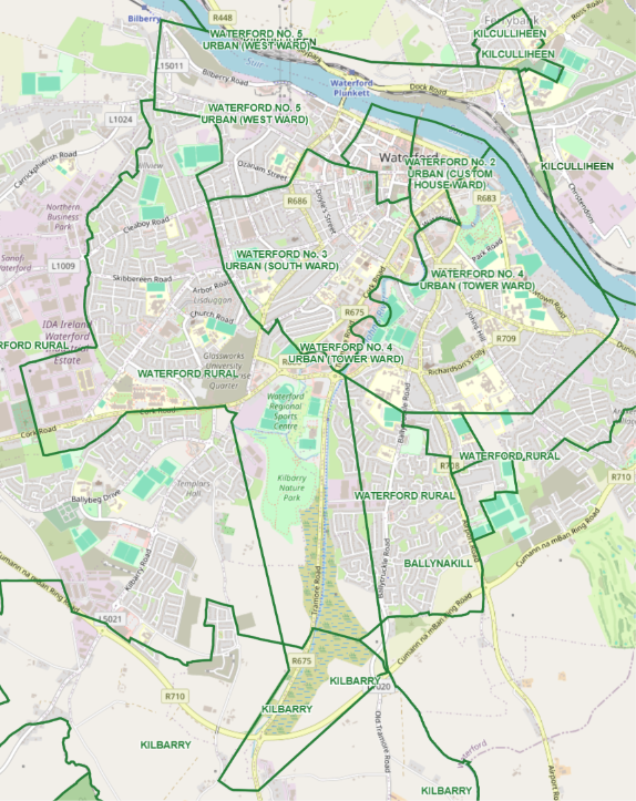
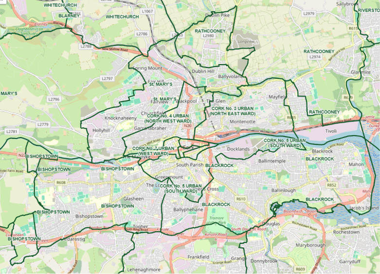
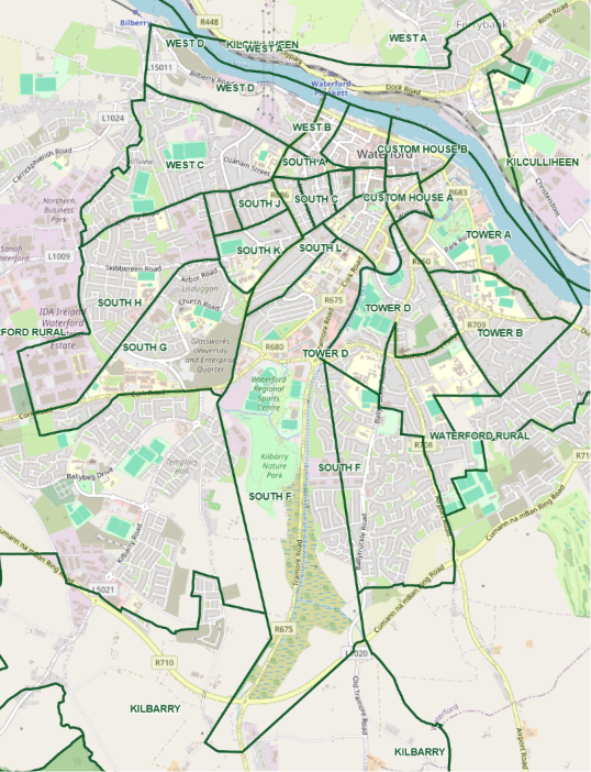
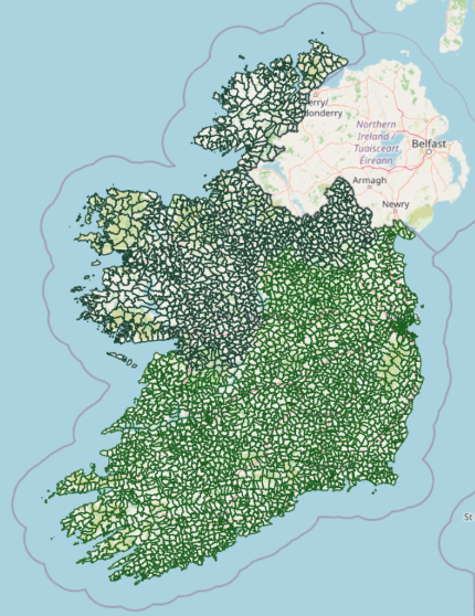
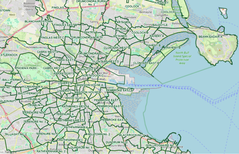
We saw a lot of interest in Civgraph, our website for Ireland’s maps, Census and election data.
Three more sets of digitised Dáil constituency maps now available on https://t.co/b93cOTi0UE
1969 (used in 1969 and 1973 elections)
1961 (used in 1961 and 1965 elections)
1959 (deemed unconstitutional, never used)
I have recently digitised three sets of historic Dáil constituencies:
1983 (used in 1987 and 1989 elections)
1980 (used in 1981, Feb 1982 and Nov 1982 elections)
1974 (used in 1977 election)
All publicly accessible on https://t.co/b93cOTi0UE
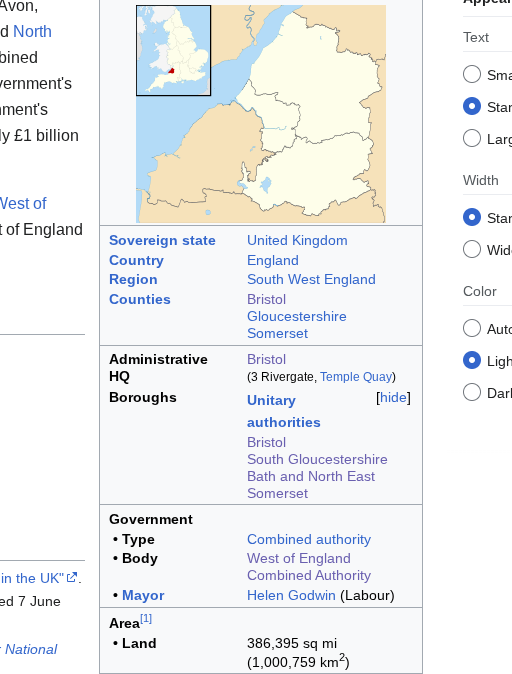
Was doing a bit of research for work, and found a Wiki box wherein it gives the West of England Combined Authority a land area of 1,000,000km2 - which is about the same size as Egypt.
The math ain't mathin' on that one.
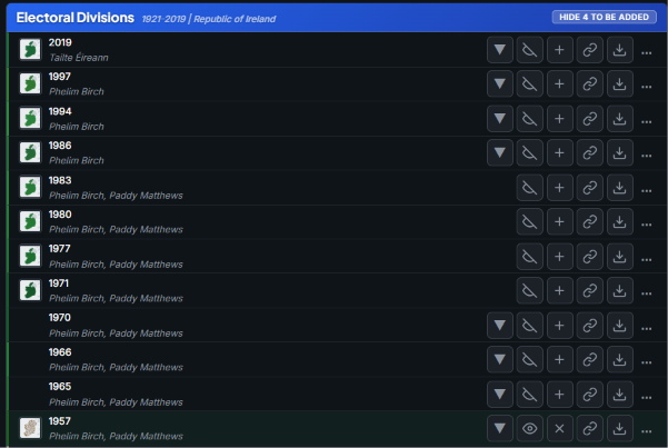
@TomEDewey1948@RealAlbanianPat Thanks! The CSO census maps go back a bit further to 2011, but I've had to put everything earlier than that together myself