Former weatherman and hockey fan livin in the lesser side of PA. No mystical energy field controls my destiny. It's all a lot of simple tricks and nonsense.
A funnel cloud was observed south of Alpine Creek Lodge along the Denali Highway on July 4, 2026, at approximately 5:00 PM AKDT. The sighting occurred in a remote area, about 80 miles northeast of Talkeetna and 70 miles northwest of Glennallen. Post 1 of 5. #akwx
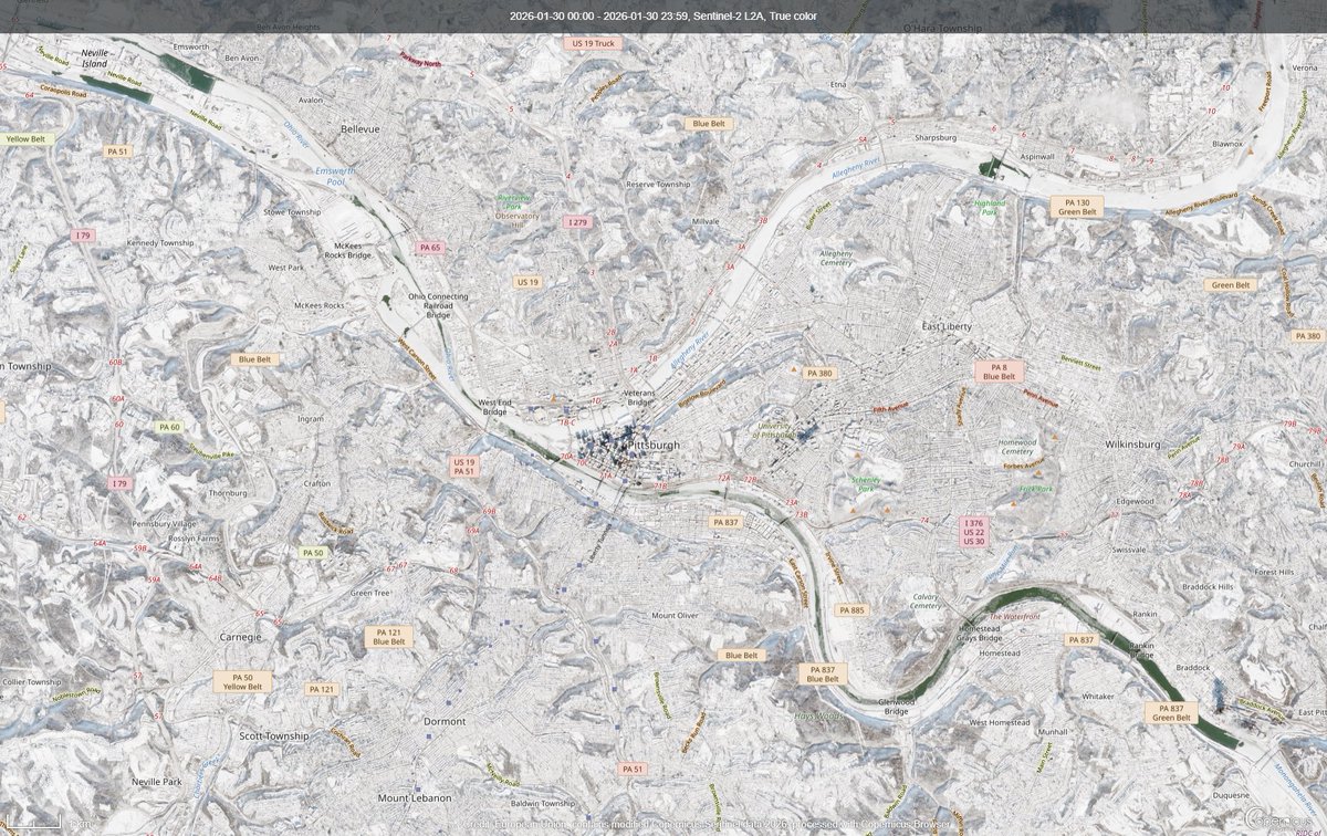
Clear skies today provided our first good satellite view of the area since our snowfall and deep freeze. Sentinel-2 imagery shows a mostly iced-over Allegheny, but still open channel on the Mon and Ohio Rivers.
🥶 A big pattern change is on the way starting late Monday. The coldest airmass so far this season will bring wind chills in the teens & 20s by Tuesday morning. Temps Tuesday will struggle to climb into the 40s, along with winds gusting 30-40 mph possible. #PAwx#NJwx#DEwx#MDwx
Multi-panel view of the last few days of Hurricane Melissa:
↖️ GOES-19 infrared brightness temp
↗️ GOES-19 visible satellite
↙️ Hurricane hunter planes & flight paths
↘️ Recon-derived flight level wind swath
⬇️ Estimated minimum pressure from recon dropsondes
A thread of videos from today’s flight into Hurricane Melissa
In this first one we are entering from the southeast just after sunrise and the bright arc on the far northwest eye wall is the light just beginning to make it over the top from behind us.
If you told me five years ago that I would capture a rocket launch on 35mm film over #Pittsburgh, I would have said that you were crazy. But here it is, the SpaceX Falcon 9 rocket, over the Steel City from a few days ago, captured on CineStill 800 film. Absolutely wild.
✍️🌡️💧 August 2025 went down as the coolest August in decades for some areas, with mean temps roughly 2°-5° below normal. It was the 2nd coolest August on record at Georgetown, DE. The AC Airport failed to reach 90° for the first time in August since 2014. #PAwx#NJwx#DEwx#MDwx
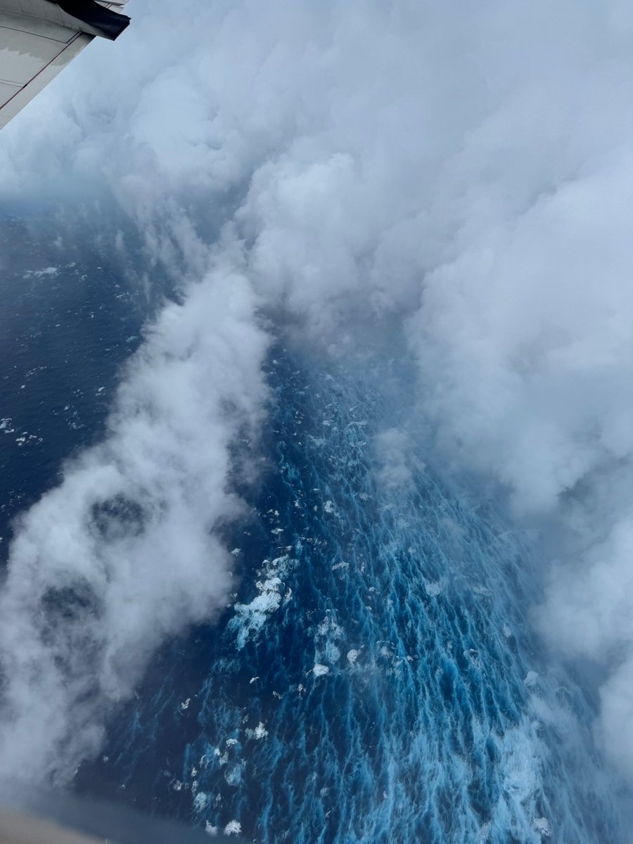
Aug 16: Images from @NOAA_HurrHunter and the @NOAASatellites Ocean Winds team show an intense eyewall in Hurricane #Erin This photo shows the ocean surface calm in the eye and roaring in the eyewall. For the latest forecast visit https://t.co/tW4KeGdBFb
Tsunami Warning/Advisory/Watch has been UPDATED as of 4:28PM on 7/29/2025.
Tsunami Warning/Advisory is now in effect for Aleutian and Pribilof Islands, and part of Alaska Peninsula. Much of coastal Alaska is in a Tsunami Watch. Here are the new headlines (1/4):
Heat Advisory in effect for Western North Slope, until Saturday night, with max temperatures of 80 to 90 degrees. The hottest temperatures will in the plains near Umiat. Hot temperatures may continue through the end of the weekend. #akwx
PIT's high of 91°F Thursday marks the 5th day in a row with temps at or above 90°F. While this happens every few years in Jul/Aug/Sep, it's fairly rare for June. The last time PIT had 5 or more 90° days in June was 1994.
Will we make it 6? The forecast for Friday is 89°F.
There's no doubt about it many were feeling hot, hot, hot today in the Eastern United States! Many daily records were set. By the way, if you want to cool off you had better luck in Las Vegas, NV today which only reached 94 for a high!