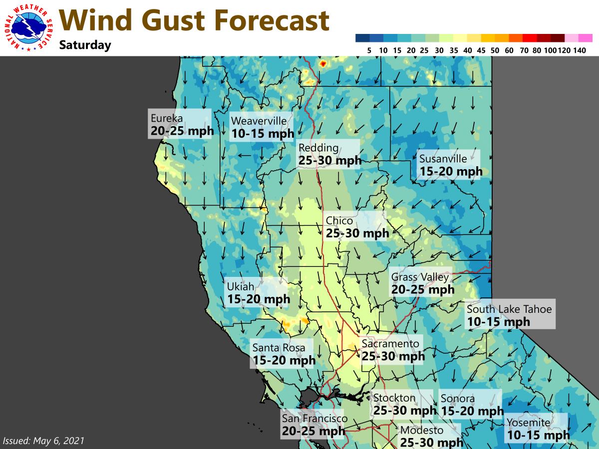
Very dry & breezy weather expected this weekend. Saturday gusts could reach 30 mph across interior #Norcal Please practice fire weather safety! For more on wildfire preparedness, visit https://t.co/4PbDmtOuXj #OneLessSpark#CAwx
Showers and thunderstorms will be possible across much of interior #NorCal today. The main threats with any storms would be small hail, brief heavy rain, gusty winds, & lightning. Remember, always take shelter if you hear thunder or see lightning! #CAwx
𝐏𝐔𝐁𝐋𝐈𝐂 𝐒𝐄𝐑𝐕𝐈𝐂𝐄 𝐀𝐍𝐍𝐎𝐔𝐍𝐂𝐄𝐌𝐄𝐍𝐓 🚨 We have seen an uptick in the number of Fentanyl-related deaths around Placer County over the past year. Please watch below 👇🏼 https://t.co/T7LXHUNP92
⚠️ A Winter Storm Warning has been issued as snow returns to the area. The heaviest snow is expected Sunday night - early Monday morning. Expect foothill and mountain travel delays & chain controls. Travel is highly discouraged! #cawx
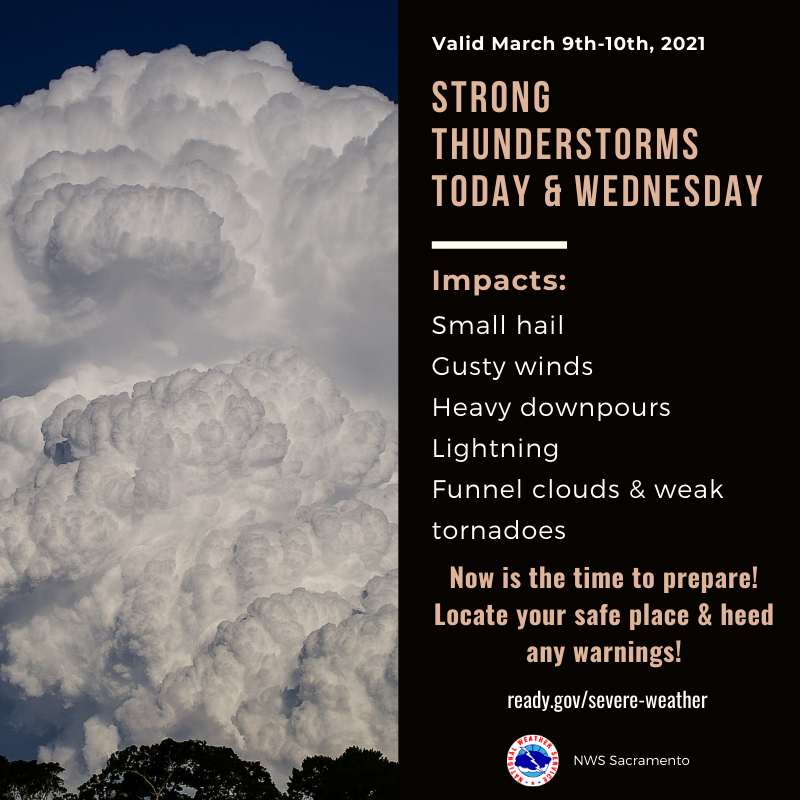
Thunderstorms are possible today & tomorrow afternoon & evening. Some thunderstorms could become strong with funnel clouds or weak tornadoes possible.
Now is the time to prepare! Locate your safe place & know what to do if a storm forms near you. https://t.co/xA6DIGPWkt #CAwx
Today's weather system will bring cooler temperatures to interior #NorCal. High temperatures across most of the area will be around 10-15 degrees cooler than yesterday. Valley temperatures today will be in the mid to upper 50s with cloudy skies & precipitation later today. #CAwx
Widespread rainfall & periods of moderate to heavy snow are expected today across #NorCal. Here's a look at forecast timing of the precipitation. It will spread south thru the area beginning late morning thru the afternoon. Heaviest precipitation is expected this evening. #CAwx
Here are the updated snow totals for the weather system moving across the area today into Friday morning. Except mountain travel delays, chain controls, and slick roads at times. If you must travel, have an emergency kit and leave plenty of extra time. #CAwx
Cool and unsettled weather is on the way. The next chance for precipitation could arrive as early as Thursday with chances lingering into the weekend. #cawx
We're not done, more precipitation is on the way! Here is a model loop depicting moderate to heavy rain and mountain snow spreading across the area tonight and continuing into Thursday. #CAwx
⚠️ A strong winter storm is forecast to create hazardous mountain travel late Sunday night - Monday. A Winter Storm Watch has been issued. Please plan for travel delays, chain controls, and slick roads. #CAwx
With the #COVID19 pandemic, there's more reason than ever this year to get your holiday shopping done early and avoid the crowds. Consider ordering from businesses in advance, with curbside pickup when possible. Other ideas to help reduce risk: https://t.co/mT12an9cad
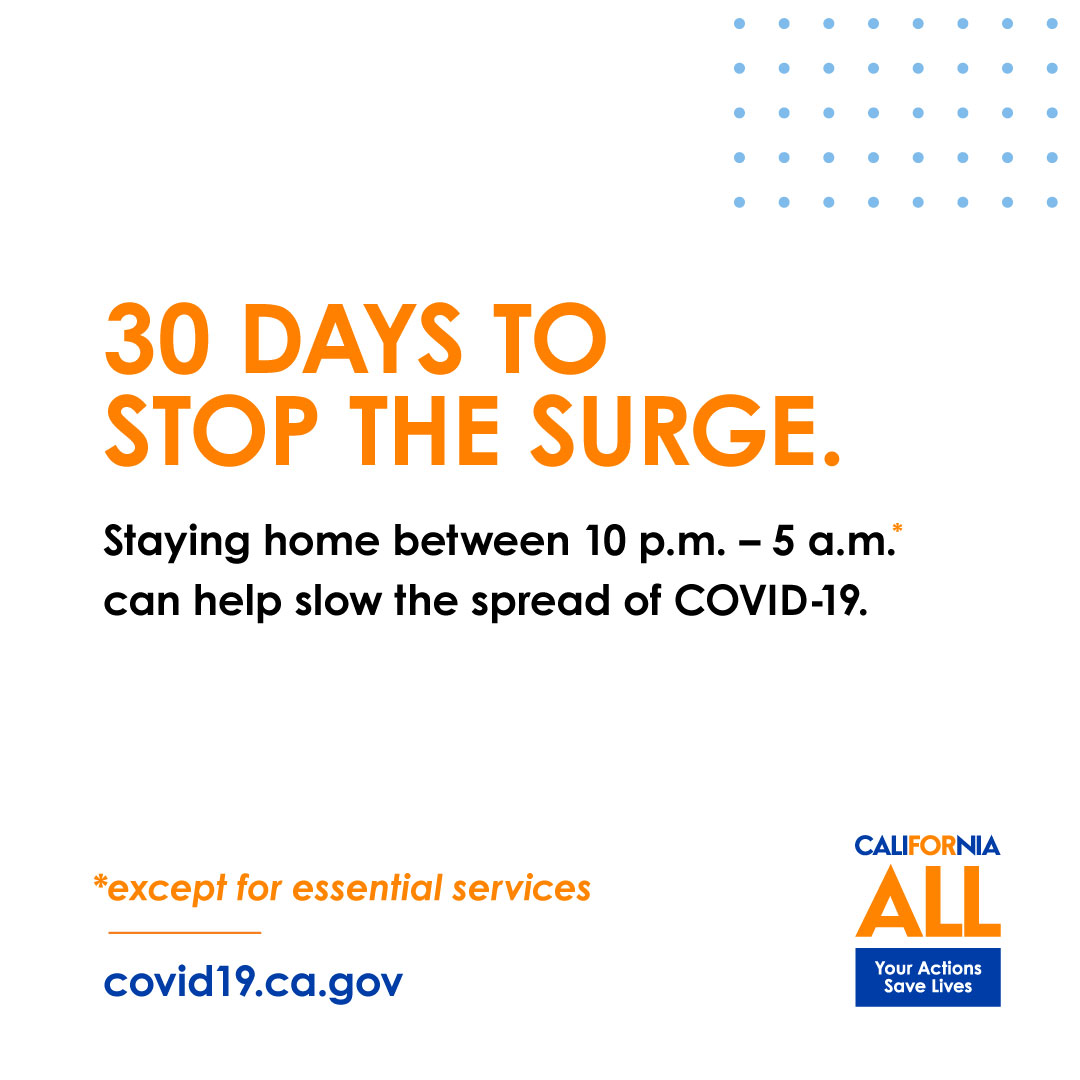
#COVID19 is increasing at alarming rates in #California + we all need to do our part to #StoptheSurge. To keep yourself + your loved ones safe, it's vital that we take precautions to celebrate the holidays more safely. California flattened the curve once and we can do it again.
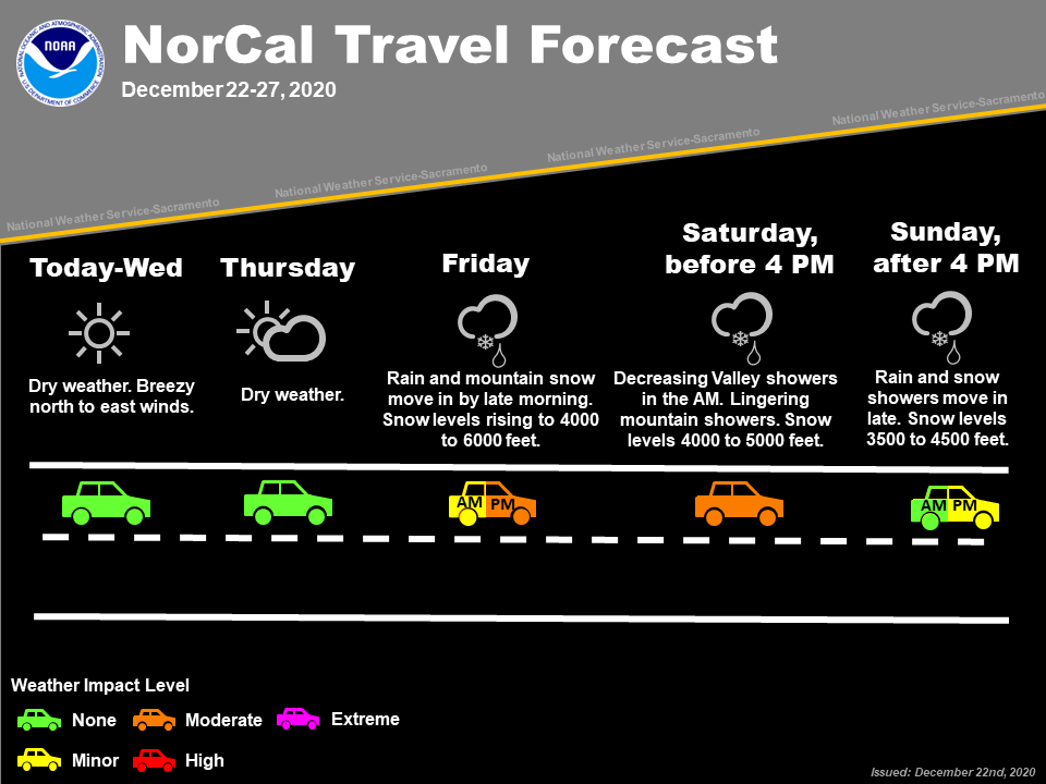
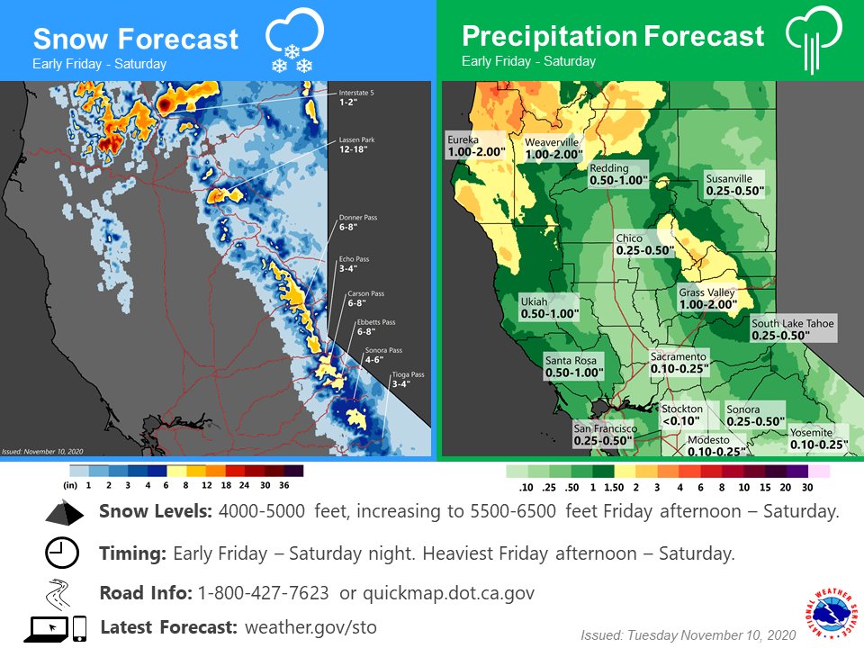
Rain & mountain snow return to #NorCal late this week. Here's a look at forecast precipitation amounts for early Friday - Saturday night. Keep in mind that forecast amounts could change as we get closer to the event. If you have mountain travel plans, expect travel impacts! #CAwx
No one wants to get sick and miss out on quality time during the holidays. Get a flu shot now, and better your chances of avoiding the flu. You will help protect yourself and those you spend time with.