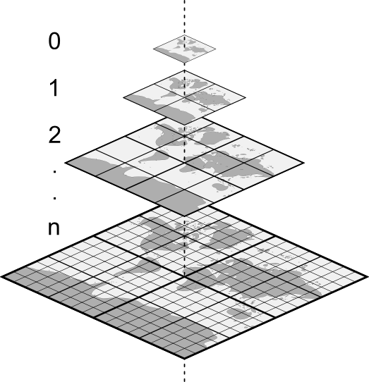
📢 Web mapping app developers! 🗺️🚀 XYZ tiling scheme has been the go-to for web mapping. OGC Tiles takes tiled map data to the next level. 🌍🔀 @tschaub introduced you to projections, zoom levels, and moving XYZ tile sets to OGC Tiles. https://t.co/N0PnLXYtDb
Planet's @sgillies is at it again! fio-planet, a package of Fiona CLI plugins from Planet Labs, is out. Read all about pipelines manipulating streams of GeoJSON features, without using more complicated tools such as GeoPandas, PostGIS, or QGIS. https://t.co/Ife3YVCtDH
Announcing the 2.0 release of our Python SDK! V2 abstracts out the details of interacting with Planet’s APIs. The new no-code CLI makes interaction with Planet APIs easy—so you can focus on actually using the data! https://t.co/va7S5NZaG2
@sgillies explains why Planet supports Python Geospatial Stack, and connects the dots between the open source native code projects (GDAL, GEOS, PROJ) and the core stack Shapely, Pyproj, Fiona, Rasterio, GeoPandas, PDAL, and Xarray. https://t.co/92ahcvv9sW
@kevinlacaille delivers a cloud project image collection—that's images in the cloud, not cloudy images: getting an account, setting up the JSON, a Python example, our no-code CLI, and your Planet data’s in Google #EarthEngine (GEE). https://t.co/Wc5GLwO7Kq
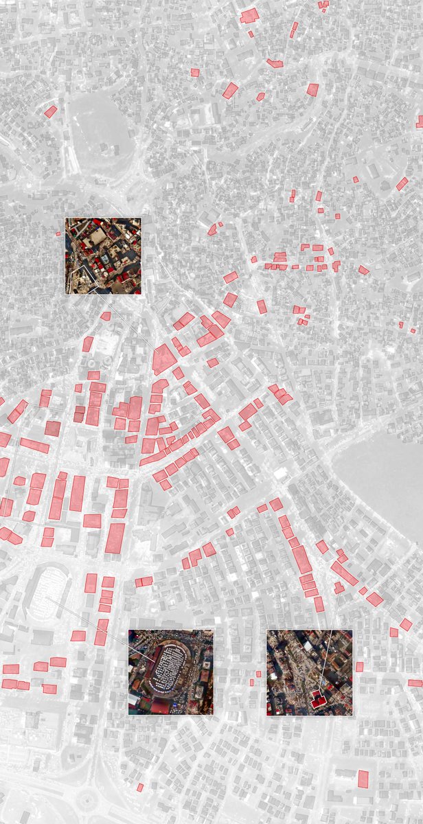
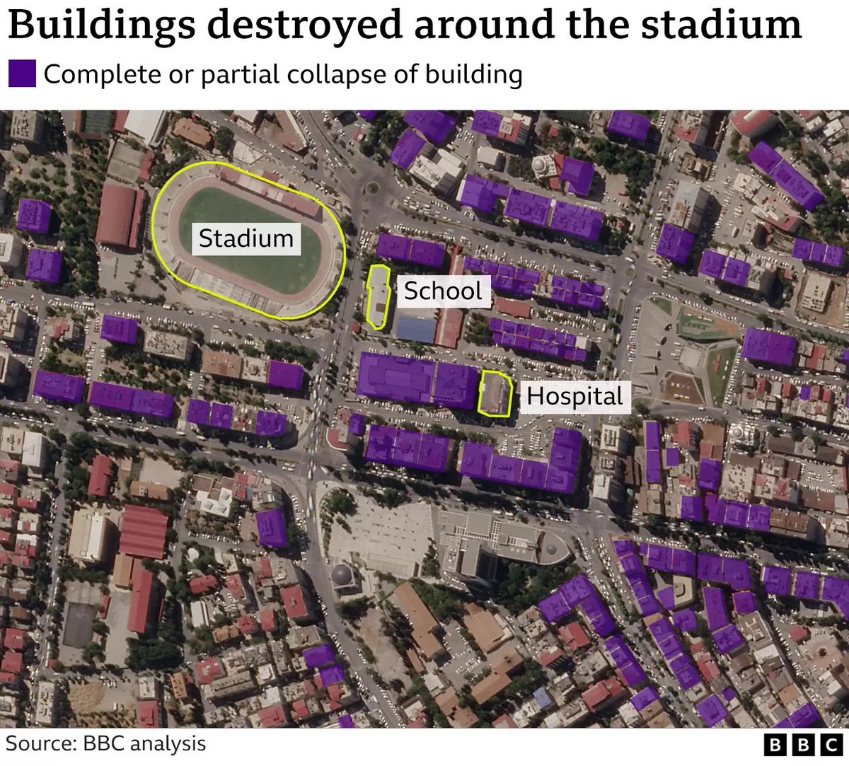
Incredibly fast work by reporters to produce building-by-building damage maps of Kahramanmaras, Turkey.
@NYtimes & @Microsoft - https://t.co/8QjsvnE7TM
@BBCWorld - https://t.co/8lKdp7h1iJ
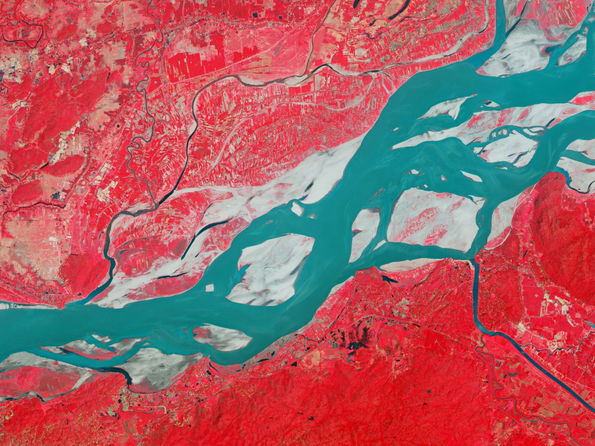
@Planet continues to make earthquake data available free 🇹🇷🇸🇾: [email protected]
Looking for a mapping library to use with React? We’ve released `@planet/maps`. It wraps OpenLayers classes in declarative React components, making it easy to integrate mapping functionality into your existing apps. https://t.co/cPW0YuQRM4
@sgillies talks about complexity, its impact, and how to manage it for geometry objects in this first Planet Developers Deep Dive: Simplifying Your Complex Area of Interest https://t.co/DoXcmZPJsV
Fun stats on @Planet's tally after yesterday's launch:
- 35th rocket (32nd successful) 🚀🚀
- 532 satellites deployed (+100% record of contact maintained)🛰️🛰️🛰️
--> Averaging >3 launches & >50 sats/yr for the past 9 yrs!
And on @SpaceX:
- 9th launch
- 155 satellites deployed :)
We’re proud to release the first beta of our Planet SDK for Python to make accessing Planet data even easier. It includes a flexible command-line interface and a newly designed Python API with async capabilities. Learn more at https://t.co/1MNnSlxmpI. Feedback welcome!
Happening now: Planet's Director of Strategic Science Initiatives @tanyaofmars is talking about how satellite imagery is used to do science in real life.
Feeling the FOMO? Register anyway - we'll send out a recording of today's webinar early next week.
https://t.co/ZC3jbNR7Wy
Join @PlanetDevs and I this Friday (Nov 4) at 8AM PT/11AM ET to learn how @planet's APIs can help you level up your scientific research!
Register for free at the link below:
https://t.co/YI7BSu0Fvq
Wondering what's new for developers on Planet's platform? Interested in getting your hands on our latest dev tools and resources?
Sign up for Planet's developer newsletter, Wavelengths, to get our quarterly digest of dev news delivered to your inbox! https://t.co/1brd6BmEam
How does @theduckylittle parse and serve raster data in Planet Explorer? He loads the images as NumpyTiles and applies enhancements dynamically. You too can conduct geospatial analysis from your browser with tools like the Explorer Image Enhancement Tool. https://t.co/XwKyj5mJUA
We had a lot of fun generating the examples for Basemaps in Orders. Check out the short-n-sweet Example Request using order type, raster tools, and cloud delivery. Right?!? https://t.co/pvvxbsK7oc
We’re thrilled to release support for ordering Planet Basemaps in our Orders API. You can now order using an area-of-interest, apply raster processing tools, and deliver to your cloud storage all in a single API call! Read more here: https://t.co/zLnNNILgPR
.@tschaub used our open source go-stac GitHub project to crawl publicly accessible STAC endpoints, recording millions of statistics. Check out the summary of the project and register to be included in our next crawl: https://t.co/JWa1TZL3gP
In our latest @planetdevs post, we share a #scipy2022 tutorial on "Eroding Coastlines: A GeoSpatial and Computer Vision Analysis" w/ Planeteers @kevinlacaille and Mansi Shah. Learn why coastal erosion matters, and get a link to the notebook and recording: https://t.co/JWa1TZL3gP