The weather is set to turn widely unsettled as we see out the last few days of 2024, with potentially some wet and very windy weather at times
Weather warnings are already in force for Monday and New Year's Eve across parts of the north ⚠️
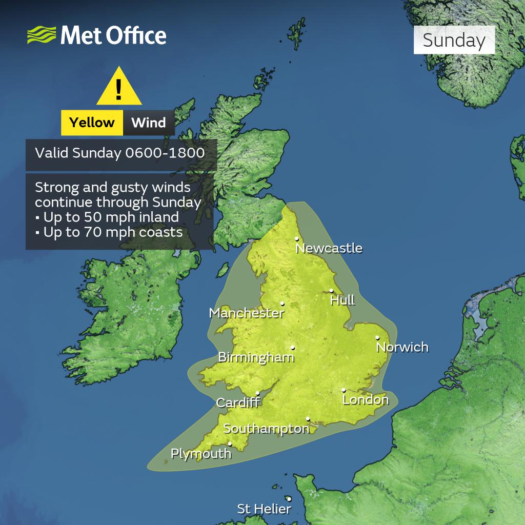
⚠️ Yellow weather warning issued ⚠️
Strong winds across England and Wales
Sunday 0600 – 1800
Latest info 👉 https://t.co/QwDLMfRBfs
Stay #WeatherAware⚠️
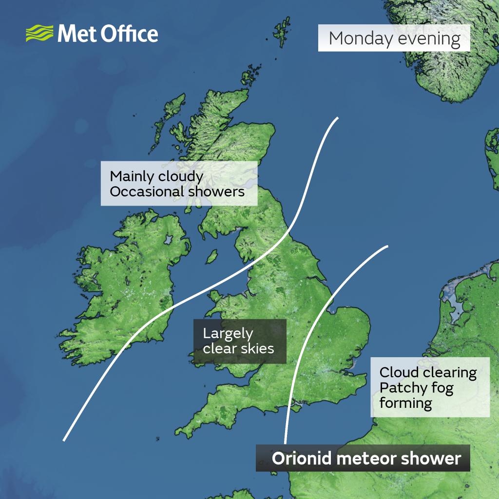
Look out for the Orionid meteor shower tonight!
The peak is tonight but don't worry if you have cloudy skies and can't see them - the #Orionids continue for another few weeks 🌠
📺 On Friday's episode of Kent Tonight:
🚔 Canterbury stabbing sees high street taped off
🚧 Dartford cafe closes due to roadworks
💛 Youth convention marks World Mental Health Day
Watch the full episode here 👇
https://t.co/ASCkDpKe6G
There's still some uncertainty in the track of #HurricaneKirk and how it may influence the weather across the UK mid to late next week
Each green line on this clip shows a possible track as it becomes an ex-hurricane and moves towards northwest Europe
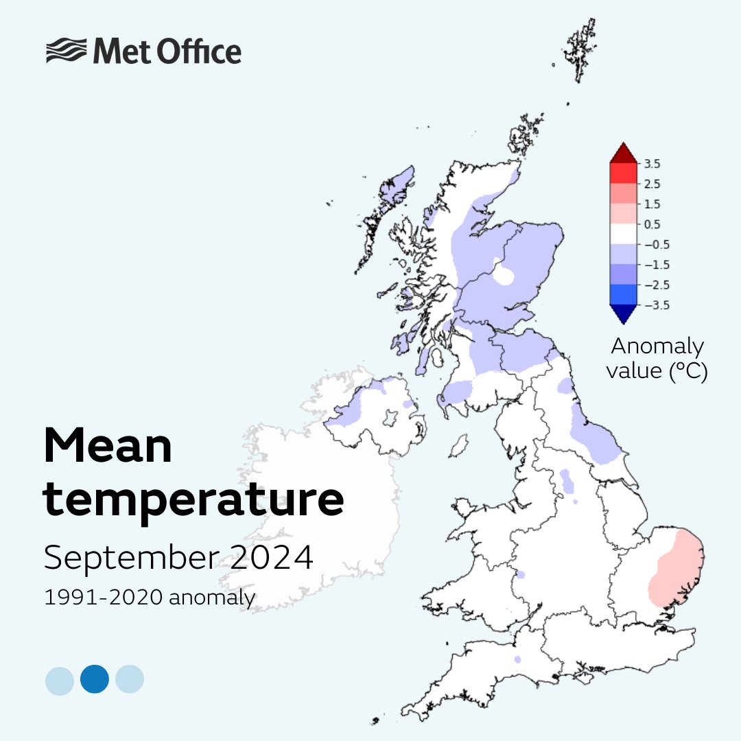
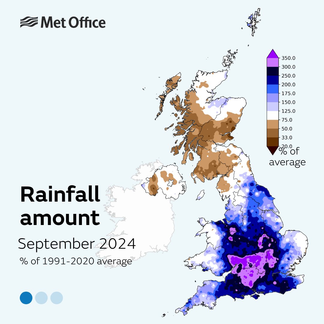
☔️ September 2024 has been the wettest September on record for some counties, according to provisional Met Office statistics.
Get the details in the Press Release below, or read this short thread 👇🧵
⚠️ Yellow weather warning issued ⚠️
Rain across central and southern parts of England and Wales
Thursday 1700 – Friday 1000
Latest info 👉 https://t.co/QwDLMfRBfs
Stay #WeatherAware⚠️
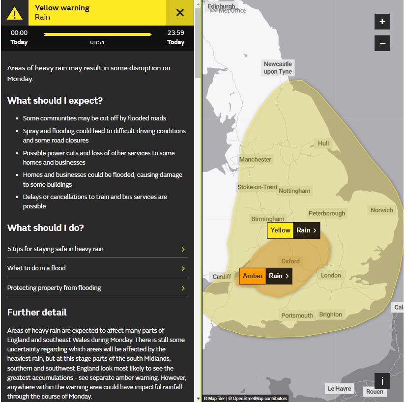
⚠️ Yellow weather warning UPDATED ⚠️
Heavy rain across parts of England and southeast Wales
Monday NOW – 23:59
Latest info 👉 https://t.co/QwDLMfRBfs
Stay #WeatherAware ⚠️
A cold but bright start to Sunday in the south ⛅
Cloudy with spots of rain and drizzle slowly moving into northern parts of England and Wales 🌧️
Sunny spells and heavy, blustery showers drifting in from the west over Scotland 🌦️