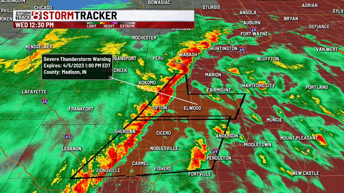
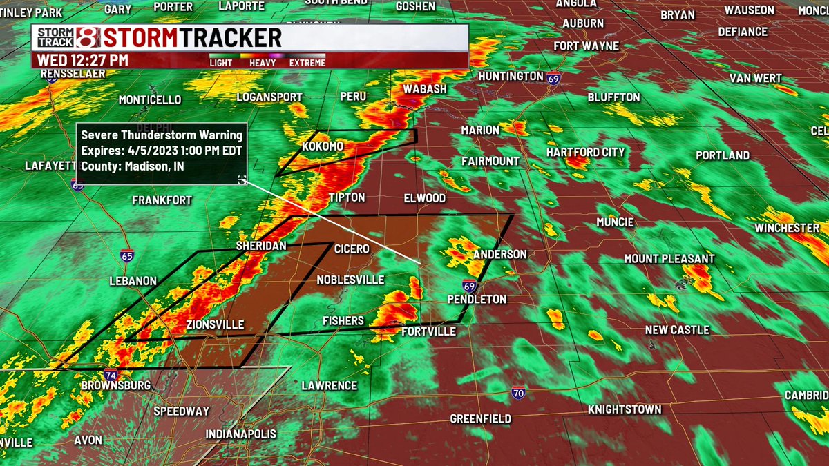
NEW Severe Thunderstorm Warning for portions of Delaware/Hamilton/Howard/Madison/Tipton counties until 1 PM EDT. Main hazard is 60 MPH wind gusts, but there is some rotation as well.
NEW Severe Thunderstorm Warning for portions of Boone/Hamilton/Madison counties until 1 PM EDT. Main hazard is 60 MPH wind gusts, but rotation is also being noted.
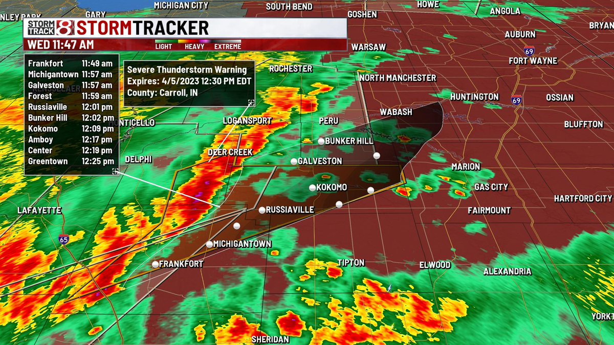
NEW Severe Thunderstorm Warning for portions of Carroll, Clinton, Howard, Tipton counties until 12:30 PM EDT. Movement is northeast at 55 MPH. Hazard is 60 MPH wind gusts, but there is also some rotation on this storm too.
Two EF1 tornadoes were confirmed by NWS in northern Hancock County from Monday's storms. The first tornado began 3 miles SSE of McCordsville and was on the ground for 3.34 miles. At 1:35 pm, there was a second more brief EF1 tornado 2 miles ESE Ingalls.
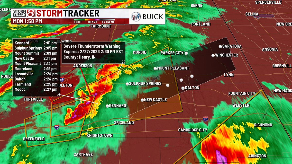
A new Severe Thunderstorm Warning has been issued for parts of Hancock/Madison/Delaware/Henry counties until 2:30 PM EST. Hazard is 60 MPH wind gusts and nickel sized hail, but there is also rotation occurring.
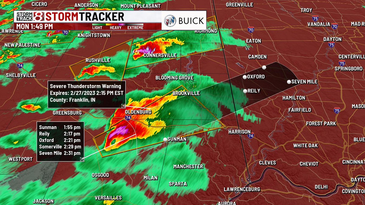
A new Tornado Warning has been issued for parts of Franklin/Dearborn/Ripley counties until 2:15 PM EST. This is a radar indicated threat and you need to take cover immediately!
A new Severe Thunderstorm Warning has been issued for portions of Franklin/Ripley/Dearborn counties until 2:15 PM EST. Hazard is 60 MPH wind gusts, but rotation is also occurring with this storm.
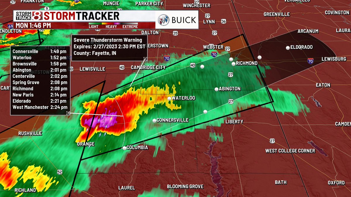
A new Severe Thunderstorm Warning is in effect for portions of Wayne, Fayette, and Union counties until 2:30 PM EST. Main hazard is 60 MPH wind gusts, but there is also rotation on it.
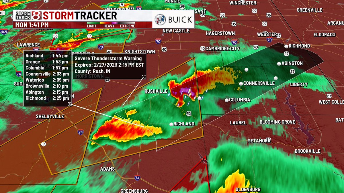
Severe thunderstorm warning for portions of Decatur and Rush continues until 2:15 PM EST. Hazard is 60 MPH wind gusts, but there is also rotation as well.
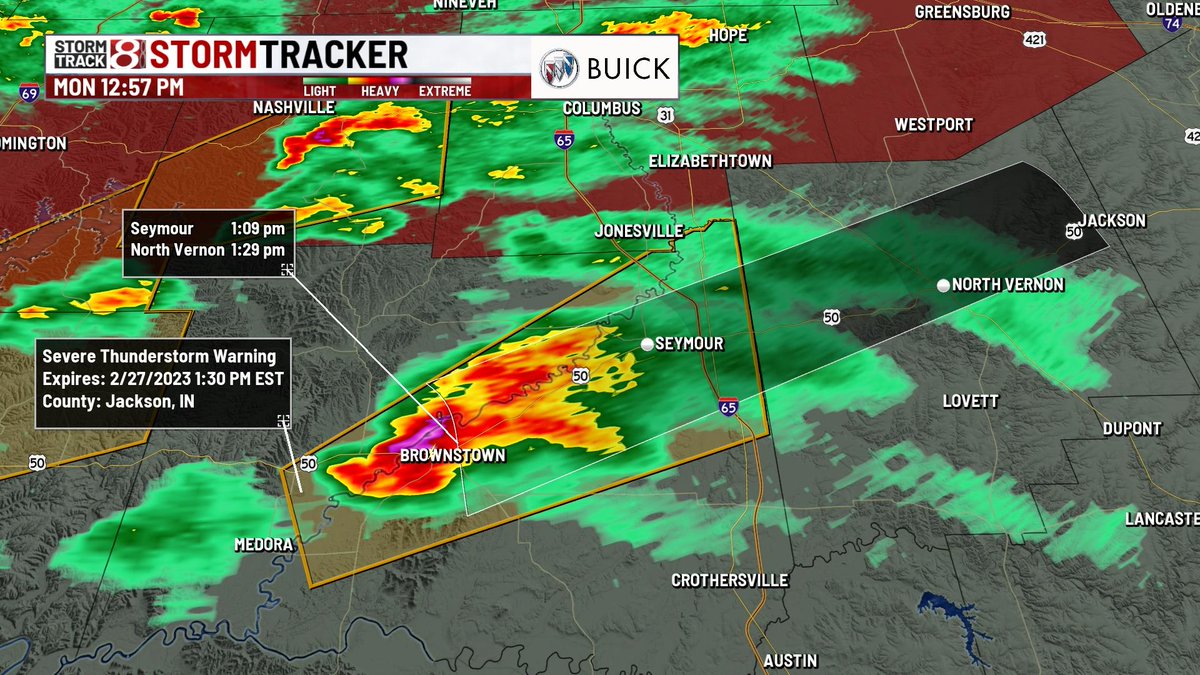
A new Severe Thunderstorm Warning has been issued for Jackson county until 1:30 PM EST. Hazard is 60 MPH wind gusts, but there is also some rotation on this storm too.
A new Severe Thunderstorm Warning has been issued for Brown county until 1:15 PM EST. Movement is northeast at 45 MPH. Hazard is 60 MPH wind gusts, but there is some rotation on it as well.
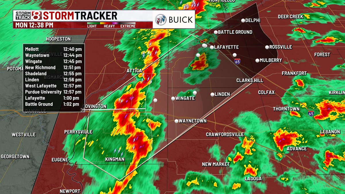
Strong thunderstorms are racing to the northeast at 55 MPH towards locations such as Wingate, Waynetown, and eventually Lafayette. Wind gusts up to 50-55 MPH and small hail are the main concerns.
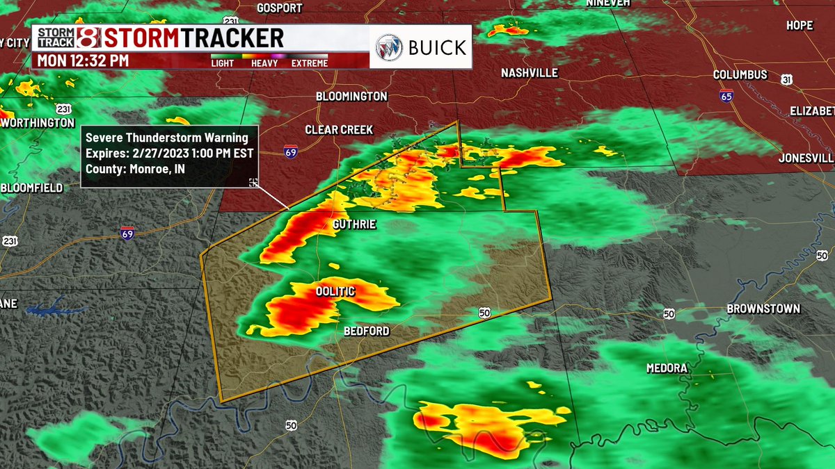
A new Severe Thunderstorm Warning has been issued for portions of Lawrence/Monroe counties until 1 PM EST. Main hazard is 60 MPH wind gusts, but there is also some rotation. This does NOT include Bloomington.
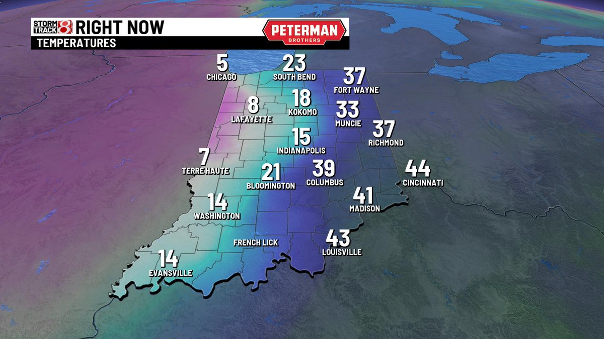
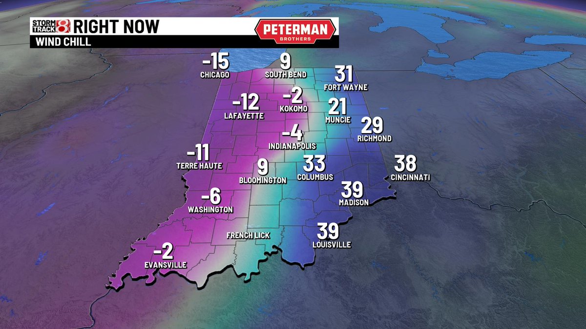
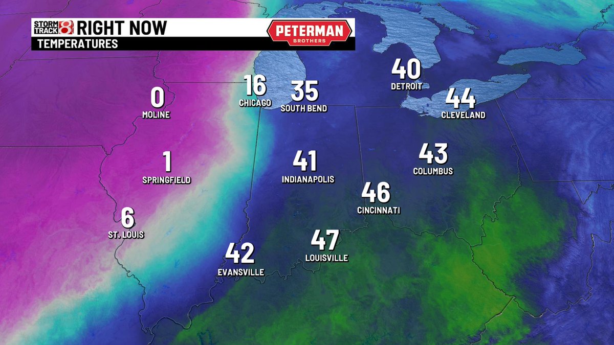
Current temperatures and wind chill as of 6:37 PM EST.
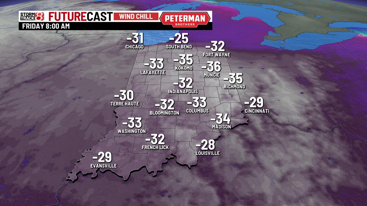
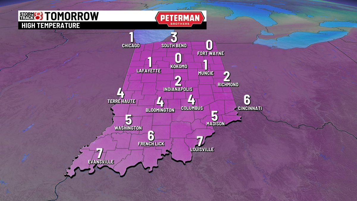
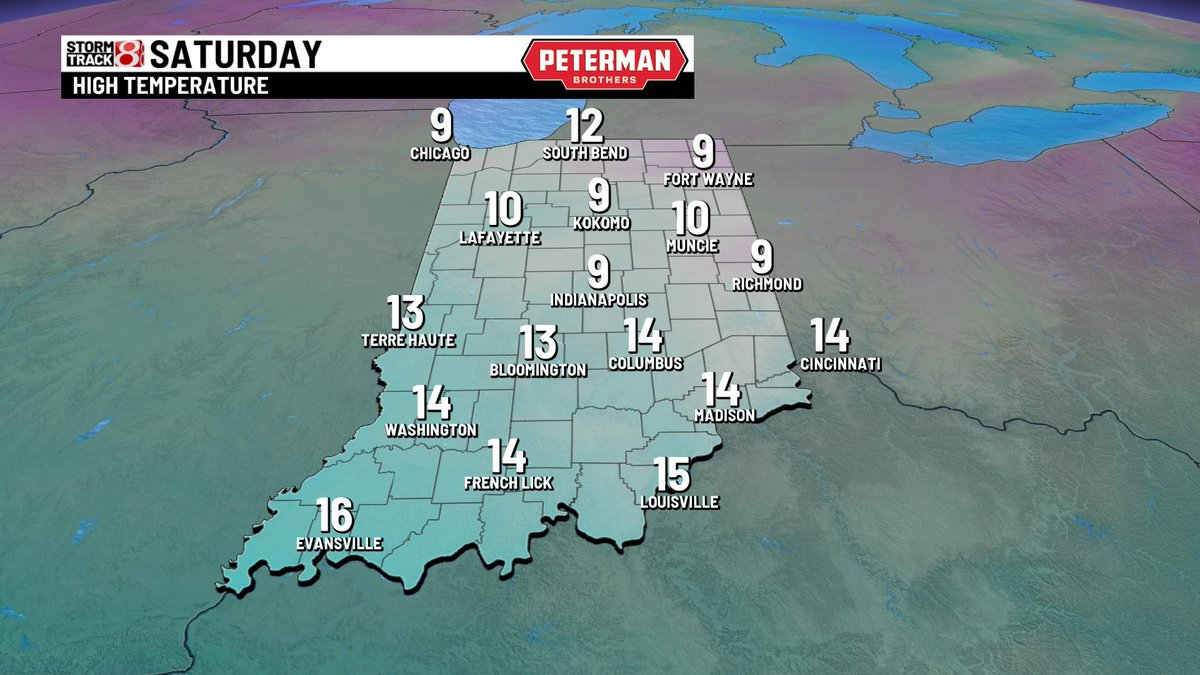
This is quite the sight. Air temperatures will be in the negative single digits by daybreak Friday.
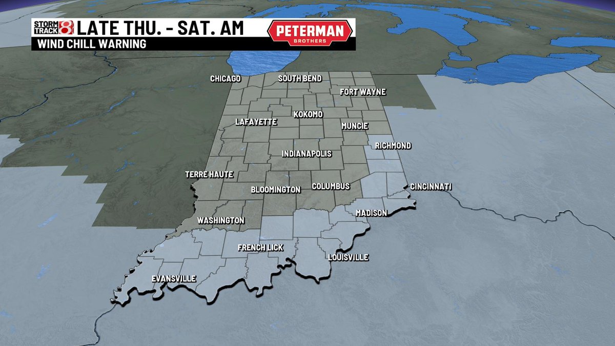
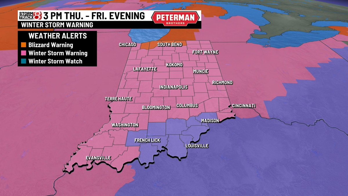
Additional details to keep in mind for tonight and into Saturday:
- Snowfall rates up to 1"/hour THU. night
- Blizzard conditions THU, night & FRI.
- Wind chill values down to -30 to -35 FRI. AM
- Gusts up to 50-55 MPH FRI.
- Frigid air SAT. with wind chills -10 to -20
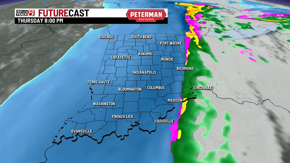
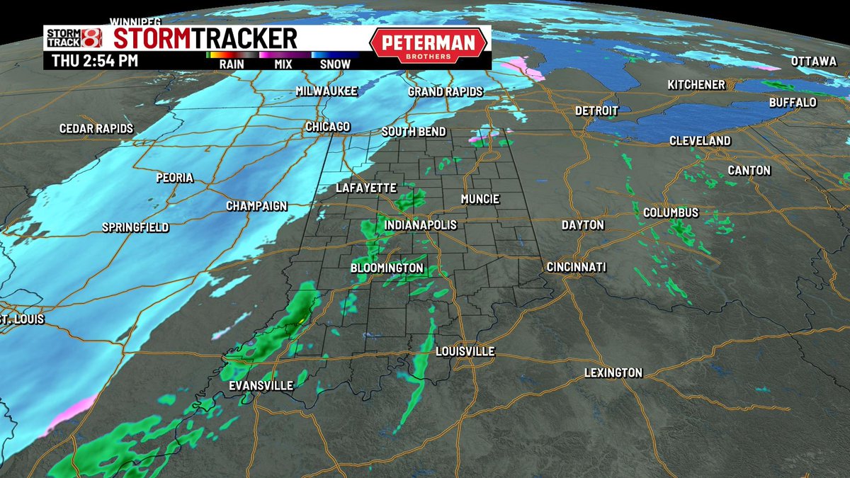
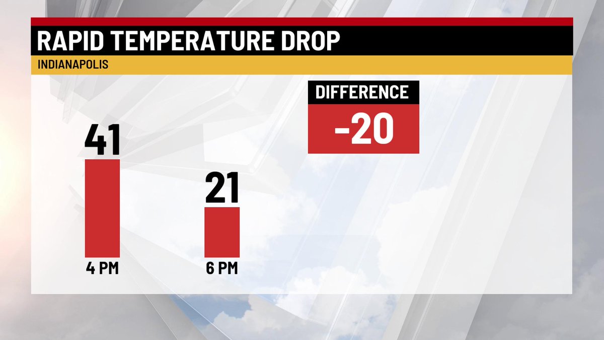
Sct'd rain is ongoing through central Indiana while we wait for the snow in Illinois to slide into the state. Winter Storm Warnings remain in effect for much of Indiana with wind chill warnings out for southern/eastern counties. High winds, cold, and slick spots arrive by FRI.