Join us for a hurricane evacuation exercise on Friday, June 5, at 2 p.m., at the Corpus Christi Gym, 3202 Cabaniss Parkway. Volunteers will act as evacuees needing transportation to safe locations. Pets must be on a leash or in a crate. #CorpusChristi#HurricaneSeason#BeReadyCC
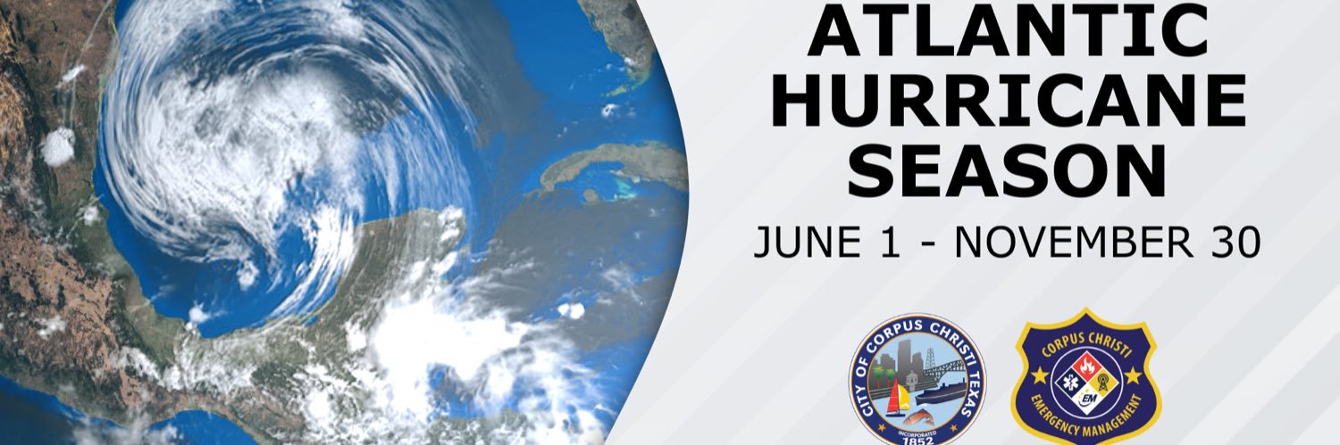
Be Ready, Corpus Christi. The Atlantic Hurricane Season runs from June 1 through November 30. Early preparation for a storm is crucial to ensuring your safety this season.
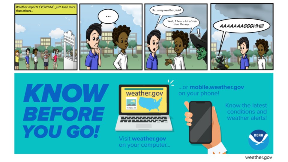
For resources on evacuation routes, emergency plans, tips, and to sign up for Regional Reverse Alerts, visit https://t.co/EpfWC5fmdE.
#CorpusChristi #HurricaneSeason #BeReadyCC
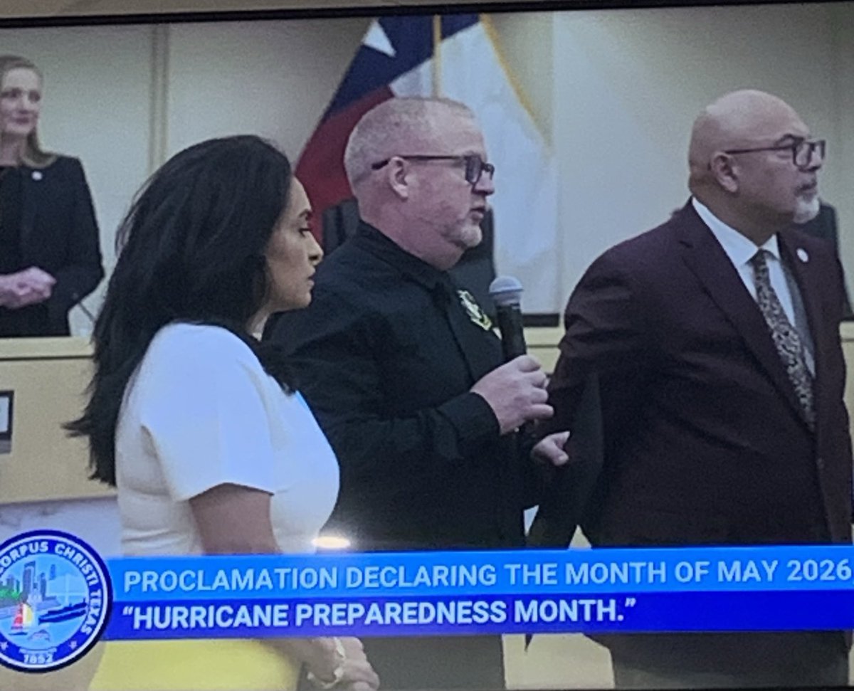
The City of Corpus Christi Emergency Management Coordinator, Jace Johnson, received the Hurricane Preparedness Month Proclamation from Mayor Guajardo. Be prepared friends!
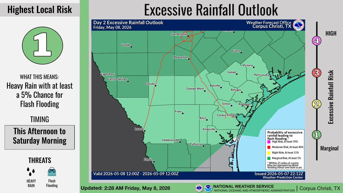
There is a Marginal Risk of Excessive Rainfall this afternoon through Saturday morning. Rainfall totals of 1.5-2.5 inches with isolated 3 inch amounts are possible. Low-lying areas, urban areas, creeks and streams may flood. Turn around, don't drown!
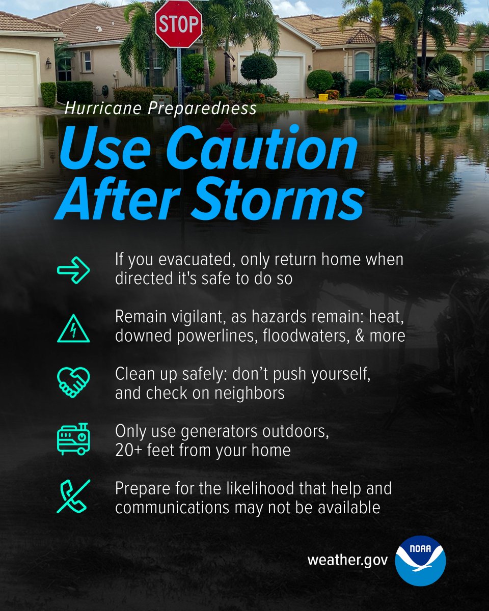
Be prepared for hurricane season by knowing what to do during a storm. Whether you’ve evacuated or are sheltering in place, know what to expect from the hazards you may face. #HurricanePrep#HurricaneStrong
https://t.co/oe3xnAheVx
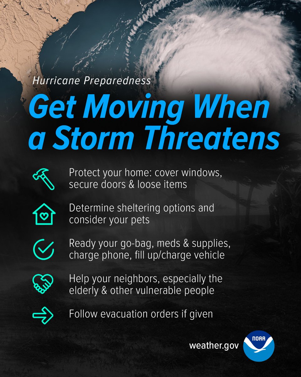
Do you know what to do when a storm threatens? Prepare for hurricane season by taking the time now to understand the actions needed when time is of the essence. #HurricanePrep#HurricaneStrong
https://t.co/otVIaV8ftK
Prepare for hurricane season by knowing how to understand forecasts. They can tell you a lot about what is expected, including the storm’s path, rainfall amounts, wind speeds, and more. #HurricanePrep#HurricaneStrong
https://t.co/6u2zD8zK9I
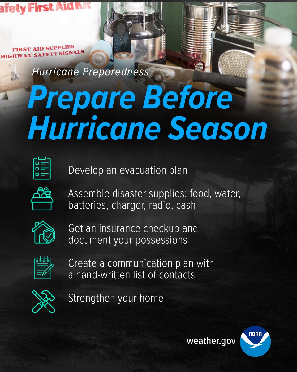
The best time to prepare for hurricanes is BEFORE hurricane season begins. Avoid having to rush through potentially life-saving preparations by waiting until it’s too late. #HurricanePrep#HurricaneStrong
https://t.co/ksO03iEedN
Be prepared for an emergency, Texas 🌪️🌀🌊
The Emergency Preparation Supplies Sales Tax Holiday is April 25-27. Stock up on essentials tax-free during the #TXTaxHoliday. Check the list for the exempt items here: https://t.co/utJMzuBlyi
@TDEM
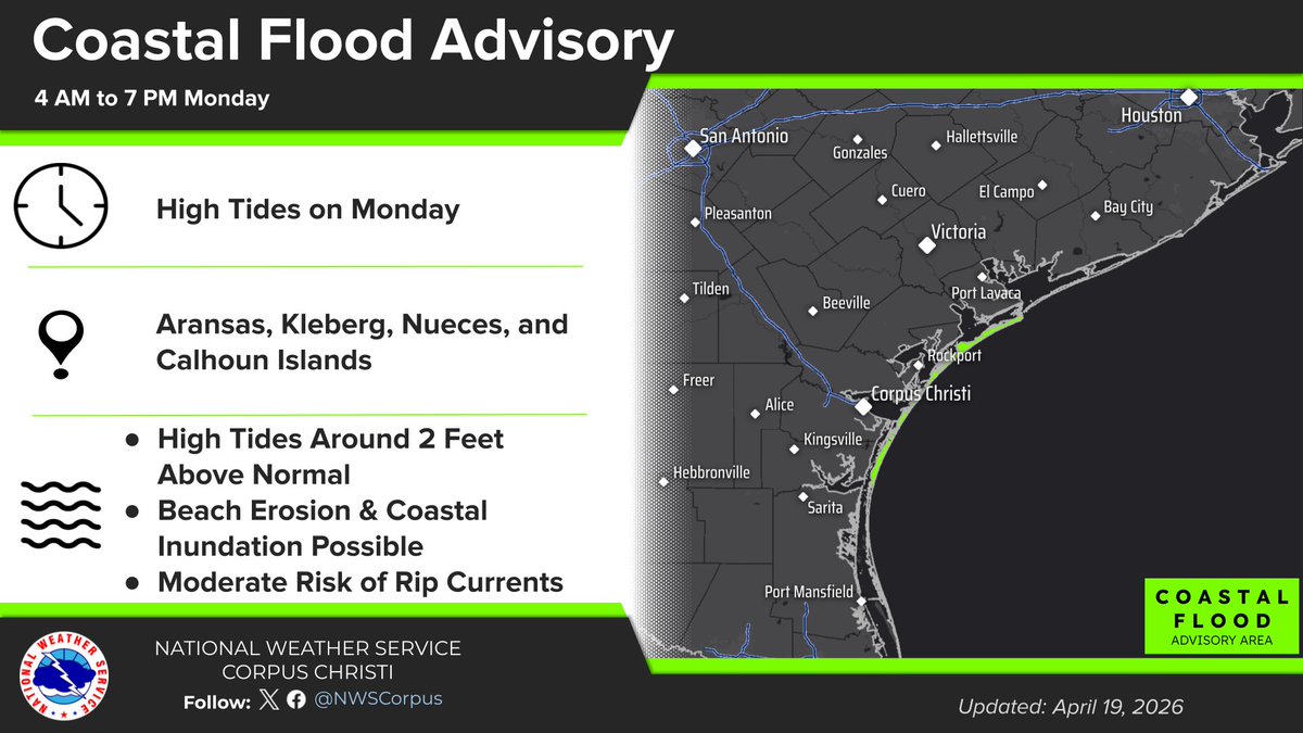
With forecast tide levels expected to be around 2 ft above MSL with the next high tide cycle on Mon AM, minor coastal flooding will be a concern. Combined with a strong, persistent easterly wind, water levels could exceed 2 ft, increasing the likelihood of minor coastal flooding.
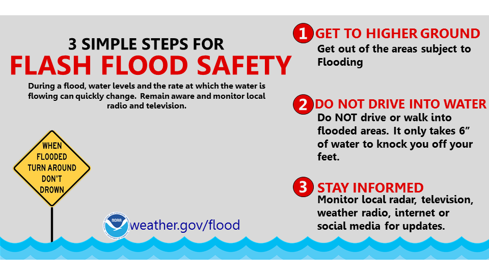
During a flood, water levels and the rate at which the water is flowing can quickly change. Get to higher ground. Do not drive or walk into water. It only takes 6 inches of water to knock you off your feet. https://t.co/ZaQw1JDCb4 #WeatherReady
NOTICE: The City of Corpus Christi will participate in a statewide drill of public warning systems on Thursday, April 2, 2026, in coordination with the Texas Division of Emergency Management.
The drill will take place between 10:00 a.m. and 12:30 p.m. and test the performance and reliability of alert and warning systems used during emergencies. Test messages may be delivered through mobile devices and other platforms, including emergency notification systems and additional communication tools.
Residents may receive multiple test alerts during this time. A primary alert will be issued through IPAWS, and those enrolled in the Regional Reverse Alert system will also receive a notification. All messages are part of the exercise, and no action is required.
This coordinated effort supports ongoing statewide preparedness. A designated testing window allows agencies to activate primary, alternate, and backup systems. After the drill, participating agencies will submit feedback, including observations and recommendations, to improve future operations.
Any alerts received during this time frame are part of the planned drill. This is only a test. Residents are encouraged to confirm that emergency alerts are enabled on their mobile devices.
#CorpusChristi #ReadyCC #EmergencyAlert #Drill
There is a threat of scattered severe storms this afternoon with the greatest threats being large hail and damaging winds. A cold front is expected to move into South Texas and stall maintaining the chance through Sunday morning.
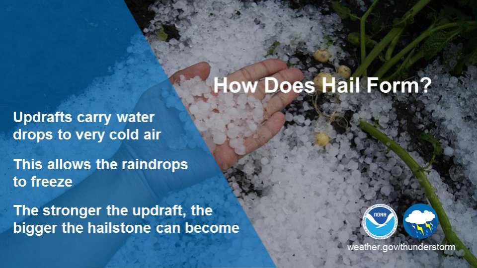
On the fourth day of Severe Weather Awareness Week, we're highlighting severe thunderstorms. Severe Thunderstorms are defined by hail (1" or larger) or wind gusts (58+ mph). Don't forget the danger of lightning too! Know when severe storms are possible and be ready!
On the second day of Severe Weather Awareness Week, we're highlighting flood safety. Never underestimate the power of water! Floodwaters can rise and flow rapidly, sweeping away people and vehicles in an instant. The safest place to be is indoors or on higher ground.
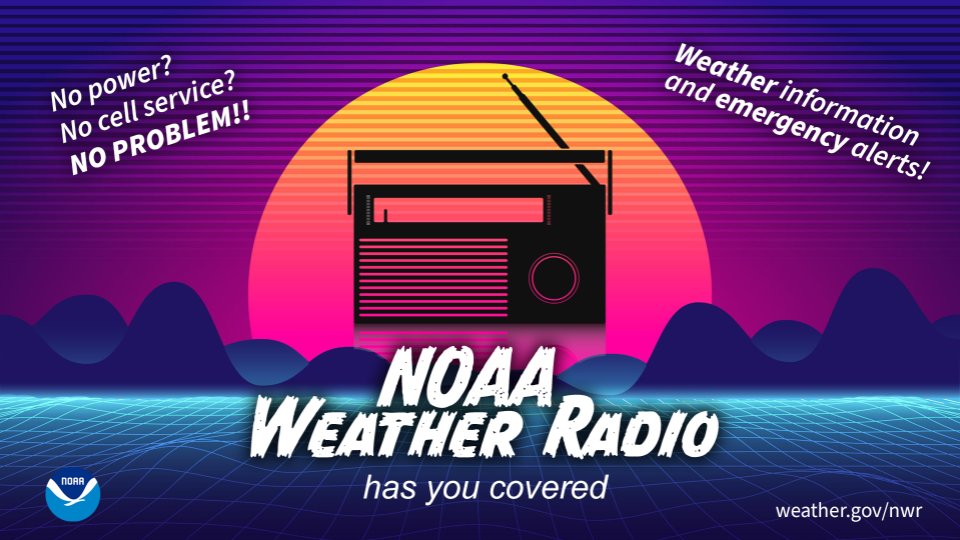
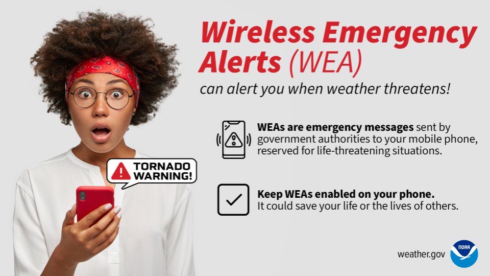
On this first day of Severe Weather Awareness Week, we encourage you to have many ways to receive emergency alerts:
📻 NOAA Weather Radio
📺 Local News Media
📱 Wireless Emergency Alerts (WEA) on your cell phone
💻 Reliable websites like https://t.co/qCGz4UGz0p and social media
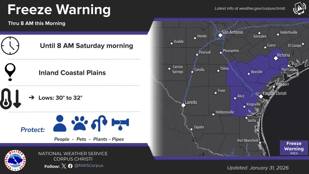
Freeze Warning has been extended westward to Jim Wells & Live Oak counties, not including the coastal portion of counties. Temperatures will be hovering around freezing for the next 2-3 hours under this clear and calm early morning.