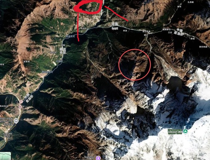
A MASSIVE chunk of glacier ice broke away on the China-Nepal border, causing a devastating wall of water racing toward Gyirong Port.
This is how the flood began. 👇
Explore the map in 3D: https://t.co/b1SlY5OCMt
The ice collapsed from around 17,000 feet on Langtang Lirung, plunging roughly 4,000 feet into the valley below with an impact reportedly equivalent to hundreds of tons of TNT. We can spot the aftermath of this collapse in today's capture on Landsat satellite imagery.
The impact shattered the ice and unleashed a violent torrent of water, rock and mud, effectively draining a nearby glacial lake into the Trishuli River.
The river rose an estimated 50-100+ feet and expanding to around five times its normal width.
Funneled through Nepal's steep mountain valleys, the flood became a deadly wall of debris.
Then it hit Gyirong Port...
What followed is the terrifying video seen around the world, with vehicles swept away, infrastructure destroyed, and people left running from something unstoppable.
And it all began with a single collapse, high in the Himalayas. By looking at the landscape before and after a disaster, we can better understand what happened, track the damage, identify areas at risk and potentially help communities prepare for future events.
Seeing the full picture can help us work towards preventing or reducing the impact of the next one.
#Nepal #Flood #China
Planet Labs को स्याटेलाइट तस्बिरको विश्लेषणका आधारमा गरिएको प्रारम्भिक अध्ययनबाट नेपाल-चीन रसुवागढी नाकाबाट करिब २० किलोमिटर उत्तरपूर्व नेपाल-चीन सिमानामा गएको हिम-चट्टान पहिरोका कारण ल्हेन्दे खोलामा गेग्य्रानसहितको बाढी आएको देखिएको छ।