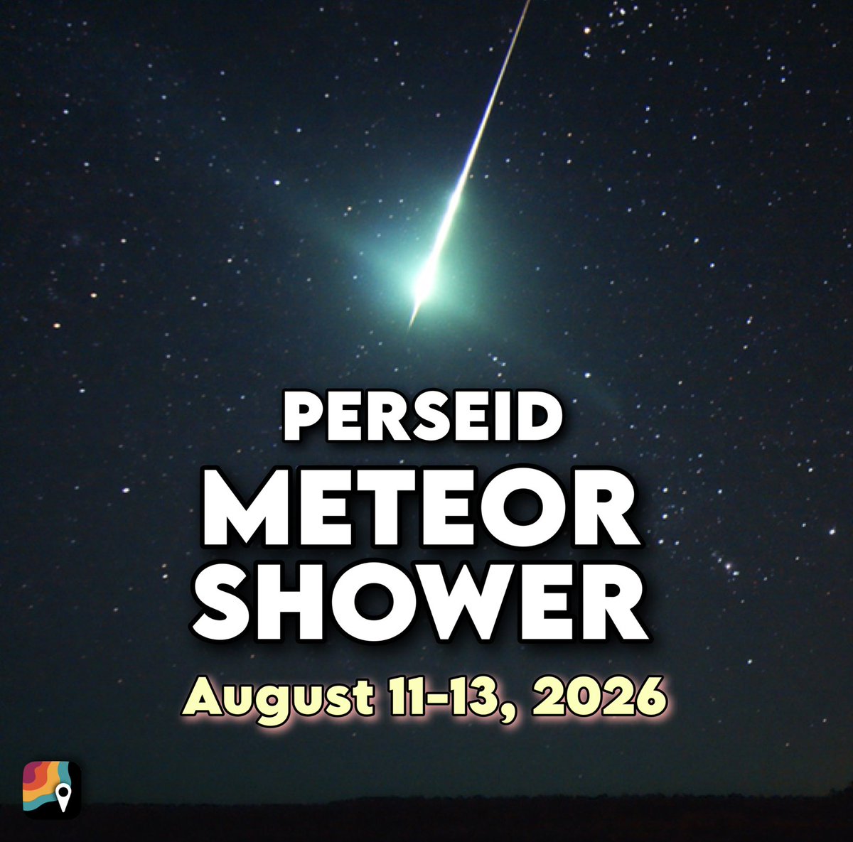
BEST METEOR SHOWER since 2018! Tuesday, August 11-Thursday, August 13!
Up to 75+ meteors will be visible each hour under clear, dark skies! You won't need telescopes, binoculars or any special viewing equipment.
There will be NO MOON the night of August 12-13 due to a "new moon" phase. That means NOTHING to outshine the fainter meteors. You'll get to see the mall!
Weather permitting, everybody should be able to enjoy the show. The display favors folks in the Northern Hemisphere – meaning North America, Europe, Asia and northern Africa will have the best viewing.
There's also no specific part of the sky you should look at. As soon as the skies get fully dark and the stars emerge, you'll have a good shot of seeing a handful of shooting stars!
Meteors are the same things as shooting stars. They're just small space rocks that burn up in the atmosphere. How small? Only about the size of a grain of puffed rice. But they're moving at 37 miles per second! That means they encounter extreme friction as soon as they enter Earth's outer atmosphere.
That energy is transformed into heat, and the meteors burn up. Perseids burn shades of red/pink, orange, yellow, turquoise and a delicate violet. And you may even see a shimmering trail linger for a few seconds too!
Why do we get the Perseids? It's because Earth is encountering a pocket of space pebbles in its annual orbit. We plow through that clump of space debris at the same point in our orbit every year (mid-August). Imagine you had a swarm of bugs that was always in the same spot in your neighborhood. Every time you drove down the street, you'd get a bunch of smears on your windshield. Same thing here! Except instead of smears, we get streaks of light.
Where do these space pebbles come from? They were left behind by the passage of Comet Swift-Tuttle, which last zipped by the sun in 1992. (It will return in 2125.) The comet is about 16 miles wide.
The best part? FIREBALLS! The Perseids are the most prolific meteor shower for extremely bright meteors called "fireballs." A fireball is brighter than Venus. Fireballs are caused by larger pieces of debris about the size of golf balls. They might penetrate a little deeper into the atmosphere and burn a bit brighter.
Tag your friends if you're planning to watch the show! And send us your photos after if you get any good ones!
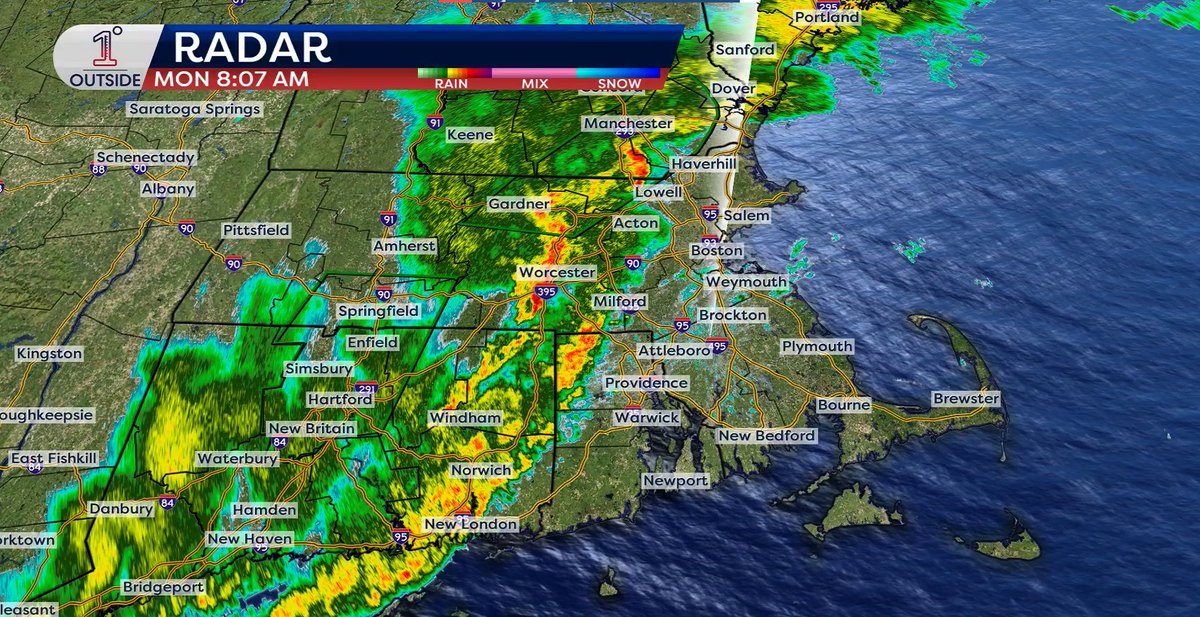
Flash flood warnings in effect as torrential downpours continue to press east - 2-4"+ of rain has already fallen in spots, reports of car stuck in street flooidng in Leominster at Lancaster St, basement flooding in Princeton, cars stuck in Agawam (all within the last 30-60 minutes, thank you @WX1BOX)
@UnitedStandMUFC But it’s the difference between what management says who we are in for vs what are they truly doing…they say a lot to appease fans and then do nothing about getting them in reality
@UnitedStandMUFC If Lewis Hall is our number one target, go down about 10 players on the list and find that player at a cheap price and that’s how United roll
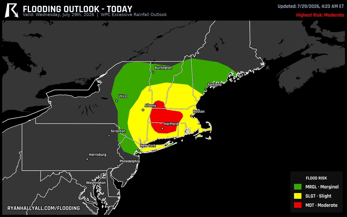
Moderate flood risk holds today across Massachusetts, Connecticut, and Vermont, stretching from around Pittsfield through Bedford and up toward Fitchburg. Storms keep firing up over that same corridor through the afternoon, and small streams and low roads can rise fast if a few rounds line up back to back. Worth checking radar before you head out that way today.
Runnin’ through Forest City, straight to Fort Fitzy. See ya there ♥️
🆚: @Union_Omaha
🏆: @USLLeagueOne
⏰: Gates at 5:30 PM, kickoff at 7 PM
🏡: Fitzpatrick Stadium, Portland, ME
📺: ESPN+
🎉: Link below to find a watch party
https://t.co/p0jeToY7mN
SPC just pushed today's tornado odds from 5% up to 10% over Wisconsin, Iowa, and Minnesota, still inside the same Level 3 zone from this morning. Charles City, Decorah, and Oelwein, IA sit right in that highest-odds bullseye, with storms expected to fire back up between 3 and 9 PM and the roughest stretch landing close to 6. A couple of these could turn into real tornado producers, not just quick spin-ups. Coverage looks likely to come on this evening as things peak near 8.
MA Dept of Environmental Protection has issued an air quality alert for sensitive groups today due to elevated levels of fine particulates from Canadian wildfires
A tornado-supercell perspective like none captured before. Almost three days later we are still wrapping our minds around the wonder of the Tulliby Lake, Alberta tornado.
With this speed-ramped clip from our 360, you see large oil tanks (4-8 tons empty) being knocked over and a grove of trees demolished as the twister moves onto the lake surface, illuminating the subvortices near ground level. At the same time we can see the entire tornadic structure, wall cloud, RFD cut, billowing updraft and fanning out anvil cloud 12 miles above - complete with a double rainbow.
Sadly, just downwind a house was swept clean from its foundation and vehicles launched into shredded forest, but fortunately, the home was unoccupied at the time.
We have a lot of data analysis to do, but we will share both findings and amazing video perspectives like this over time on our socials!
- Nelson Tucker
SPC has a 30% damaging-wind area up for parts of northern New York, Vermont, and Maine tomorrow.
That hatched zone is the piece I'm watching: it means a few storms could pull into one big line and blast out 80+ mph gusts. Beyond the tornado threat we flagged earlier, this wind setup is the widespread one to respect.