Modern Assyrian ancestry can simply be modelled as:
IA Upper Mesopotamian+Iranian+Armenian/IA-Anatolian, max. 4 sources all is needed to target actual ancestry for any modern avg.population.
We don't need similar+large num. of sources competing to guess where Assyrians are from.
When removing +admixture (Armenian, Iranian Zoroastrian) drift causation, the modelling captures a vague 50-50 result for modern Assyrians
3rd image further proves it demonstrating overfitting due to very similar sources (upper Mesopotamian) being used to target populations.
@RuitheMedes Mar Ephrem and his Assyrian lineage.
https://t.co/7NOphCYRel Old Testament comments on the Assyrians such as Sheol, God's Wrath, ..etc.. = biblical imagery/metaphorical, not a secular, ethnic statement.
@kurrekurda@namogoran6 Native Syriac speaking population regaining strength in Mosul Province after centuries of oppression and countless massacres - I don’t see an issue here.
And the Nineveh Plains region was majority Assyrian during that time.
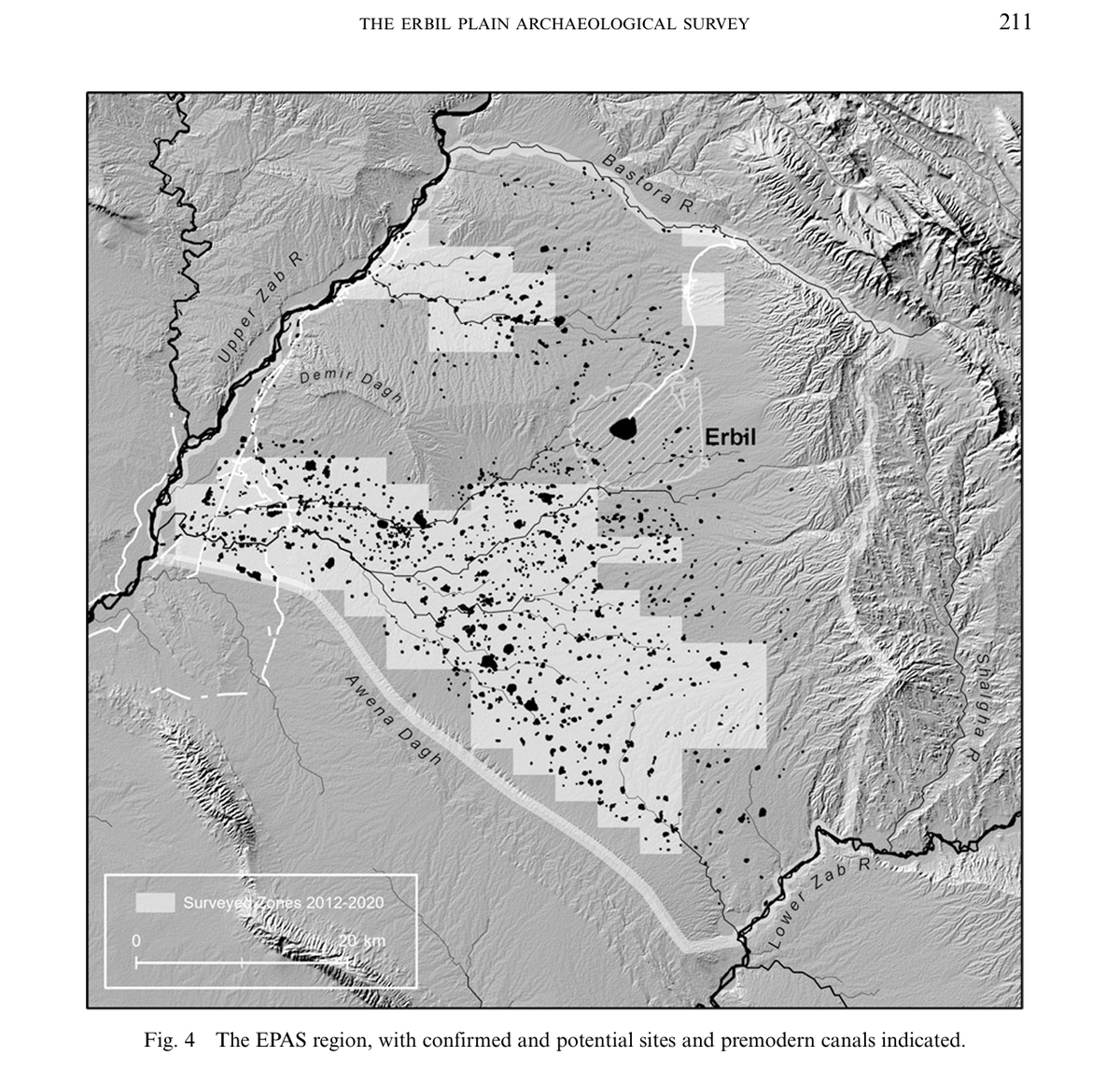
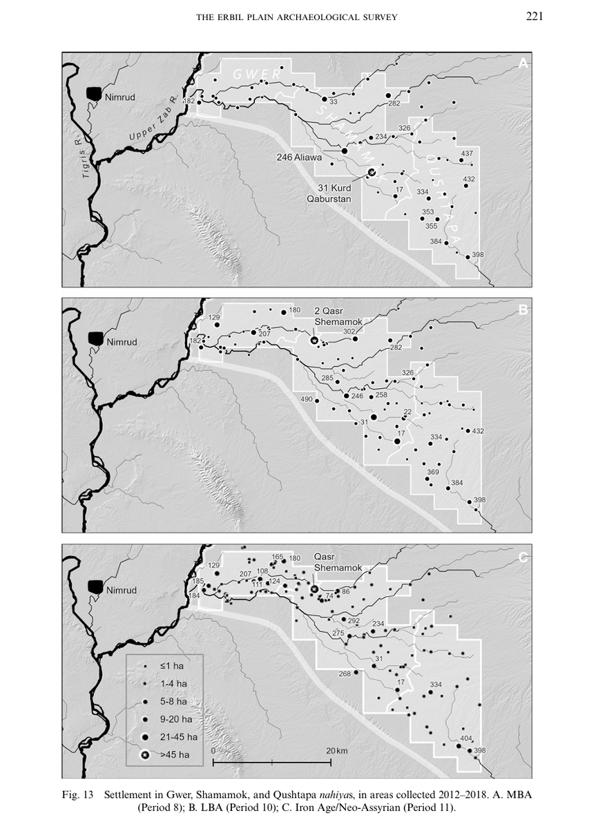
Sennacherib's Bastora Chai subterranean channel served its purpose to feed the region, the ruralists (lower EPAS/Shamamok area) benefited from increase food production for themselves & the state (tax), while the urbanites, i.e Arbela (Erbil city) benefitted due to rapid growth.
EPAS — Interesting info. about the ancient Erbil Plain agrarian practice is during the Bronze Age the area was a dry-farming plain, while substantial irrigation agriculture was only practiced by the Neo-Assyrian state via the multi network canal project, Sennacherib engineering.
According to Prof. H. Keuhne, the river terraces and plains surrounding Arbela (Erbil) was abundantly irrigated, the region was heavily engineered both hydraulically and demographically, the Assyrian canal systems fed into a large irrigated zone directly between Arbela and Kalhu.
The intention of such projects isn't only to feed the population, rather the objective was to connect the Assyrian heartland together via hinterland expansion
For instance, the lower Erbil Plain rural area was designed to sustain the Assyrian capital cities of Arbil, & Kalhu.
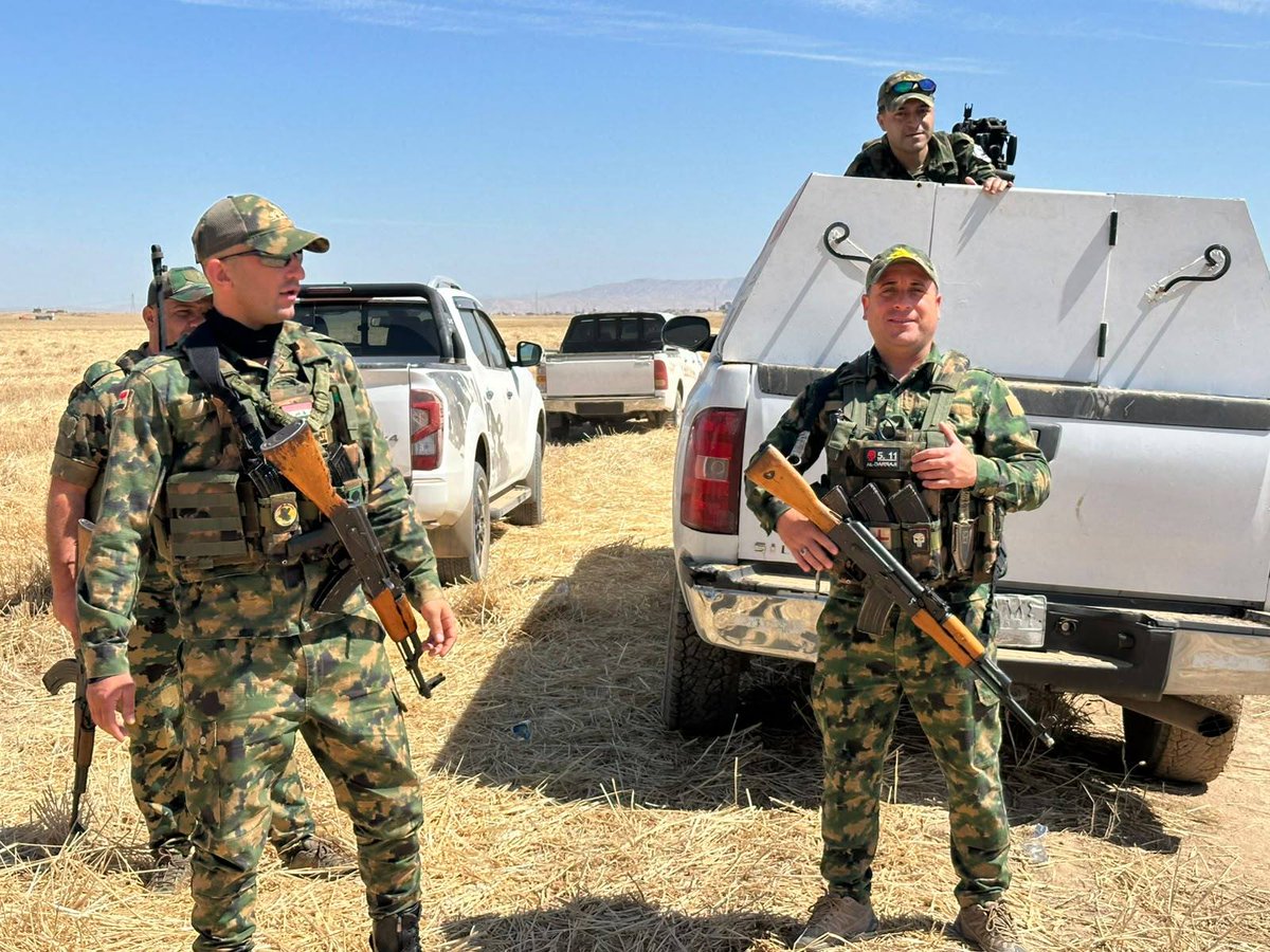
Iraq — Assyrian NPU (13th Regiment) inspecting the outskirts of Bakhdida city, Nineveh Plains, Assyria, a routine applied day and night to keep the area safe.
Autosomal DNA of Batnaya village, Assyria-
Batnaya population is small & conservative, 1 sample is enough to determine the population is Mesopotamian, this also rules out the hypothesis that medieval Batnaye were Medes (Iranian) due to a misunderstanding of church politics.
Batnaye were historically part of the land of the Assyrians (Athra d-Athoraye) during the early medieval period, and declared their local cultural belonging in 1729 when Batnaya united with Tel Keppe and Alqosh villages as 'representing Ninevites' (Ninwaye) in Constantinople.
@Kurdistan_AR This is all wrong.
During the Hellenistic period, Atropatene/Magna Media was located in today’s west Iran, including your founder tribe Kyrtians, the Assyrians (Aturia) was located in the Nineveh region, north Iraq, your map regarding 2000-year culture zones is purely fictional.
@AramaicWire It is part of the PMF under NSS (Iraqi authority) with around 1000 active force, there were rumours about troop size increase to around 4-5K NPU per Baghdad support, though haven’t heard anything else on that.