1/3: Well I just wanted to say that I am officially the weekend meteorologist at WBRZ in Baton Rouge, Louisiana. I have loved weather ever since I was a kid. I have also always wanted to be a meteorologist.
Tropical Storm Watches have been issued along the central Gulf Coast, extending from Sargent, Texas to Morgan City, Louisiana. The National Hurricane Center has also started issuing forecasts for Potential Tropical Cyclone One.
More details---> https://t.co/rwfhpab56n
🌪️ Preliminary recap of the 5/6/26 SW MS tornadoes:
3 tornadoes have been confirmed across our area from this event. 2 were rated EF-1 in Pike/Walthall Counties.
A significant, long-lived tornado moved across northern Wilkinson County, the strongest for them since May 12, 1990.
Rain totals from the past 2 days depict a soggy south Louisiana & Mississippi.
The Baton Rouge area saw the highest rain totals between 6 to 8" while areas east saw closer to 3 to 5" toward Gulfport.
More rain is in the forecast thru Monday!
More Info: https://t.co/zGOHJT3OVj
The forecast for Thursday and Friday is a tale of two trends! 📉📈
Thursday is trending drier as that cold front stalls further south—expect plenty of clouds, but fewer storms than we first thought. 🌥️
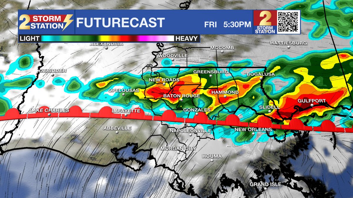
Friday flips the script! ⛈️ The front lifts back north, bringing numerous rain and storms. Some could be heavy, so watch for localized flooding.
Total rainfall through the weekend could hit 2-5". Keep the umbrella close! ☔️
☔ Rain Alert: Thursday’s hit-and-miss showers turn into a widespread soak by Friday.
⏰ Timing:
- Thurs: Hit-and-miss early; heavier storms late PM/Evening.
- Fri: Messy most of day; widespread rain for the PM commute.
📏 Totals: 2-4" expected, with 4"+ in some spots by Sat AM.
#LAwx #Rain
🚨 Severe Weather Update for Tonight: The risk for severe weather has increased to a Level 2/5 (Slight Risk) for areas north of Baton Rouge. ⛈️
⏰ Timing: Sunset through midnight.
⚠️ Threats: Damaging winds & large hail (brief tornado possible).
Stay weather aware! #LAwx #BatonRouge