@DylanTanzi6@MomFluffyz@stevectweather It’s like people don’t understand how these models work lol they’ve been locked in for major snowfall for days now, there’s been NO shift east either from what I’ve seen. But we’ll see however if it moved East it’s way too small to even see on my end. Enjoy the snow friend!
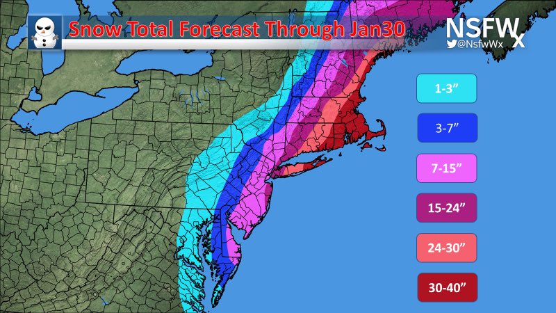
@MomFluffyz@DylanTanzi6@stevectweather Nope because models are all over the place. Everyone is likely to see over a foot of snow with the money spot probably being Suffolk - twin forks LI. Models are all over the place people watch models more then look out the window.
@cmariehope1@ndiorio34@Eweather13 Yes raising them would be correct however it would be Long Island and parts of CT that get raised by quite a bit. No one’s been lowering recently as we’re what? 3 and a half hours out now. These models are pointless at this point we’re all getting 12-20+ inches
@ndiorio34@Eweather13 Whoever’s lowering totals are wrong there’s absolutely no reason to lower totals unless you’re in mass where it can be 18-25inch rather then 30+.
@Eweather13 GFS caved to euro so now instead of 8-14 inches across Long Island id say def totals raise 100% as we zone in on less Thant 24 hours till first snowfall
@sportsontvguy@JackSillin Seen a couple things so far 16-25 inches from twin forks till mid Nassau if it keeps going west (which it’s been for hours now) it’s getting close to the final call which can bring up to 30+ across the island .