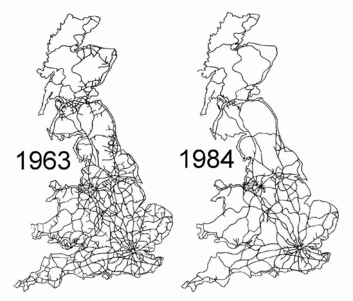
The British railway network before and after the Beeching cuts
In the early 1960s, Britain possessed one of the densest railway networks on Earth. Lines reached deep into rural counties, coastal towns, and industrial districts, reflecting a Victorian system designed for freight, local travel, and a pre automobile economy. By 1963, however, the network was widely viewed by policymakers as financially unsustainable.
That year, Dr Richard Beeching published reports that fundamentally altered British transport policy. Thousands of miles of track and more than two thousand stations were identified for closure. The objective was to concentrate resources on profitable intercity and commuter corridors while eliminating lightly used rural and branch lines.
By the mid 1980s, the results were fully visible. Large areas of England, Scotland, and Wales had lost direct rail access altogether. Road transport expanded rapidly, reshaping commuting patterns, freight logistics, and regional development in ways that still define Britain today.
This map comparison captures more than disappearing lines. It illustrates a national decision to prioritize efficiency over coverage, and a transport legacy that remains debated amid modern efforts to revive rail, reduce emissions, and reconnect isolated communities.
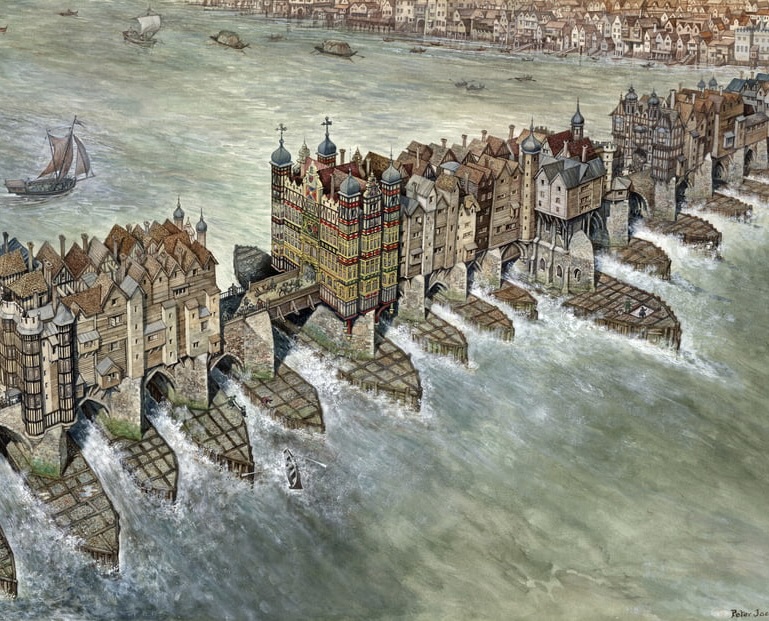
A thread of lesser-known architectural wonders that we lost over the ages (and what happened to them)... 🧵
1. Old London Bridge - the longest inhabited bridge in Europe
Há 135 anos, em 13 de maio de 1888, princesa Isabel, exercendo a regência do império em nome de seu pai, Dom Pedro II, sancionava a Lei Áurea, extinguindo oficialmente a escravidão no Brasil.
1/21