@CameronJNixon@Emokwx It's definitely a real thing! I saw this in person while flying out of Atlanta earlier this year. The only cumulus clouds in the sky were directly above the major downtown areas.
4/23/26 at 23z
@kodythewxguy Looks like a circumhorizontal arc! It's technically a type of halo rather than usual cloud iridescence since it's caused by refraction rather than diffraction, but this is much more impressive and rare to see.
@WXPeterGriffin Surface obs had the dewpoint closer to 50⁰F with some areas at 55-60⁰, so the LCL would be at most 2.7km (assuming 90⁰F temp, 40⁰F dew, and 4800ft altitude). Realistically probably 2km. Still absolutely amazing how high the LCLs can be for tornadoes around the Front Range.
This is something I have never seen before on satellite.
Clouds perfectly outlining roads.
Just incredibly neat imagery of Houston, Texas this morning.
Massive shoutout to @Emokwx who discovered it.
Nice fallstreak hole during sunset today!
The cloud is literally freezing and falling towards the ground.
This is caused by the same physics principle as putting a water bottle in the freezer and then shaking it, causing the supercooled water to suddenly turn into ice.
Check out how mesoscale dynamics caused the surface low to orbit clockwise into Colorado and briefly set up ideal synoptic conditions for cold-core tornadoes yesterday!
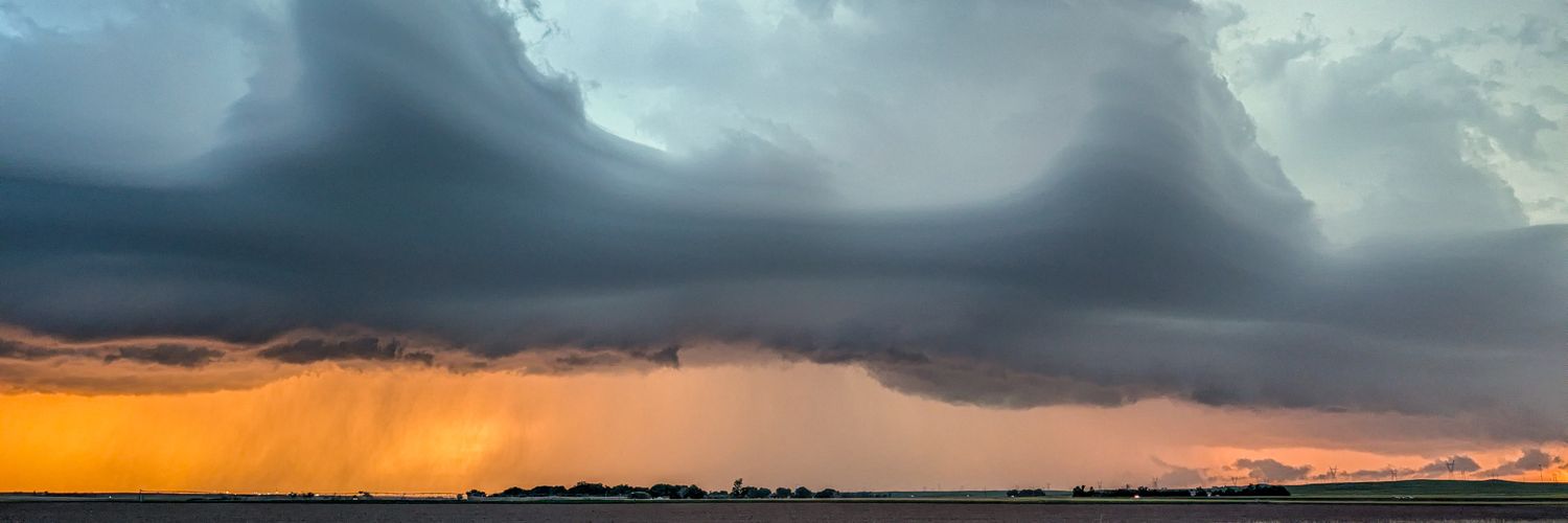
Brilliant photogenic tornado about 15 miles north of Yuma Colorado (correction to previous posts), about 6pm this evening. Footage captured by chase partner Kaitlin Groom! No damage sighted where it crossed road ahead of us #COWX
Keeping a close eye on surface low development with the highly negatively tilted trough on Saturday. Recent model runs look favorable for tornadoes, but it's unlikely to play out this way due to reduced predictability from the large cutoff low over the western US.
@StrmchsrHunterF Here's what I was talking about with the mammatus behind the tornado if anyone is curious. You can see the negative buoyancy in the time lapse. Same physical process as in thunderstorm anvils, except in this case it's part of the rear-flank downdraft!
@StrmchsrHunterF Yes!! Totally. There also appears to be some brief mammatus at the end behind the tornado if I'm not mistaken? Very interesting and unusual RFD surge in general.