Greetings!
This account is ran by @Jack60203797 and @HighwayWx.
Our primary focus is the South Atlantic basin and its (sub)tropical cyclones.
More information about this account will be posted shortly.
On May 18, 2022, a subtropical storm formed off the coast of South America.
This system is officially logged as Yakecan, and unofficially logged as 02Q (Yakecan).
We analyzed the storm and determined that it peaked with winds of 60mph(50kts).
02Q (Yakecan) will likely become extratropical later today.
The storm is currently moving southeast across the South Atlantic.
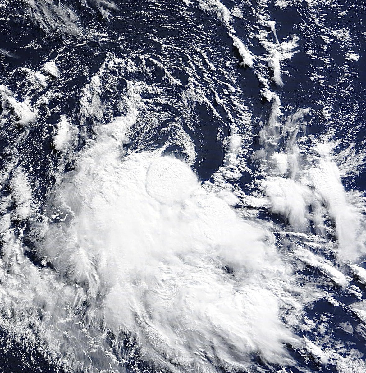
It’s current intensity is questionable right now. Satellite imagery is showing what appears to be a low level eyewall within the system.
After the sun rose across the South Atlantic today, we were greeted with an unorganized 02Q (Yakecan).
The system could organize slightly again today as it accelerates southeast.
The system should be non-tropical by tomorrow night.
02Q (Yakecan) is moving east now, away from the Brazilian coastline.
The system is continuing to fire convection over and near its center of circulation.
Not much information has changed for the system. It should begin to shift southeast soon.
The latest ASCAT pass confirmed that the system had 60mph(50kts) winds earlier this morning.
We will be waiting to see if the system has intensified anymore since then.
Overnight, our system transitioned into a subtropical storm.
It is now sustaining relatively healthy convection.
We will be referring to the storm as 02Q (Yakecan) for now.
The system unfortunately did some damage, and caused a couple of fatalities, while passing along the coast.
It will be moving away from the coast now.
We should see some organization and/or intensification over the next couple of days.
Some places along the coast of Brazil are definitely being blasted with pretty strong wind gusts currently.
The system should move away from the coast later tonight and early tomorrow morning.
It’s around that time when it could transition into a (sub)tropical cyclone.
Our system is currently off the coast of Uruguay and Brazil.
Today, it will attempt to transition into a (sub)tropical cyclone.
Relatively minor impacts should be felt along the coast.
We will provide more updates later today.
Here is a quick animation, just to demonstrate the situation that we’re currently looking at. We will provide more detailed updates as we learn more about this system.
The system will likely peak in strength once it moves away from the coast.
As of now, it’s not too clear how strong the system could get. However, it does seem that a healthy and organized tropical storm is possible if not likely.
We are continuing to monitor the potential upcoming (sub)tropical cyclone in the South Atlantic.
It’s still very present on the models, and it does appear likely that something will occur.
I’ll provide more information below.
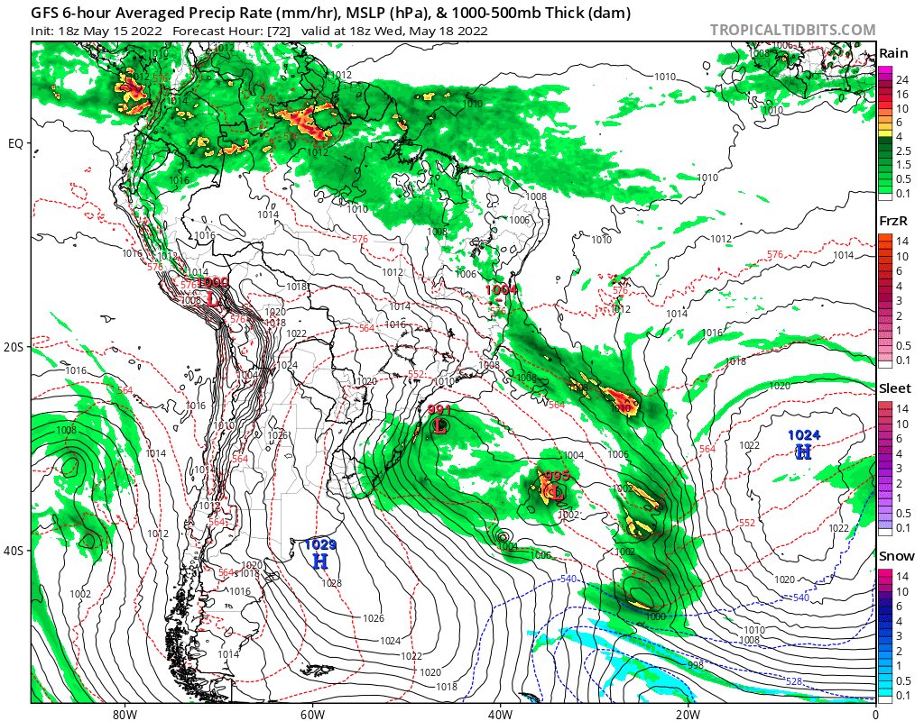
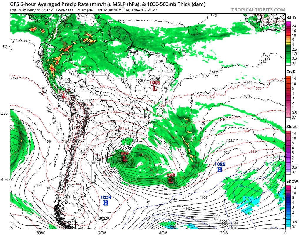
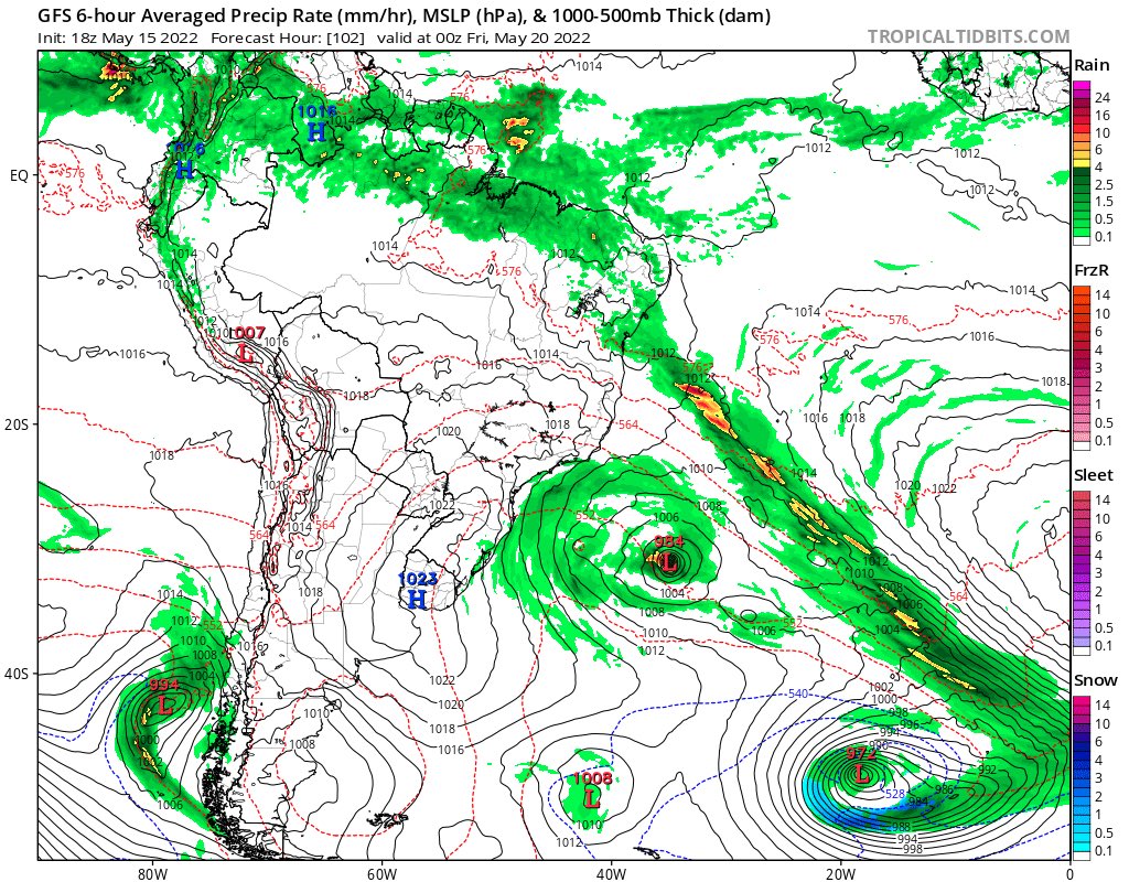
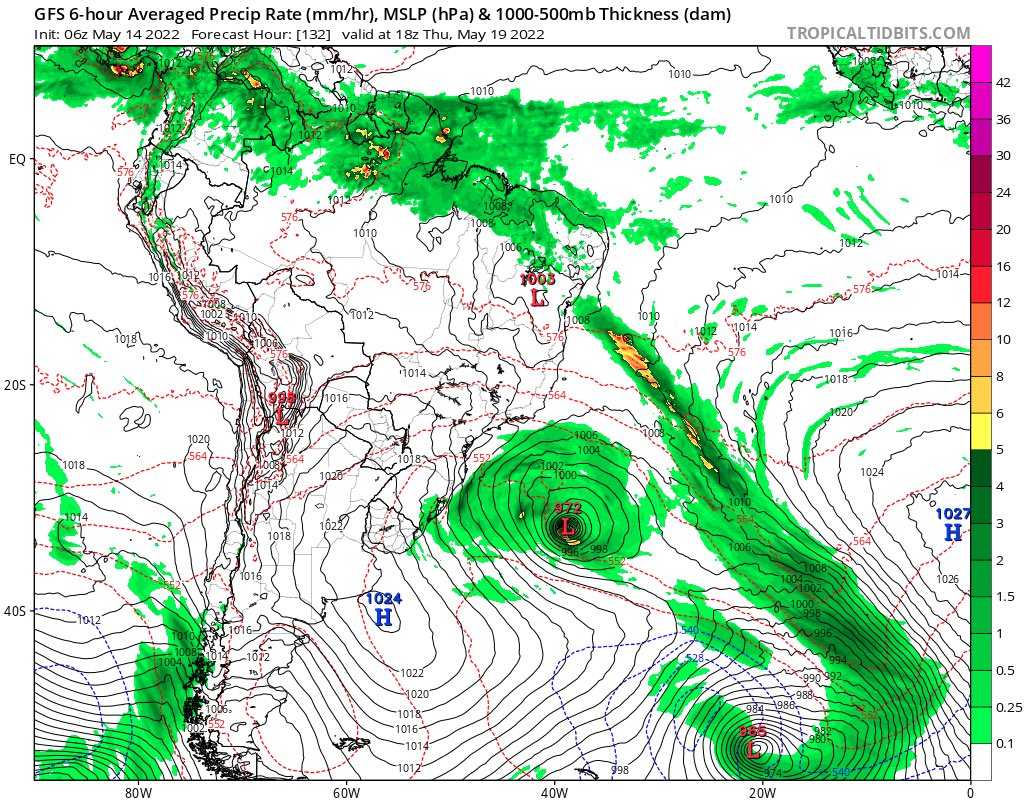
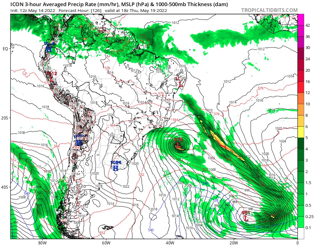
One notable trend among each of the model runs is the system effecting the coast of Brazil.
It does seem that the system will make a close pass to the coast, which of course, will bring some effects.
@LunoRawke Yeah, I wrote this tweet just prior to the new GFS run releasing.
The GFS now shows the system hitting southern Brazil as a subtropical cyclone.
If this trend continues across multiple runs I’ll make a post about it.
Hello everyone.
We’re currently watching the South Atlantic for possible development next week.
The models are hinting that this has the potential to be a somewhat impressive system.
We will definitely be keeping our eyes on this trend between the models.
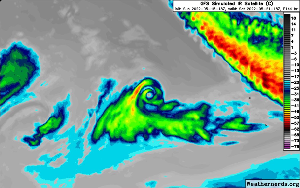
Here’s the loop of the GFS until hour 168.
As you see, the system will likely transition from an extratropical off the coast of South America.
We will monitor the situation over the next few days, and updates will be provided on this account.
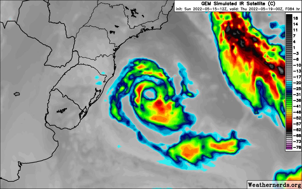
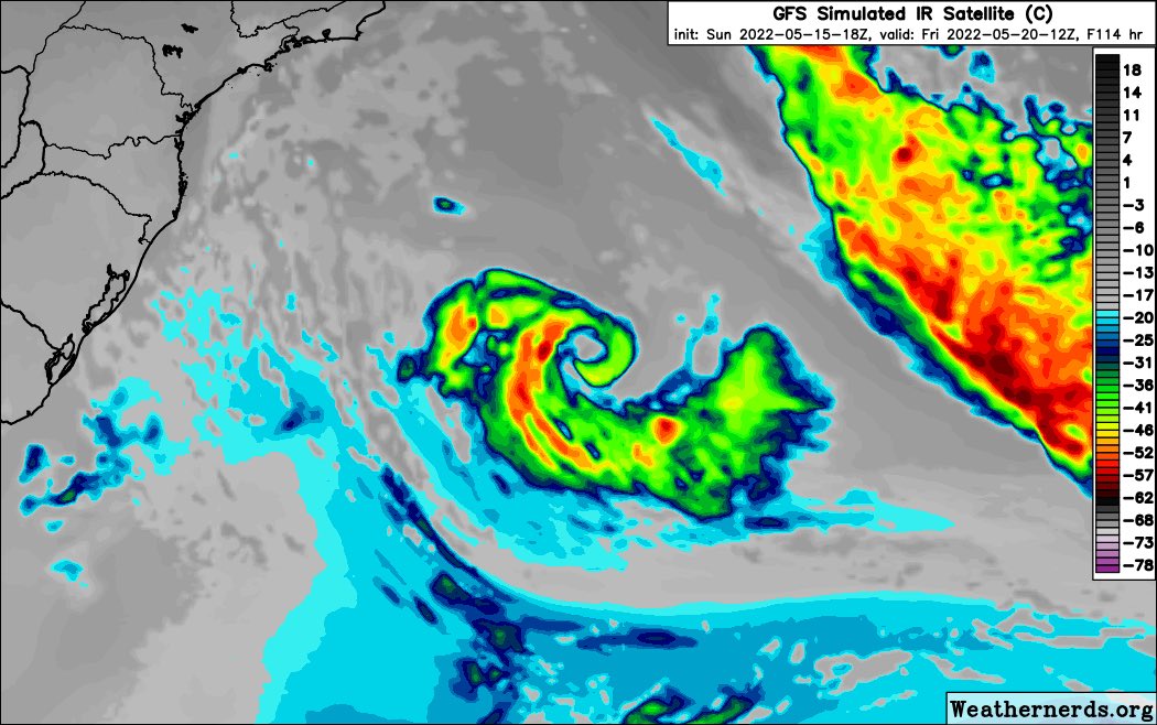
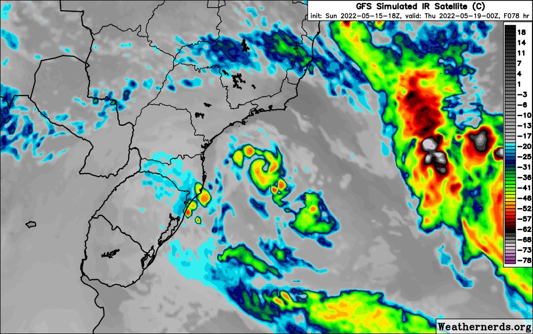
Here are the simulated satellite modes between the GFS and the GEM.
As you can see, the models are currently showing a pretty healthy tropical cyclone, possibly with an eye feature as well.