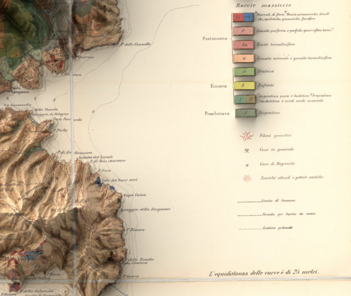
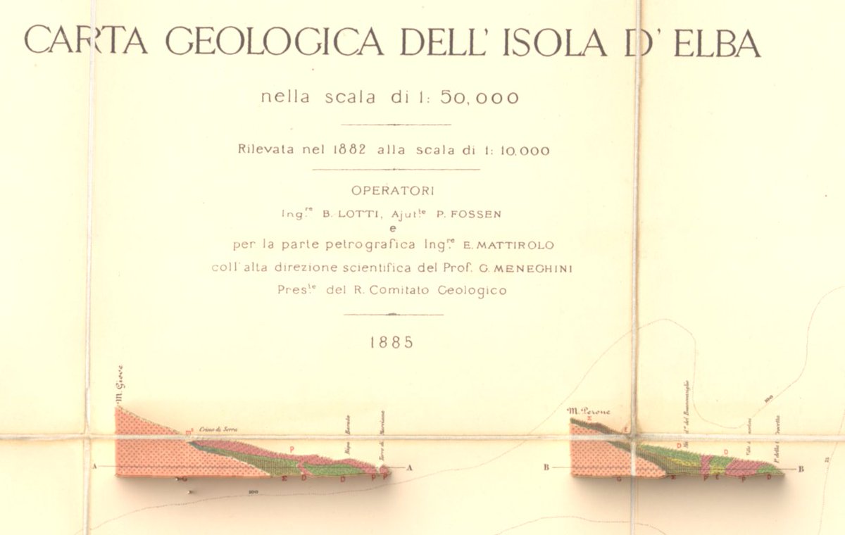
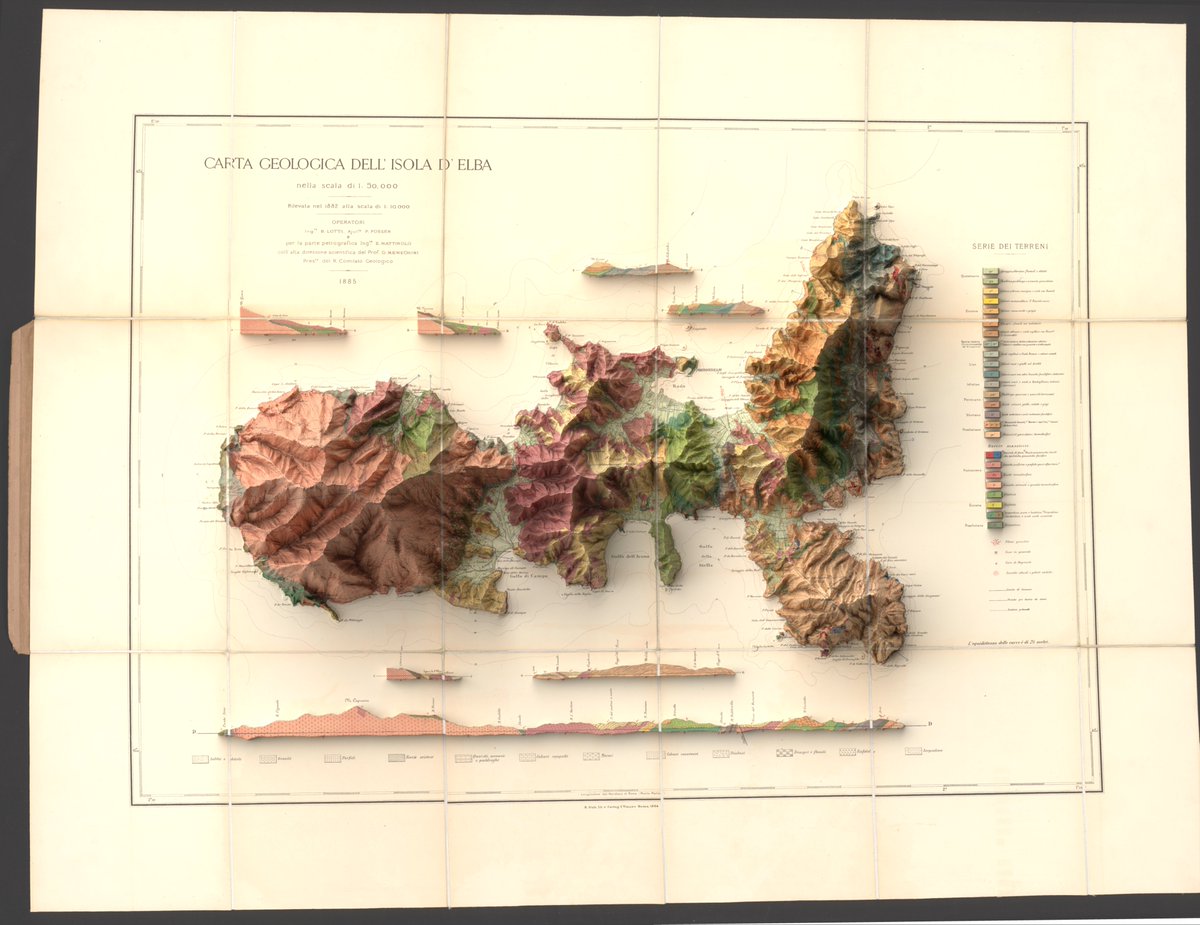
#30DayMapChallenge Day 29: Raster and Day 30: Makeover
An old map (1882) of the Isle of Elba given an exaggerated elevation makeover using DEM. Made in #qgis and #b3d
(Source of data: Regione Toscana – Modello Digitale del Terreno Orografico,License: CC BY 4.0)
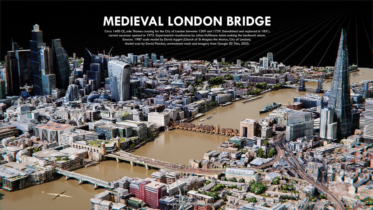
Medieval London Bridge: my Digital Reconstruction (c. 1400 CE) placing the lost structure back into the modern Thames & removing the modern one next to it. First edition for #30DayMapChallenge . Model by David Aggett 1987, scan by @artfletch . Completed in 1209, it remained the City of London’s sole river crossing until 1729. #b3d
#30DayMapChallenge Day 25: Hexagons
A little 3d hexmap of the bluntnose sixgill shark - aka Hexanchus griseus - and the largest hexanchoid shark.
Made in #qgis and #b3d with data from gbif
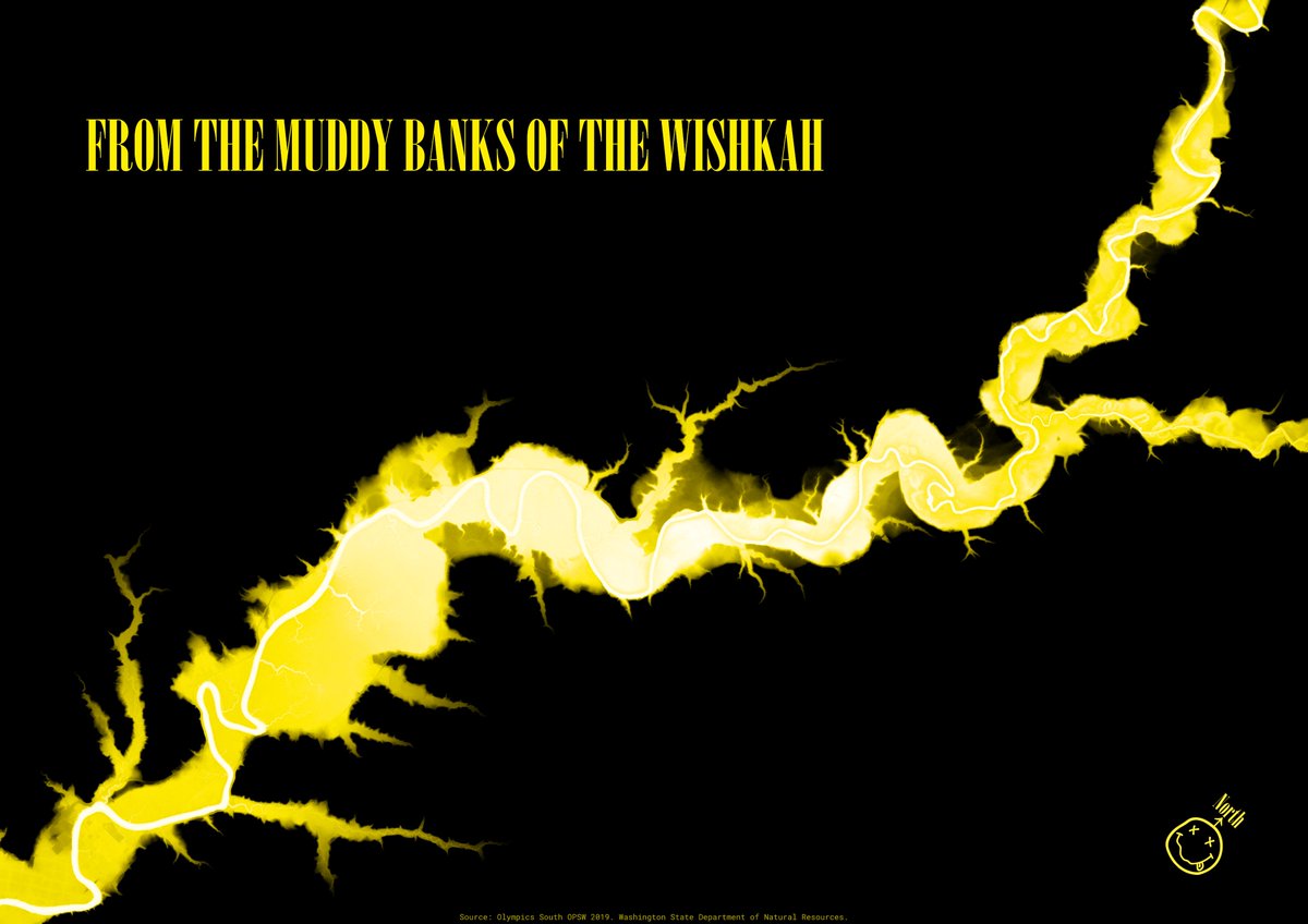
#30DayMapChallenge Day 20: Water
Been meaning to attempt a relative elevation model for a while now, so had a first stab using the tutorial by Dan Coe.
Wishkah River, Washington. Strongly associated with one of my favourite bands of course.
Made in #qgis
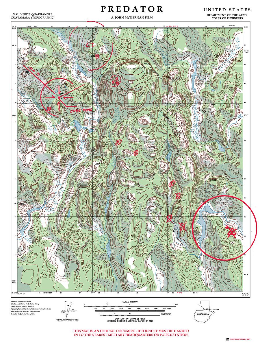
#30DayMapChallenge Day 18: Out of this World
Not quite what I originally set out to achieve, but nonetheless some sort of map celebrating the #Predator movie (1987)
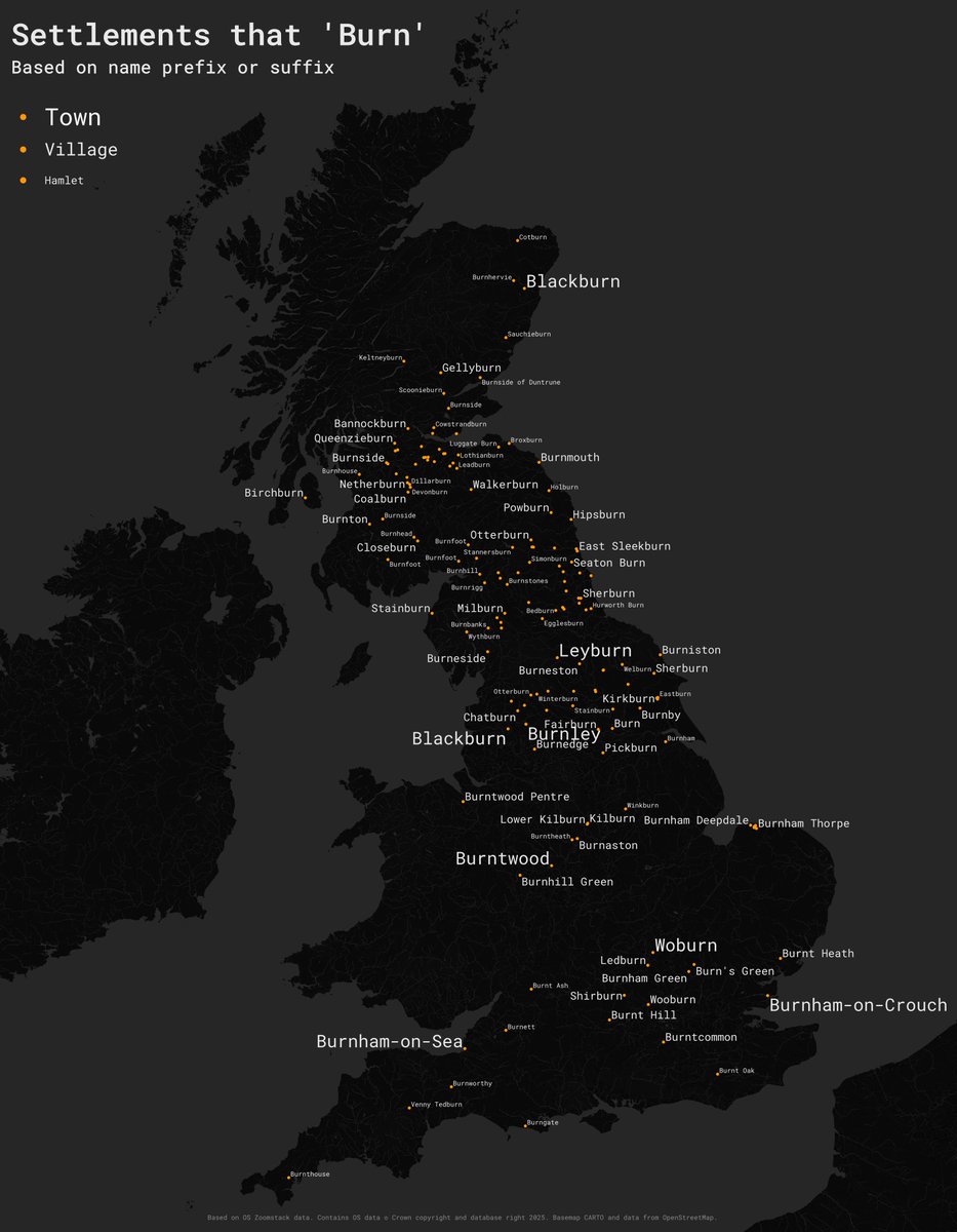
#30DayMapChallenge Day 15 – Fire.
I am still catching up so another simple one here. Place names in GB that begin with or end with 'burn'. Based on @OrdnanceSurvey#zoomstack data, made in #qgis.
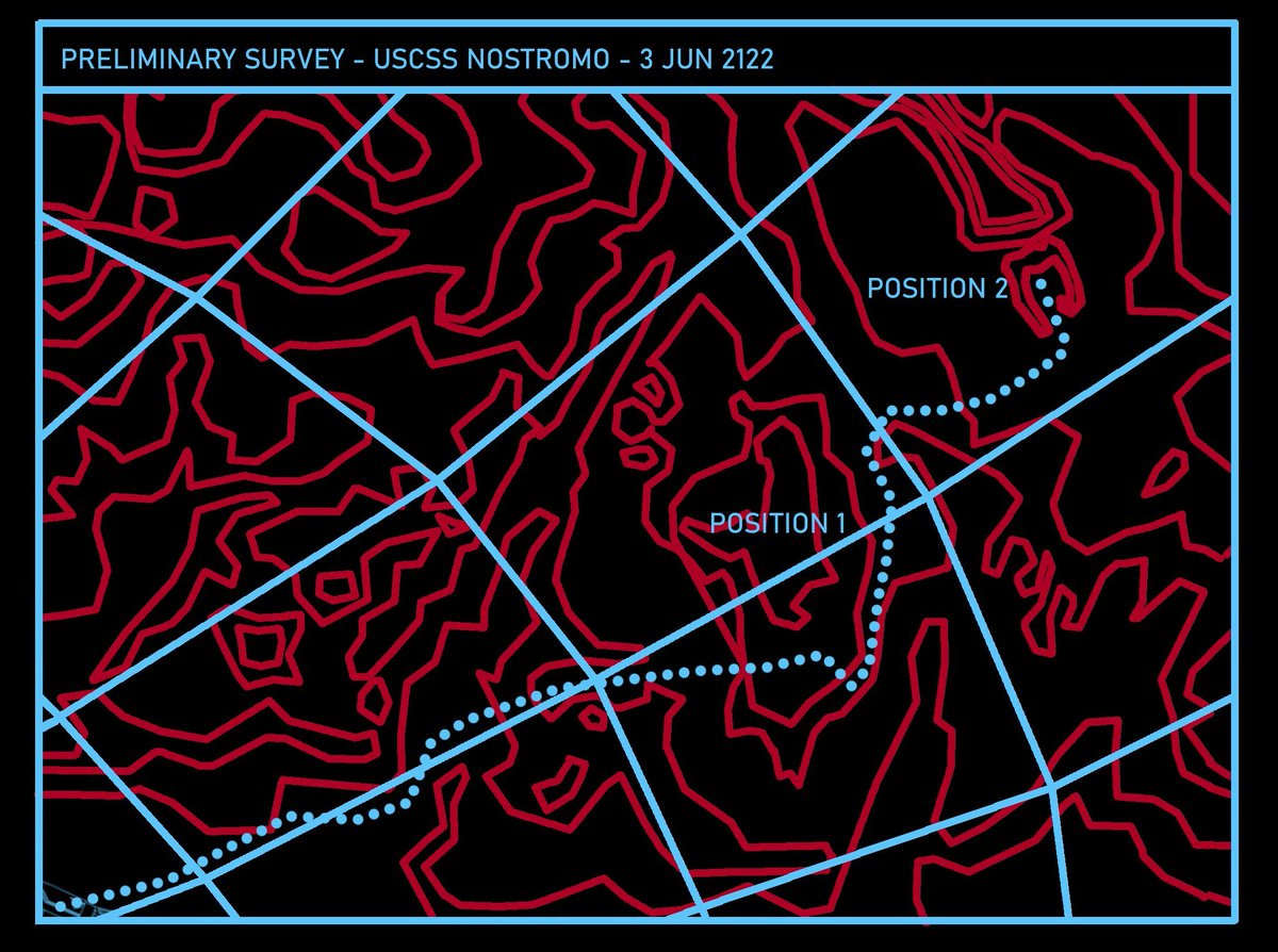
#30DayMapChallenge Day 12 — Map from 2125
Recovered transmission from the USCSS Nostromo - lost in space three years ago - reveals the vessel’s final destination before loss of contact
Made in #QGIS and #Blender, digitised from graphics seen in the #Alien movie (1979)
#30DayMapChallenge Day 13: A ten minute map and Day 14: OpenStreetMap
A quick map of Budapest. Actually took a lot less than 10 minutes using
@anvaka's city generator available at https://t.co/3gPs8RzdJG which is based on OpenStreetMap data
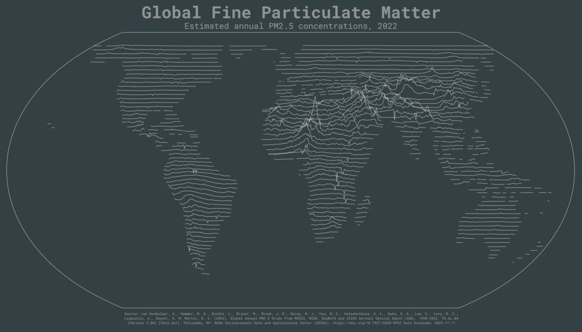
#30DayMapChallenge Day 10: Air and Day 11: Minimal
I fell behind so playing catchup, with a #joyplot map of air particulate matter based on data downloaded from NASA Earthdata. Made in #qgis.