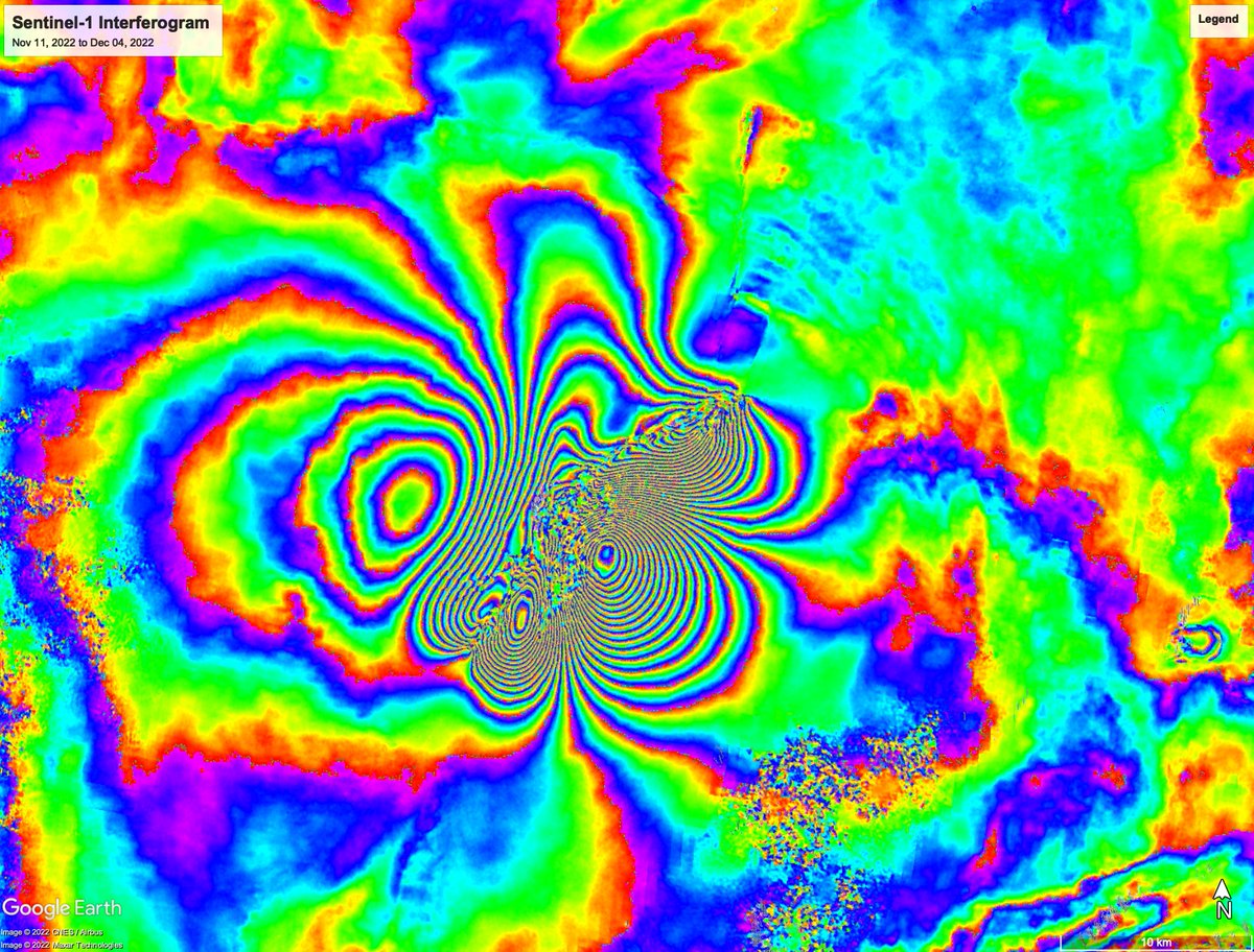
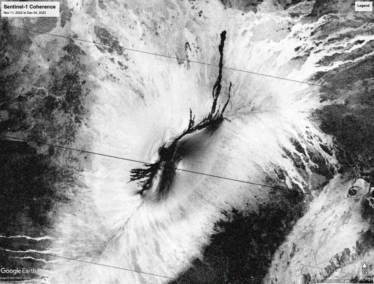
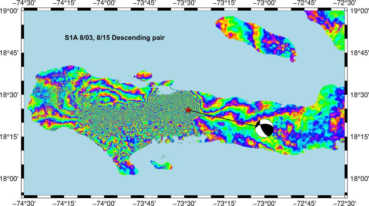
Sentinel-1 phase gradient maps show fractures in Grindavik, Icelend. Google Earth overlays from 5 Sentin el-1 acquisitions are available at: https://t.co/VMuGGU9O9f
(processed with GMTSAR)
A whole new view 🤩 🌊
First taste from the SWOT mission shows Earth’s water in higher definition than ever before. The spatial resolution of SWOT ocean measurements is 10 times greater than sea surface height data gathered over the same area by seven other satellites combined.
Oceanographer @deepseadawn made history as the first Black person to travel to Challenger Deep in the Mariana Trench, seven miles beneath the surface of the Pacific Ocean.
She shares how she overcame incredible physical odds and obstacles to get to this place in her career.
You've probably heard of Stonehenge, but what about Scrippshenge? Twice a year, the setting sun aligns perfectly between the pilings of #ScrippsPier, usually in May and August. 🌅 @UCSanDiego photographer Erik Jepsen captured this stunning #Scrippshenge image last night.
The Iceland eruption on Monday. It is still going strong, albeit showing intermittent ~12-18 hr active phases with slightly shorter pauses in between. Flying the drone on Monday was tough, very windy, but somehow it worked, with the usual panic above the crater in the end