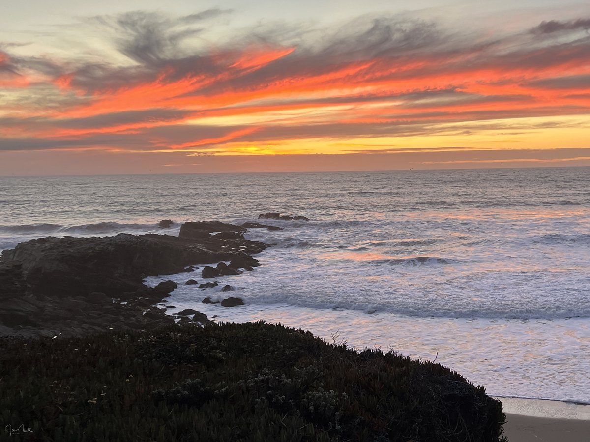
An orange sherbet sunset at Pescadero. I had driven to Pigeon Point but the sky and colors there were pretty blah! Then driving home the sky came alive. About a half dozen others pulled over to watch in wonder. (No post-processing other than to crop) 10/12/2023
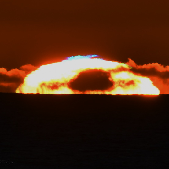
BLUE FLASH! This the most distinct example of a rare Blue Flash that I have photographed. (Zoom to see best) The exceptionally clear, post cold frontal air meant less scattering and enough refracted blue color remaining to be photographable. Half Moon Bay 11/13/2022
Light from the almost full moon is refracting through ice crystals in the high thin cirrus clouds over the Bay Area this evening to create a well-defined 22 degree lunar halo.
The San Diego County inland valleys have seen extreme temperatures before, but I can’t recall the last FORECAST of 111º. That kind of heat is dangerous, not something to take lightly. ... I��ve moved to @eyesonSDskies. Hope to see you there.
"Vapor pressure deficit" (gap between how much moisture *could* be in the air vs. how much is *actually* there) is key determinant of wildfire risk, and is increasing in a warming climate. This week, VPD in California reached highest Aug. levels in at least 40 yrs. #CAwx#CAfire
Just did some rough math. It appears that we're closing in on 600,000 acres burned by lightning-sparked wildfires in Northern California *in just 7 days.* Nearly all such fires are still spreading rapidly. I'm truly at a loss for words. #CAwx#CAfires#CaliforniaWildfires
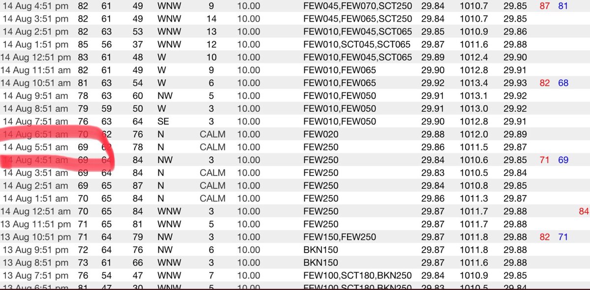
Hey man, remember the 60s? The last time San Diego had a temp reading in the 60s was before 6 a.m. Aug. 14. The low this morning was 72. No 60s are in the forecast for the next week. Normal low this time of year is 67. I’ve moved to @eyesonSDskies. See you there! #sandiegoweather
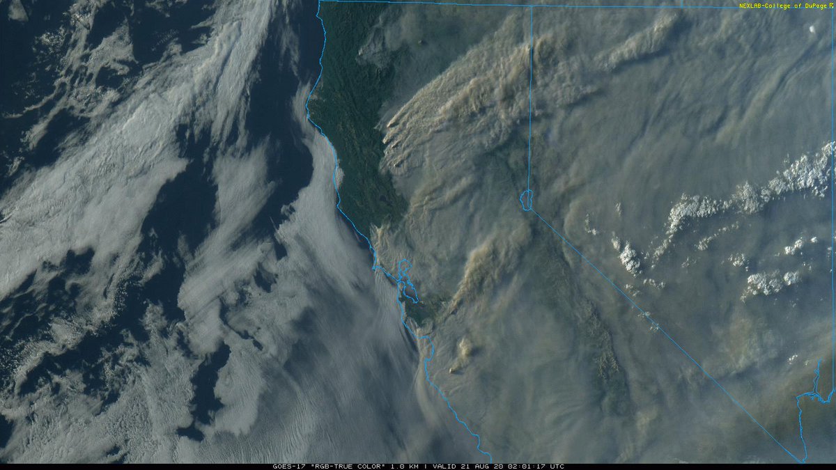
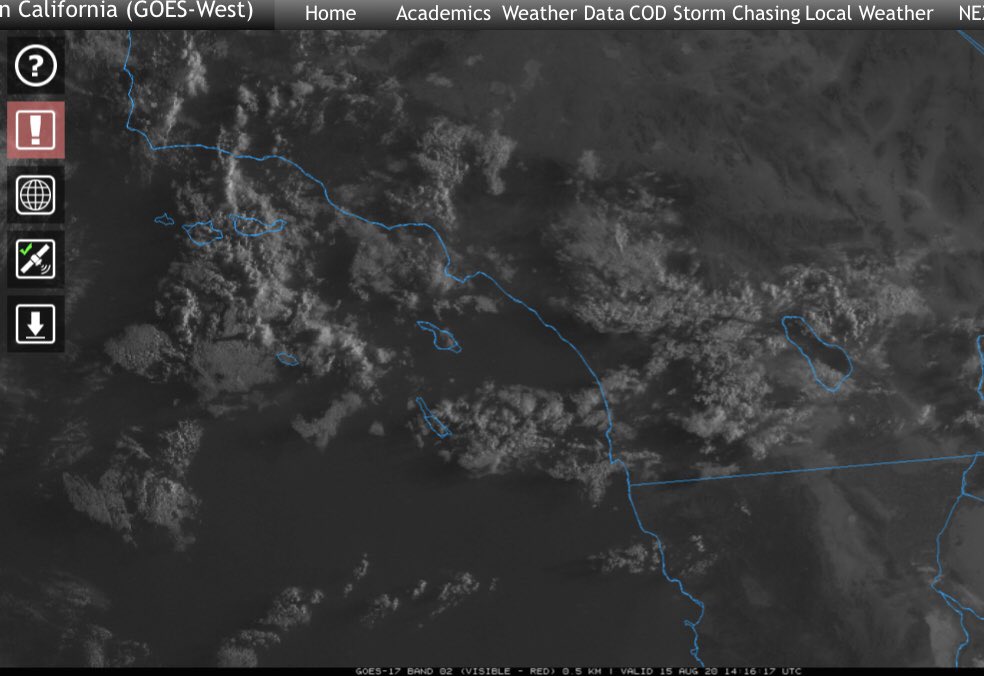
Well, this is some terrible timing: on top of continued record heat today and beyond, risk of thunderstorms with dry lightning also rising. High-res models depicting pretty widespread elevated convection central and northern California. Major fire weather threat... #CAwx#CAfire
Last night will probably be the first in at least a week’s worth of nights that never dip below 70º in San Diego. The low last night was 72. The record for the highest minimum on Aug. 15 is 74, set in 1992. I’ve migrated to @eyesonSDskies. Hope to see you there. #sandiegoweather
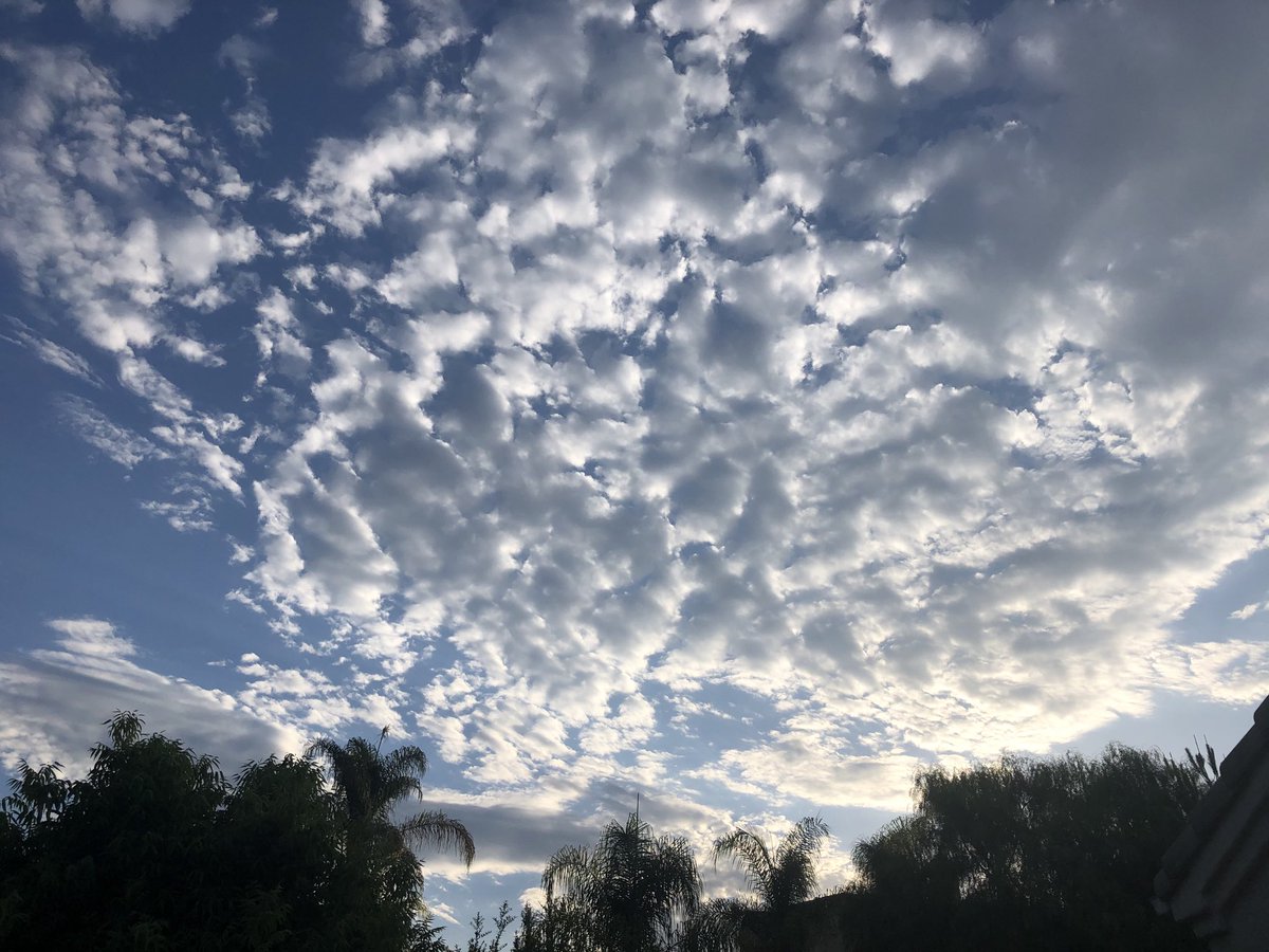
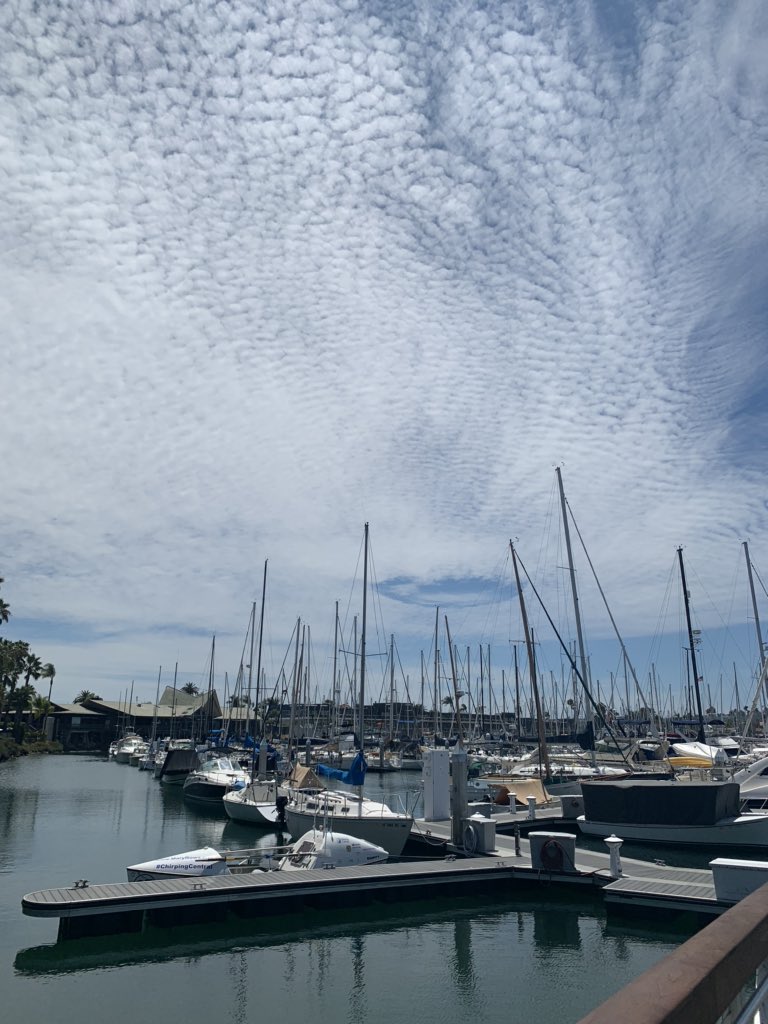
Monsoonal moisture is giving us beautiful, textured skies today. It is also creating a chance for thunderstorms in the mountains and desert, where the high temps could get knocked down a degree or two but the humidity will make it feel even hotter. #sandiegoweather#NWSSanDiego
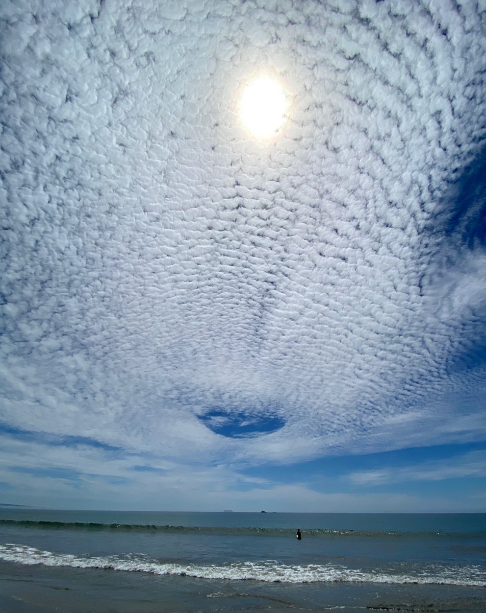
Cool shot of a Fallstreak Hole (also called a "hole punch cloud") over San Diego today!
These are formed by aircraft penetrating through the cloud layer, resulting in rapid crystallization of droplets and subsequent fallout.
This page has more info: https://t.co/oLd3cy6hSE
787 reports of wind-related severe #weather on Monday. Highest total of 2020 in the USA... & majority were related to #derecho that moved thru Iowa & #Chicago area. #ILwx#IAwx@nbcchicago
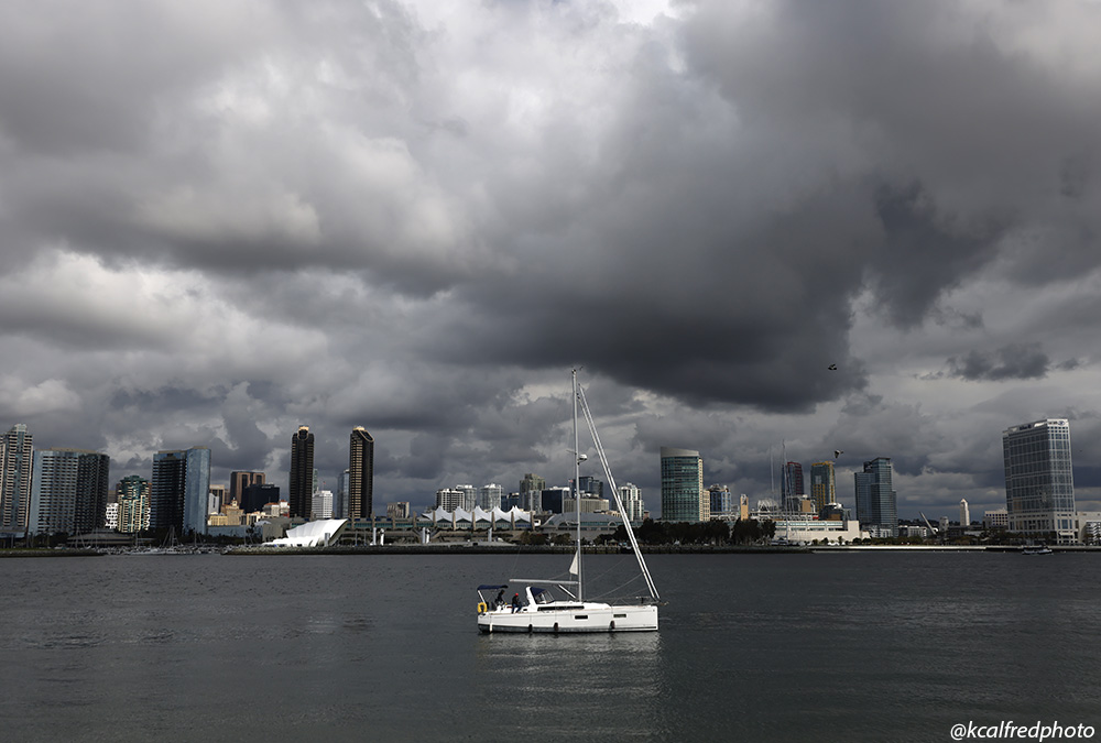
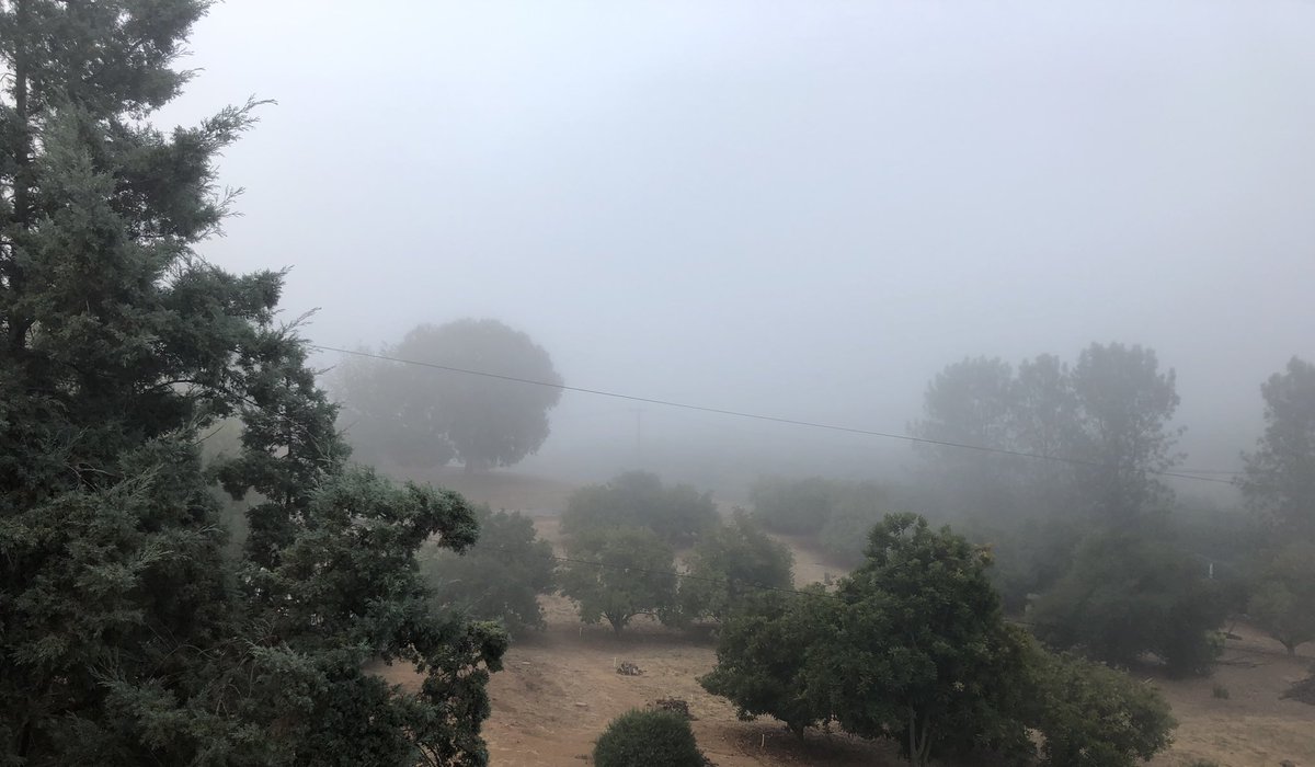
Interesting weather week: Dense fog in inland North County burned off quickly this morning. A lot to keep an eye on: clouds from current Hurricane Elida arriving Thursday (rain not likely), excessive heat Friday & Saturday, maybe a coastal eddy over the weekend. #sandiegoweather