Last shows for @KWCHSarah tonight! Sad for us, happy for her (she’s headed home to TX to be a teacher). We started weekends together, and now I’m honored to help send her off! So is her friend Pancake pictured here in his best Hawaiian for the occasion.
A Severe Thunderstorm Warning has been issued for NW Elk, NE Cowley, SE Butler, and SW Greenwood Counties until 3:45 p.m. Golf ball size hail and 70 mph wind gusts will be possible as the storm moves to the southeast around 20 mph. #kswx#storm12
Storms could produce large hail and damaging wind gusts in Kansas this afternoon and evening. Here's a better look at the timing of these storms... #kswx#storm12
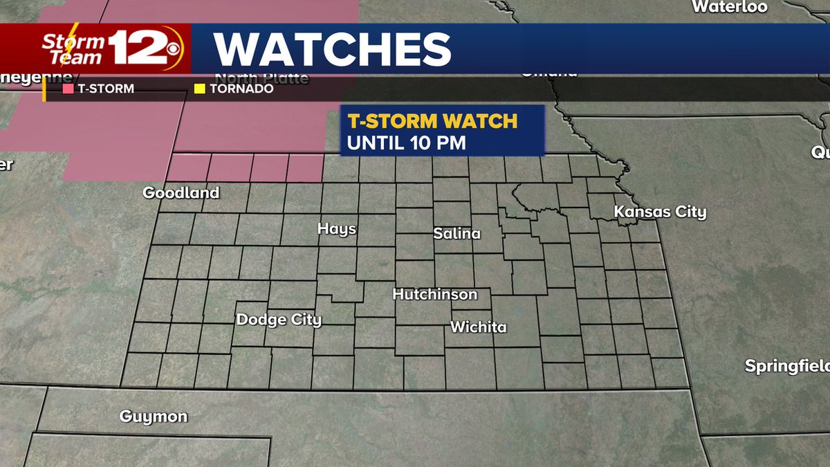
A Severe Thunderstorm Watch has been issued for northwestern Kansas until 10 p.m. Wind gusts around 70 mph and hail around 2 inches in diameter will be possible this evening. Please stay weather aware today if you're in this area! #kswx#storm12
Showers and storms will continue to move to the southeast through the rest of the day as a cold front moves through the state. This front will move into south central KS tomorrow, keeping the chance for rain in the forecast through then. #kswx#storm12
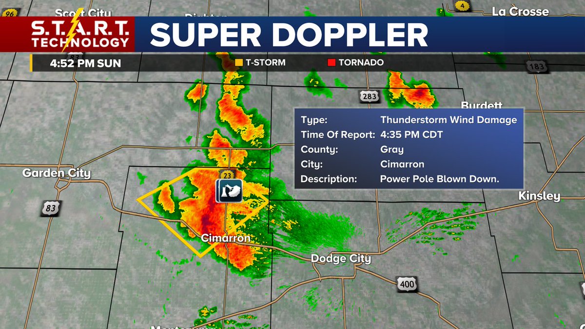
Reports of a downed power pole and golf ball sized hail are coming in from Gray County this afternoon. This storm is moving slowly, to the southwest at 10 mph. #kswx#storm12
A Severe Thunderstorm Watch has been issued for western Kansas until 11 p.m. Our main threats through the rest of the day will be large hail, damaging wind gusts, and heavy rainfall. Please be careful and stay alert if you're in this area. #kswx#storm12
Storms have started to fire up this afternoon near Dodge and Jetmore in southwestern Kansas. We don't have anything severe yet, but there is some lightning, so please be careful! #kswx#storm12
Storms will be possible for parts of Kansas tonight & tomorrow afternoon/evening. Please stay weather-aware if you have outdoor plans this holiday weekend, especially if you live in western Kansas. Here's a look at the latest forecast... #kswx#storm12
Ready for the Fourth of July?
It's going to stay dry for the weekend! Our highs will be mild, in the upper 80s and we'll have a partly to mostly sunny sky. #kswx#storm12
WEEK AHEAD: Our highs will stay mild and we'll have scattered showers and storms possible Monday, Tuesday, Wednesday, and Thursday. Rain will come to an end just in time for your 4th of July weekend. #kswx#storm12
This storm moving through Cowley County produced a 52 mph wind gust. Please be cautious if you are in the line of the storm (it is moving to the east). #kswx#storm12
Storms moving through central and eastern Kansas have been producing very high wind gusts this afternoon. A semi rolled over in Chase County. These storms are moving to the northeast slowly. #kswx#storm12
A Severe Thunderstorm Watch has been issued for central and eastern Kansas until 9 p.m. Large hail and damaging wind gusts will be our primary threats today, but we will keep you updated through the evening. #kswx#storm12