When fieldwork meets the #NanoBanana trend…😎
While Nano Banana turns selfies into collectible models, our GNSS solutions transform on-site measurements into precise digital datasets. Both remind us how technology bridges the physical and digital worlds.✨
#SingularXYZ
#SingularXYZ FAQ Series - How to do visual AR stakeout with Orion ONE Series? 🌟
By overlaying stakeout points directly on the real-world image, Orion ONE helps you finish stakeout tasks over 50% faster than traditional methods.
🎥 Watch 👇
#GPS#GNSS#geospatial#AR#GIS#rtk
💡In our previous blog, we explained GNSS antenna calibration and the role of NGS certification. This time, we'll take a closer look at the calibration files produced by NGS—ANTEX and ANTINFO—and how these files can be understood and applied.
Read👉 https://t.co/eFrEdqj9BQ
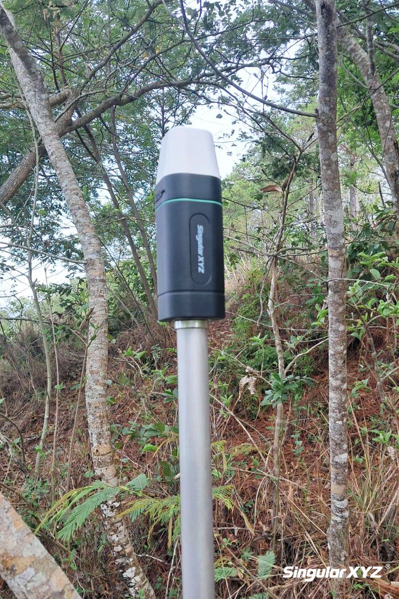
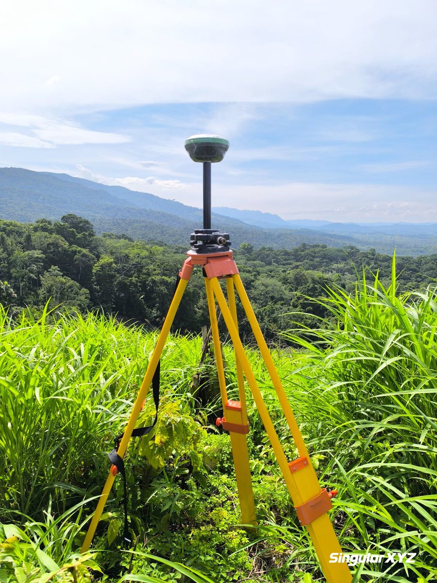
📍Jungle boundary survey for land management
Even in heavy foliage and humid conditions, X1 delivers reliable RTK performance, helping surveyors complete boundary marking without interruption.🌿
More about X1 https://t.co/2YrdVXYVbo
#GIS#geospatial#surveying#RTK#GNSS#GPS
📡Clear & Precise Laser Surveying — Day or Night With Orion ONE Visual & Laser RTK, simply stand, aim, and capture — no steps wasted, no points out of reach.
Credit: Top Cadastru Bucovina S.R.L
More about Orion ONE https://t.co/QunQKJ2bZa
#GIS#surveying#RTK#surveyor#GPS
🚀 Delivered and Deployed — X1 Pro RTK in Action!
From unboxing to first fix, the X1 Pro is already proving its worth in the field with its compact design, all-round functionality and centimeter-level accuracy.
Thanks to our local partner for ensuring a smooth handover & support.
Visualizing Points, Simplifying Stakeout — with Orion ONE🎥
By overlaying design data onto the real-world environment, Orion ONE Visual & Laser RTK helps surveyors intuitively locate stakeout targets with high precision & less effort.
More about Orion ONE https://t.co/QunQKJ2bZa
🎉 SingularXYZ has officially released a new series of leveling instruments: the DL07 and DL15 digital levels, along with the AL15 automatic level. this lineup covers a range of leveling needs across construction and engineering tasks.
Read news https://t.co/9wmM0Lw3aQ
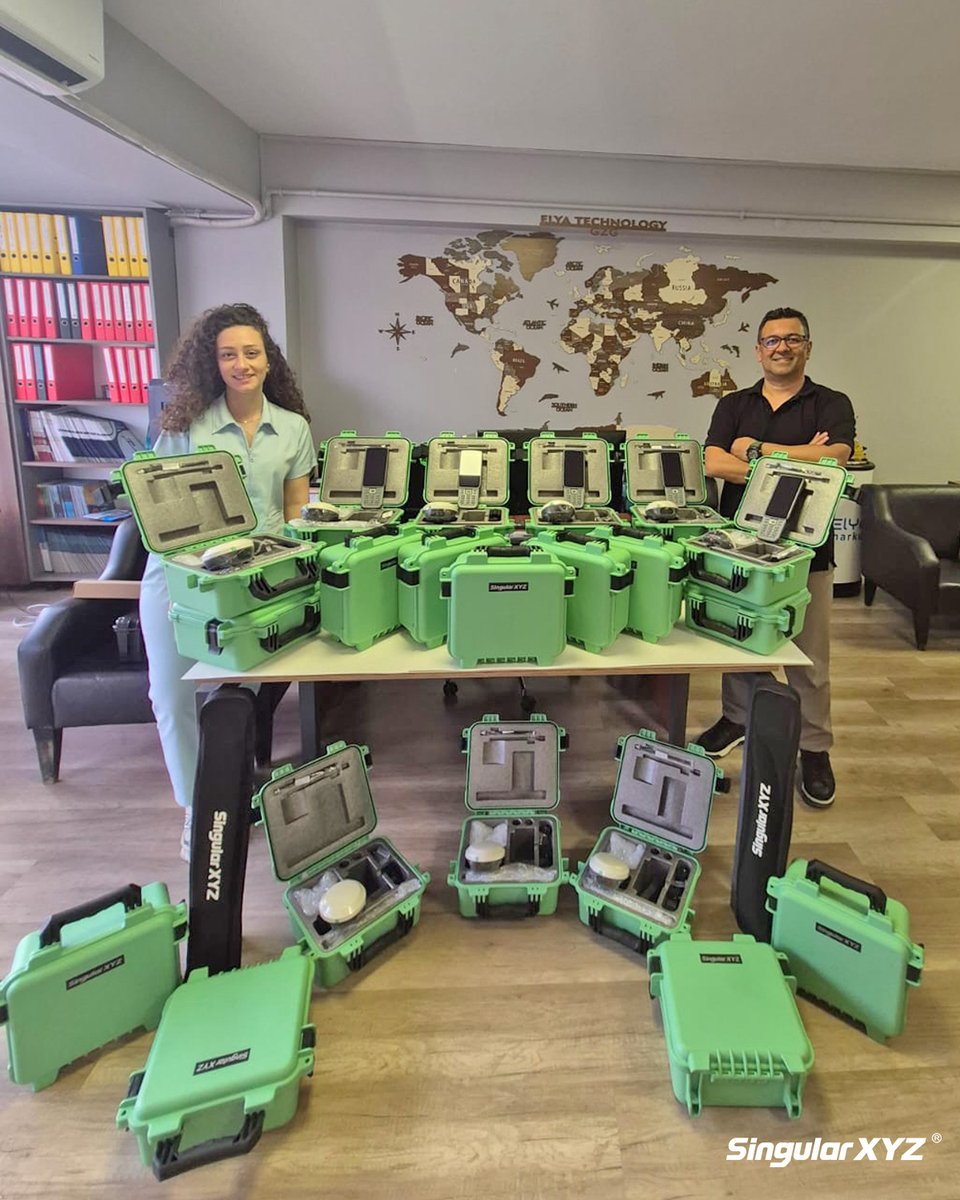
📦 New Arrival in Türkiye – Our Turkish partner has just received a new batch of Orion ONE visual & laser RTK ! The advanced sensor fusion technology is set to bring new momentum to the local surveying and construction market. 🛰️🚧
Credit: SingularXYZ partner @elyatekno
💡Understanding MSM4: The Universal Message Format in GNSS RTK💡
In this blog, we'll break down what MSM4 is, what it includes, how it compares to other MSM types, and why it has become the go-to solution for differential GNSS corrections today.
Read https://t.co/axUog4TtXc
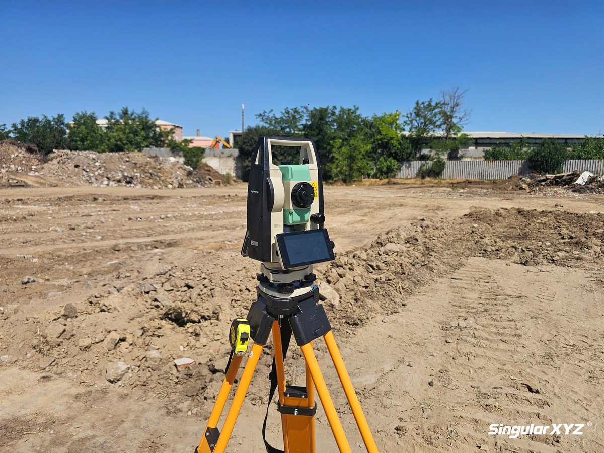
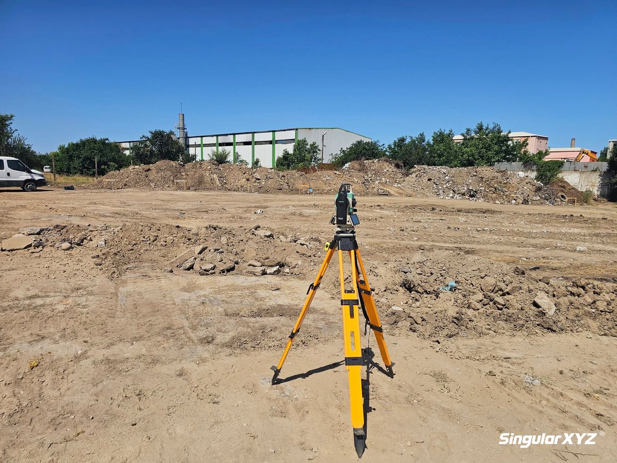
🚧 STSA9 Android Total Station in Action on Construction Site
With its Android-based OS and touchscreen control, the STSA9 makes fieldwork on construction sites more efficient than ever—delivering millimeter-level accuracy faster and easier.
https://t.co/QGNdtKbjs5
#geospatial
🌐 Reliable GNSS Performance in Challenging Forested Terrain
The Sfaira ONE Plus excels in land boundary surveys, even under tree canopy. With the compact design and robust signal tracking, it is well-suited for applications in land demarcation, forestry & rural property surveys.
📍An impressive user case of X1 GNSS receiver in Cornwall!
In this project, our user leveraged the centimeter-level precision of the X1 to survey accurate GCPs, enabling high-resolution drone mapping & 3D modeling of the site.
cr. TinkeringwithJERD
Watch: https://t.co/xWO4a7khbx
In the previous blog, we explored the communication system built into the mainboard of an RTK GNSS receiver. Continuing this series, today's blog will focus on the main functional modules integrated into the receiver's mainboard.
Read the blog 👉 https://t.co/hJAcB9oqtY
📦 From Unboxing to Fieldwork — X1 RTK Kit in Action!
Quick setup, stable performance — the X1 RTK delivers precise positioning with built-in radio mode even in the forest. Paired with the 6" screen & full-keyboard of SC300 controller, ensuring a clear & smooth experience.
🌿 Forest survey in action with X1 GNSS Receiver!
Working deep in dense forest and along streams, the X1 performs reliably in internal radio mode — providing centimeter-level accuracy in challenging environments. From creek banks to thick forest canopies, keep the survey going.
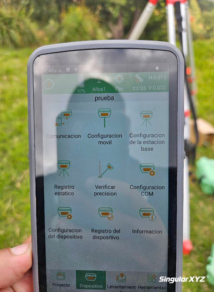
📡First station in a nationwide GNSS network!
This newly mounted SingularXYZ SV100 reference station is part of a national project aimed at enhancing geospatial infrastructure and RTK coverage in Romania.
📍Surveying With STSA9 Android Total Station!
Experience smarter, faster fieldwork with STSA9 — featuring an intuitive Android system, 5-inch HD touchscreen, and integrated SingularPad software for onboard TPS survey! 📐
More about STSA9 https://t.co/m7V4n09fFc
#geospatial
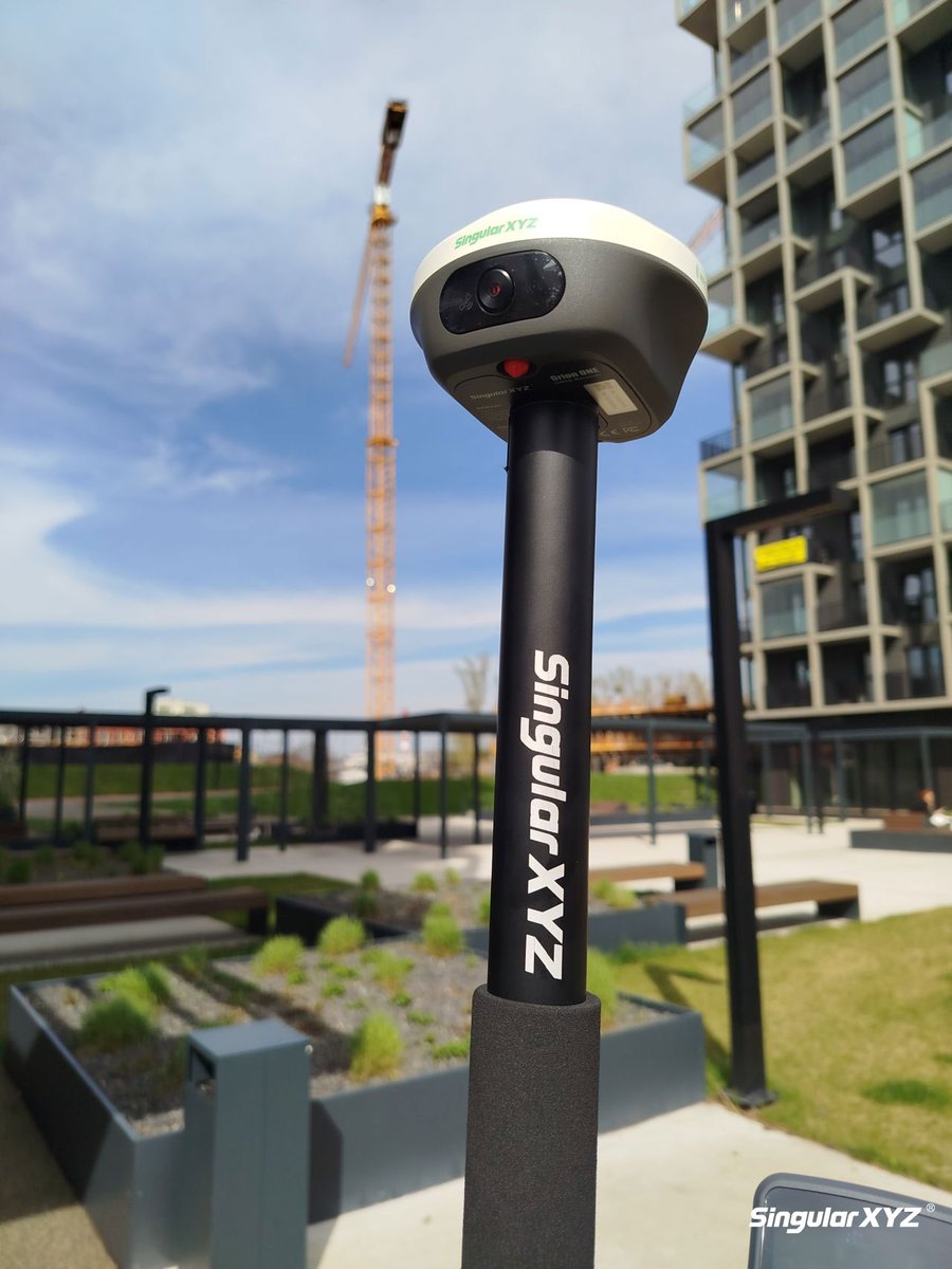
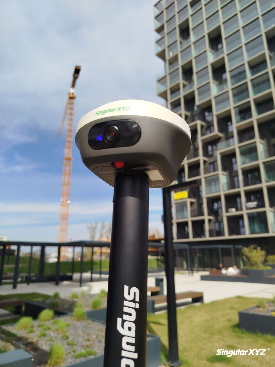
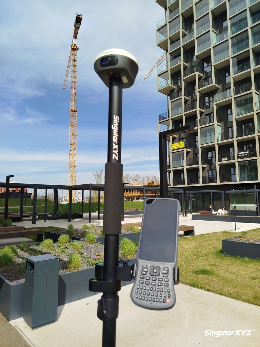
Kicking off today’s site work with the Orion ONE GNSS receiver 📍
From high-rise layouts to tight urban corners, its AR visual stakeout and laser measurement features help you find what to stakeout and measure what you see - fast and accurate.
#GIS#geospatial#RTK#surveyor#GPS