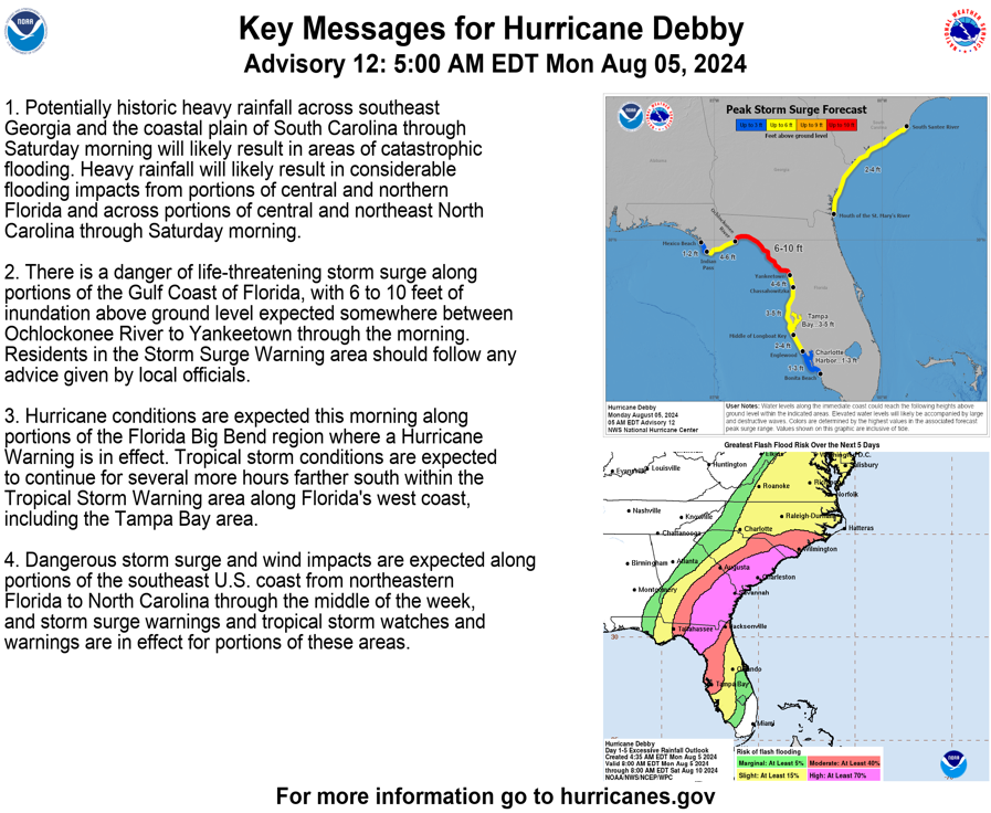
#Debby Has made Landfall Around 7:30am EDT. Expect life threatening Storm Surge and Damage. Power Outages are likely. Flooding will be severe.
| #FLWX#GAWX#SCWX#NCWX | #hurricane#Landfall |
5 am EDT: Hurricane #Debby very near landfall in the Florida Big Bend. Life-threatening storm surge expected in portions of Florida and major flooding is forecast for the southeastern U.S. Here are the Key Messages. https://t.co/tW4KeGdBFb
11:37am CDT #SPC Day1 Outlook Moderate Risk: from far northwest Oklahoma through central and eastern Kansas into west-central Missouri https://t.co/TgJgC6cj9Y
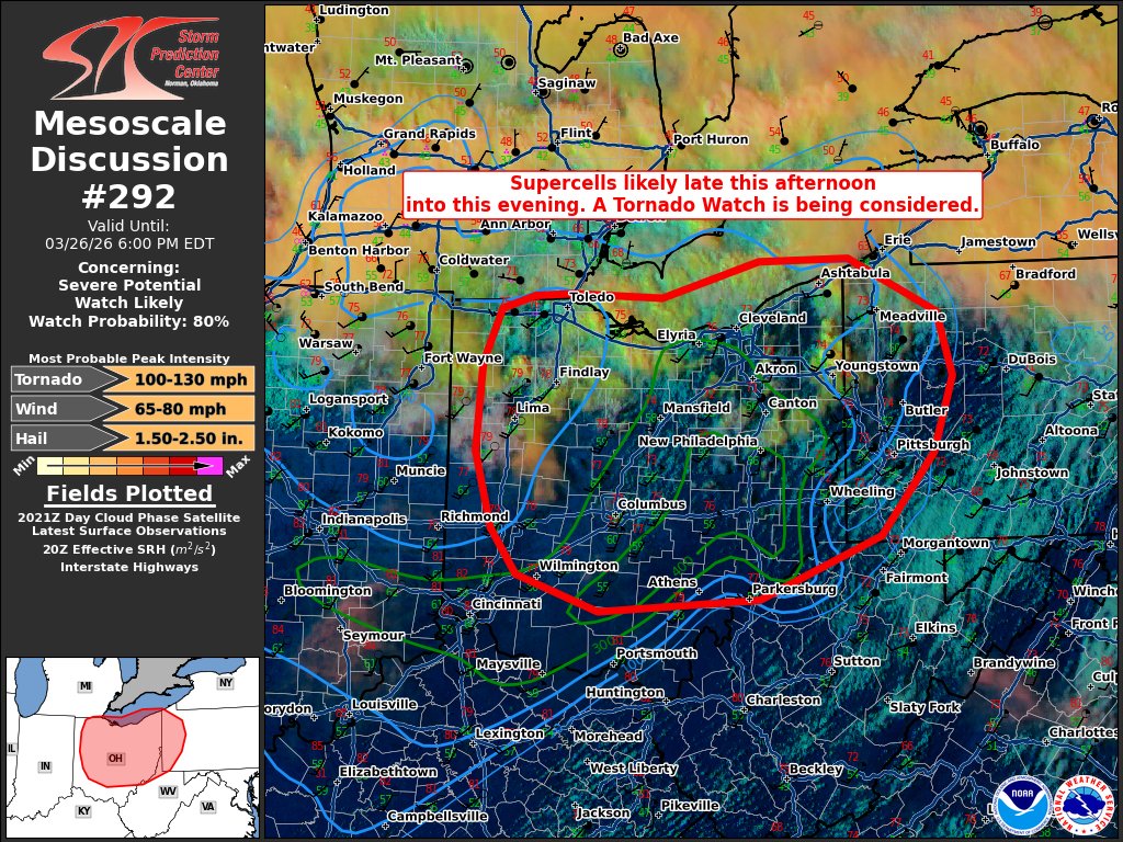
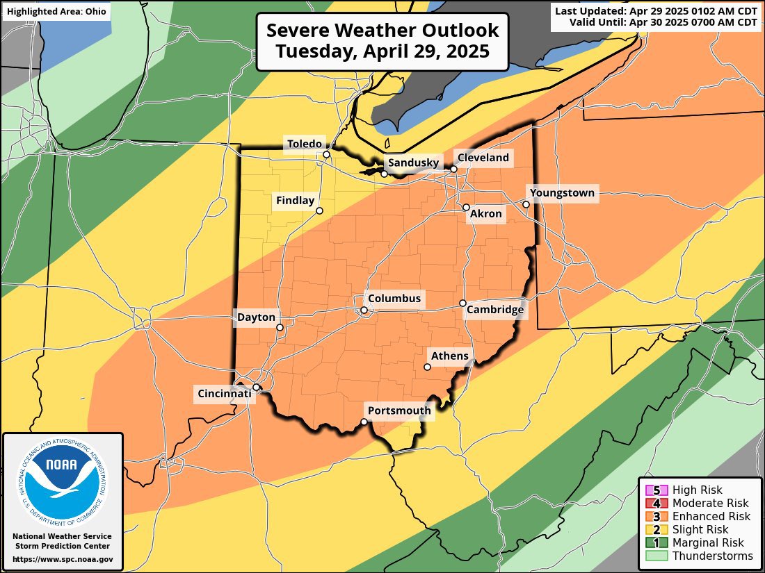
#ohwx - Potential for Severe Thunderstorms Increase this afternoon.
The Concerns will be Damaging winds over 60mph. Moderate Hail. And the chance for few tornadoes isn’t out the window.
Have a way to receive weather alerts. Timeframe for storms seem to be after 1pm.
A PDS (Particularly Dangerous Situation) tornado watch has been issued for the Mid MS Valley into southern IL/IN through midnight central time.
Several strong (EF2) to intense (EF3+) tornadoes are likely this afternoon/evening.
Multiple rounds of severe storms are expected.
12:57am CDT #SPC Day1 Outlook High Risk: across parts of northeast Arkansas, far southeast Missouri, far southern Illinois, western Kentucky, western Tennessee and extreme northwest Mississippi https://t.co/TgJgC6cj9Y
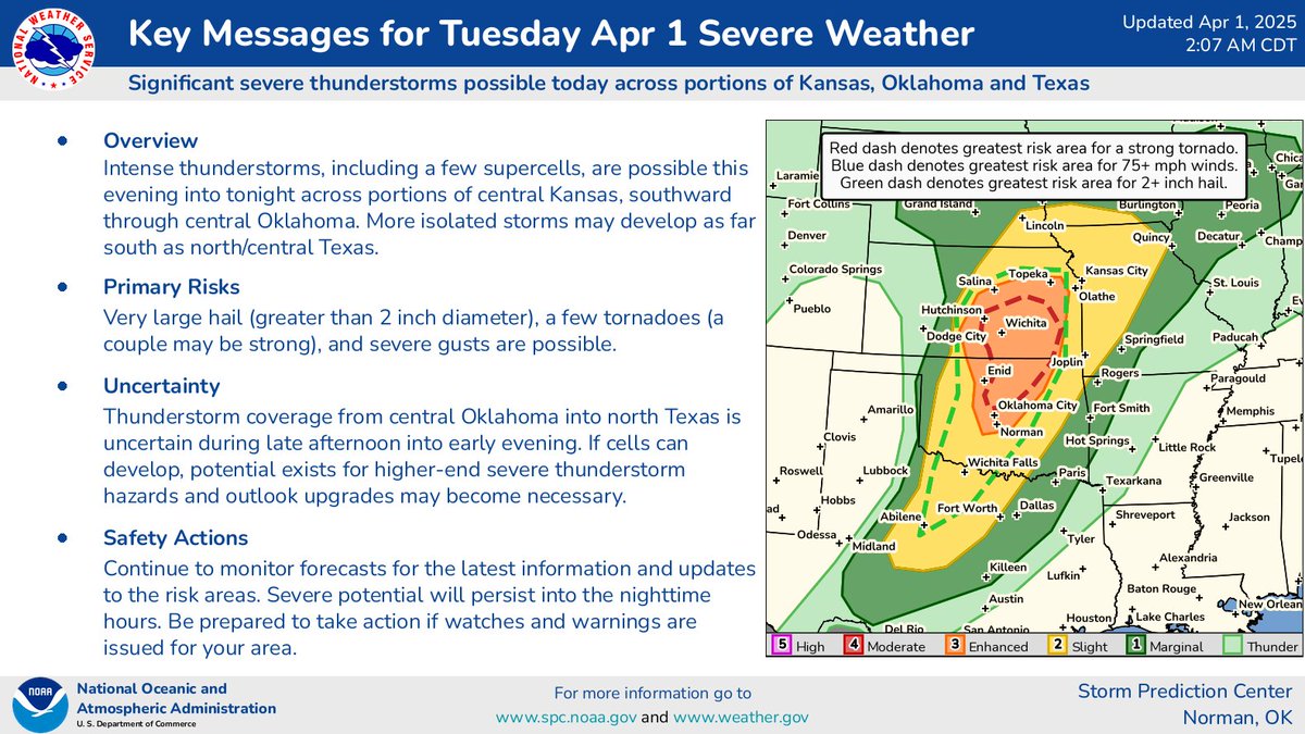
Severe thunderstorms are expected across portions of the central and southern Plains today (4/1/25). Significant hail (2+ inch diameter), tornadoes (a couple may be strong), and severe wind gusts are possible this evening and tonight.
@isabelle_wts Keeping the Enhanced is worthy enough at this time. Due to uncertainty of the models and prefrontal cells and the ability of the expected explosion of line of storms to form. Which gives the amount of uncertainty of the environment.
Let’s all wait until Wednesday.
12:40am CDT #SPC Day1 Outlook Enhanced Risk: late this evening across parts of north central Oklahoma into south central Kansas https://t.co/TgJgC6cj9Y
[3:34 PM] A Flood Watch is in effect from Wednesday evening through Sunday morning for the highlighted area. Multiple rounds of storms are expected, and flooding caused by excessive rainfall is possible.
3/31/25: Swaths of severe thunderstorm wind gusts are expected across the Southeast today. For the latest forecast information, visit https://t.co/St6FGvEy8Q