Only 4% of AEC data is structured & defensible.
Most construction site data lives in photos, PDFs, and inboxes, not in decisions.
Structured, geo-located field documentation changes that.
Learn more: https://t.co/6yPkDgl7Ro
#ConstructionTech#AEC#CivilEngineering#FieldData
Great kick-off to the week at the @CofC!
Thanks to Kristen McMullen, Carrie Blair Messal and Emily Wiseman for hosting Landon Messal, P.E. and creating space for an honest conversation around entrepreneurship and building something from the ground up. And a special thanks to Gary Collins, a longtime advisor and colleague, for bringing thoughtful business perspective and depth to the conversation.
From building in the field to scaling SiteMarker, the discussion centered around what entrepreneurship actually looks like beyond the highlight reel: resilience, clarity, execution, and learning in real time.
We’re always impressed by the caliber and curiosity of students at College of Charleston, and we’re excited to see where their careers lead.
Grateful for the conversations and the energy in the room.
#Entrepreneurship #Leadership #BusinessWeek #CollegeOfCharleston
On February 16, Landon Messal will be speaking at the @CofC during Business Week.
He’ll be diving into his entrepreneurial journey, what it actually looks like behind the scenes, and the realities of building something from the ground up.
Building in the field. Scaling in the real world.
If you’re in Charleston, come join the conversation.
Details: https://t.co/7eUUEVHvT4
#Entrepreneurship #ConstructionTech #Leadership #BusinessWeek #CollegeOfCharleston
70% of construction data is wasted.
It just continues to live in camera rolls, email threads, PDFs, and shared drives; captured, but never truly applied.
Digital transformation isn’t about new tools. It’s about eliminating uncertainty.
Today, most AEC teams still rely on manual documentation, siloed data and assumptions instead of evidence. That works, until it doesn’t.
The next generation of projects will be built by teams who can see reality in real time, not rely on old non-contextual data.
The shift is already happening at SiteMarker.
Book a demo to see how we put your data to work: https://t.co/mWgGYZXhky
#AEC #AECIndustry #CivilEngineering #ConstructionManagement
What stood out the most to us during our time at @universityofga, was that how many students and practitioners are already thinking beyond the studio, focused on how design intent carries through to the field. It was encouraging to see college programs prioritizing real-world application alongside theory.
These conversations reinforced something we hear often: landscape architecture is more than design. It’s the ongoing coordination of vision, constructibility, and execution on site.
A clear takeaway from the week: the next evolution of the profession will be driven by better communication, shared context, and smoother handoffs across teams.
#AEC #CivilEngineering #ProjectManagement #Construction #LandscapeArchitecture
Great conversations yesterday at the UGA Short Course, organized by @universityofga, with landscape architects, planners, and project leaders around a shared theme we kept hearing: field documentation still breaks down at the handoff between site and office.
Whether it’s photos living in camera rolls, notes in notebooks, or reports taking longer than they should, the challenge isn’t effort, it’s structure. Teams want documentation that’s visual, contextual, and easy to refer to later.
Excited to keep learning from these conversations over the next few days and share what we’re hearing from the field.
If you’re here in Athens, come say hello!
#UGA #AECIndustry #SiteMarker #LandscapeArchitecture #CivilEngineering #AEC
Announcing the SiteMarker + Nearmap integration for up-to-date aerial imagery.
Outdated satellite maps slow down real work.
SiteMarker now integrates with Nearmap to bring fresh, high-resolution aerial imagery into your project layers,often captured just weeks or months ago.
📍Draw your area
📅 Select the desired capture date
💾 Save the layer
In many areas, you’ll get imagery from just a few months back. For example: instead of seeing a blank construction site, you could be looking at a finished school.
It’s a faster, clearer way to understand your jobsite, and show your progress.
Want up-to-date aerials across all of your projects?
Set up a demo with our team: https://t.co/39SgMg4euc
#ConstructionTech #FieldVisibility #SiteMarker #Nearmap #AerialImagery #SWPPP #CivilEngineering #JobsiteTools
We’re thrilled to welcome DesignWorks to SiteMarker.
DesignWorks is an international Landscape Architecture, Urban Design, and Planning firm located in and inspired by the landscape and urban form of Charleston, SC. Their work focuses on creating life-enriching places that balance environmental enhancement, stewardship, and social engagement.
Over the past two decades, nearly 100 professionals have contributed to DesignWorks’ legacy, shaping communities locally and globally. Their vision has been recognized with national, regional, and state awards from the American Society of Landscape Architects and the Urban Land Institute, as well as the City of Charleston’s Award for Design Excellence.
Now, with SiteMarker, DesignWorks has a powerful new tool to strengthen that vision with site-level precision. Whether coordinating with civil engineers, managing landscape construction inspections, or documenting as-builts and punch lists, SiteMarker supports their mission to create memorable places that provide lasting value.
“This platform has expedited and streamlined the process of coordinating between disciplines and contractors. SiteMarker has become an integral part of our workflow.”
— Miles Holland, DesignWorks
We’re proud to partner with a team that continues to elevate the built environment through clarity, creativity, and care.
Welcome to SiteMarker, DesignWorks.
#LandscapeArchitecture #AECInnovation #CharlestonDesign #FieldFirst
Led by Paul Kissinger, FASLA, PLA, SiteMarker is being used in coursework, at @UMSEAS, to give students hands-on experience with modern field documentation, across masterplanning, survey design, and observation walks.
By comparing traditional methods with SiteMarker’s digital workflows, students learn how site notes, photos, and observations can be centralized, geo-tagged, and reported in real time, preparing them for industry best practices.
Read the article here: https://t.co/woD57b8jTk
#AEC #ConstructionTech #SiteMarker #CivilEngineering #LandscapeArchitecture
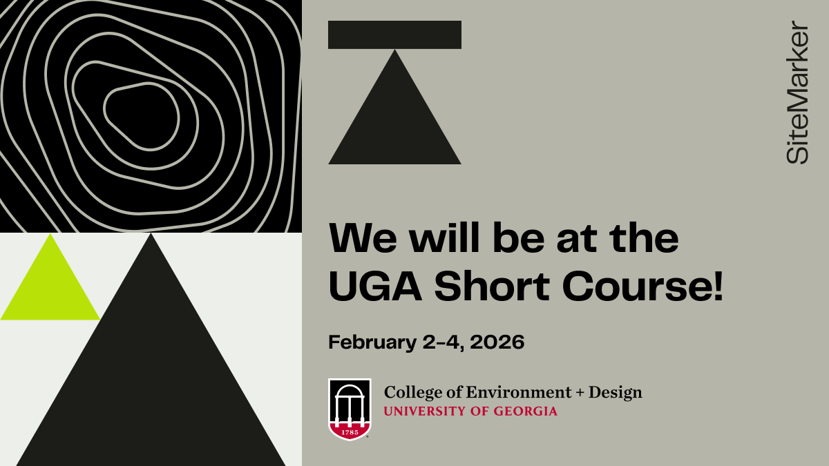
We’re excited to be attending the UGA Short Course next week, organised by @universityofga.
The UGA Short Course brings together landscape architects, designers, planners, and project leaders to share real-world ideas shaping the built environment, and that’s exactly the conversation we’re excited to be part of.
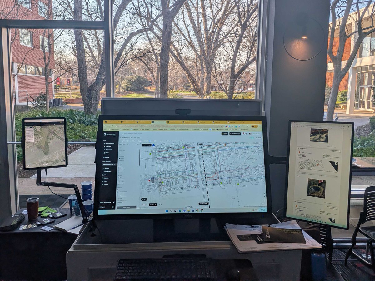
At the event, we’ll be showing how SiteMarker helps teams modernize field documentation with a map-first approach, capturing geo-tagged photos, notes, and site conditions, turning them into clear, defensible reports, and keeping everyone aligned from planning through construction.
For landscape architecture teams, better documentation means protecting design intent, reducing rework, and spending less time on the administration front.
If you’re attending, come & say hello, we’d love to talk!
See you in Athens!
We’re excited to be attending the UGA Short Course next week, organised by @universityofga.
The UGA Short Course brings together landscape architects, designers, planners, and project leaders to share real-world ideas shaping the built environment, and that’s exactly the conversation we’re excited to be part of.
At the event, we’ll be showing how SiteMarker helps teams modernize field documentation with a map-first approach, capturing geo-tagged photos, notes, and site conditions, turning them into clear, defensible reports, and keeping everyone aligned from planning through construction.
For landscape architecture teams, better documentation means protecting design intent, reducing rework, and spending less time on the administration front.
If you’re attending, come & say hello, we’d love to talk!
See you in Athens!
Led by Paul Kissinger, FASLA, PLA, SiteMarker is being used in coursework, at @UMSEAS, to give students hands-on experience with modern field documentation, across masterplanning, survey design, and observation walks.
By comparing traditional methods with SiteMarker’s digital workflows, students learn how site notes, photos, and observations can be centralized, geo-tagged, and reported in real time, preparing them for industry best practices.
Read the article here: https://t.co/woD57b8jTk
#AEC #ConstructionTech #SiteMarker #CivilEngineering #LandscapeArchitecture
There’s no better way to understand what matters in the field than being in the field. These visits sharpen how we support on-site workflows, site documentation, and real-time issue capture. But more than that - they remind us why we build SiteMarker in the first place: to listen, learn, and solve real problems with real people.
Big thanks to Thomas & Hutton for showing us how they're using SiteMarker at Project Connect.
The only thing better than being on site with your client is flying over the site! Big thanks to Will Gregg for an incredible flight to Greenville and back. Captured this awesome pic of Project Connect on our return flight.
#ConstructionTech #FieldOperations #ClientCollaboration #FromAbove
Our Founder & CEO Landon Messal, P.E. joins the Built With Purpose Podcast with Chris Fay to unpack the real-world friction so many civil, DOT, and utility teams are feeling - and what it takes to lead through it.
In this episode:
- Why innovation often stalls in the field
- The leadership gap in AEC tech
- How simple, field-first tools create real change
- What Landon’s hearing from teams across infrastructure and civil sectors
If you're building in AEC - whether it's teams, tools, or smarter workflows - this conversation is going to hit home.
Listen here: https://t.co/UZ57x51MlQ
Big thanks to Chris for having us on and creating space for conversations that move the industry forward.
#AEC #ConstructionTech #SiteMarker #CivilEngineering #InfrastructureLeadership #BuiltWithPurpose
As we approach two years with DRG, we’re reminded why in-person time matters.
This week, we joined the DRG team on-site in Myrtle Beach for a hands-on walkthrough with new users and a working session with their most active crews. The feedback was sharp, the questions were thoughtful, and the collaboration was exactly what we aim for.
Big thanks to Cam Parker and team for hosting us. Every visit like this helps us build a better tool - one that works the way field teams actually work.
Real-world workflows
Visual, location-based capture
Input that’s shaping what’s next
SiteMarker is designed for the people who move fast, coordinate across roles, and need their documentation to keep up. DRG continues to be a field-first partner in every sense.
Here’s to the road ahead - and more time on the ground with teams that keep us honest.
#ConstructionTech #FieldToOffice #InPerson
We’re thrilled to welcome DesignWorks to SiteMarker.
DesignWorks is an international Landscape Architecture, Urban Design, and Planning firm located in and inspired by the landscape and urban form of Charleston, SC. Their work focuses on creating life-enriching places that balance environmental enhancement, stewardship, and social engagement.
Over the past two decades, nearly 100 professionals have contributed to DesignWorks’ legacy, shaping communities locally and globally. Their vision has been recognized with national, regional, and state awards from the American Society of Landscape Architects and the Urban Land Institute, as well as the City of Charleston’s Award for Design Excellence.
Now, with SiteMarker, DesignWorks has a powerful new tool to strengthen that vision with site-level precision. Whether coordinating with civil engineers, managing landscape construction inspections, or documenting as-builts and punch lists, SiteMarker supports their mission to create memorable places that provide lasting value.
“This platform has expedited and streamlined the process of coordinating between disciplines and contractors. SiteMarker has become an integral part of our workflow.”
— Miles Holland, DesignWorks
We’re proud to partner with a team that continues to elevate the built environment through clarity, creativity, and care.
Welcome to SiteMarker, DesignWorks.
#LandscapeArchitecture #AECInnovation #CharlestonDesign #FieldFirst
Announcing the SiteMarker + Nearmap integration for up-to-date aerial imagery.
Outdated satellite maps slow down real work.
SiteMarker now integrates with Nearmap to bring fresh, high-resolution aerial imagery into your project layers,often captured just weeks or months ago.
📍Draw your area
📅 Select the desired capture date
💾 Save the layer
In many areas, you’ll get imagery from just a few months back. For example: instead of seeing a blank construction site, you could be looking at a finished school.
It’s a faster, clearer way to understand your jobsite, and show your progress.
Want up-to-date aerials across all of your projects?
Set up a demo with our team: https://t.co/39SgMg4euc
#ConstructionTech #FieldVisibility #SiteMarker #Nearmap #AerialImagery #SWPPP #CivilEngineering #JobsiteTools
Here’s a simple math problem most platforms don’t want you to do:
You’ve got 12 subcontractors, 3 inspectors, 4 PMs, and an owner who wants weekly reports.
That’s 20+ people who need access to the field data.
Most tools charge you for every seat. SiteMarker doesn’t.
We price by active project, so you can scale without budget drama or spreadsheet audits.
Invite everyone. No nickel-and-diming. Just clean field data flowing upstream.
Unlimited users isn’t just a perk. It’s how you move faster and stay accountable.
Stop playing musical chairs with your user licenses, book a demo today: https://t.co/FH9WHPN7vR
#constructionbudget #projectmanagement #digitalfieldtools #civilengineers #nocostcreep