Wind-assisted propulsion gets a lot of buzz. What is the technology’s actual fuel and emissions savings potential?
We dug into the interplay between wind-assisted propulsion, voyage optimization, and overall earnings.
Blog: https://t.co/szjBTy227U
Demo: https://t.co/OD2R7vUEO1
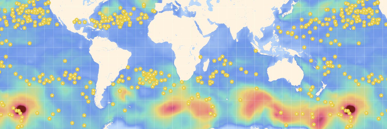
#30DayMapChallenge Day 20 — Water 🌊
Navigating smarter, not harder.
The @Sofarocean Wayfinder Voyage Simulator, built with Mapbox, lets captains and operators test and compare ocean voyage plans in real time. It runs full-physics simulations in the browser using vessel models and live forecast data — so users can adjust routes, tweak power, and instantly see the impact on ETA, fuel, and weather.
Learn more about how they built it here: https://t.co/owCV9Ecpre
#BuiltWithMapbox #MaritimeTech
🌊 Introducing the Spotter Configurator! Design your custom ocean monitoring system from surface to seafloor in minutes with this new tool.
Build your system today: https://t.co/ed9sikWWUS
#OceanScience#sofarocean#monitoring
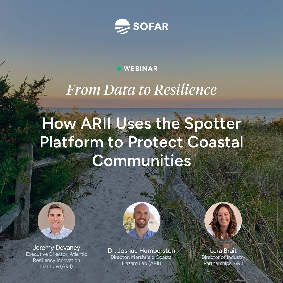
NEW Webinar! From Data to Resilience How @ARII_Institute uses the Spotter Platform to protect coastal communities.
📅 Nov 13 | 11am PT | 2pm EST
🔗 Register here: https://t.co/r0bGrHrCvy
#SofarOcean#ARII#ClimateResilience#OceanData
Honored to be recognized with collaborators for the 2025 @thenopp Excellence in Partnering Award 🌊🌪️
With @USNavyResearch, we air‑deployed Spotter wave buoys ahead of 6 #hurricanes to deliver real‑time data and improve forecasts.
Read more: https://t.co/A31EMzoT8F
#navy
ICYMI: @tradewindsnews stopped by our San Francisco office to see how Wayfinder is transforming voyage optimization for the world’s top shipping companies.
Check it out: https://t.co/tli1K3Rbav
Article and photo: @EPM_Maritime#tradewinds
⚡️The Wayfinder Voyage Simulator leverages world-class weather forecasts + vessel‑specific performance models that are updated daily.
🎥 Join our live webinar to learn why we built it: https://t.co/1vklfN82mP
#marineshipping#sofarocean
The future of voyage planning is here 🚢
Wayfinder Voyage Simulator delivers instant scenarios, real‑time intelligence, and transparent fuel/time costs—so operators can save fuel, cut costs, and reduce emissions. Read why we built it: https://t.co/o9ObA3lu5i
#shippingindustry
Honored to be in @ThetiusHQ's Top 150 for maritime innovation 🚀
With the world’s most accurate real-time marine weather, Wayfinder optimizes every voyage for safety and efficiency — delivering an average of 5%- 8% fuel savings per voyage.
#MOL@lloydsregister
🌊 Tracking Hurricane Erin
Our Spotter buoys and weather model have captured waves over 80 ft. Data from Sofar’s Weather Dashboard is powering forecasts relied on by @NHC_Atlantic + @NOAA to protect coastal communities.
Track live 👉 https://t.co/ACNcvJduSp
Sofar was featured in Bloomberg!
The article spotlights our Wayfinder platform + details how it uses the world’s most accurate marine weather to provide dynamic voyage optimization that significantly cuts vessel emissions.
Read article: https://t.co/FfG97Dl7kP
@business@climate
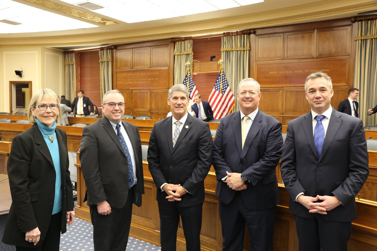
Chairman @RepFranklin thanked the witnesses from @Sofarocean, @Oceaneering, @xoceansocial, and @UCSanDiego after yesterday’s Environment Subcommittee hearing.
Strong public-private partnerships drive innovation in the ocean industry now and in the future.
In his testimony before @housescience, Sofar CEO Tim Janssen detailed why the U.S. needs strong public-private partnerships to accelerate the blue economy into an information economy powered by highly accurate marine weather intelligence.
Full hearing: https://t.co/eAumCGCn1j
During our Environment Subcommittee hearing, Dr. Tim Janssen, CEO of @Sofarocean, emphasized the importance of developing technologies to enhance our understanding of the oceans and their crucial role in our nation's success.
⬇️
Spotters airdropped ahead of #HurricaneMilton made real-time observations of the storm's extreme conditions. Here we overlay satellite imagery w/Spotter drift tracks. SPOT-31243C passed close to the eye wall, observing max wave heights of 65+ ft.
Updates: https://t.co/1fAjJ5nbGr
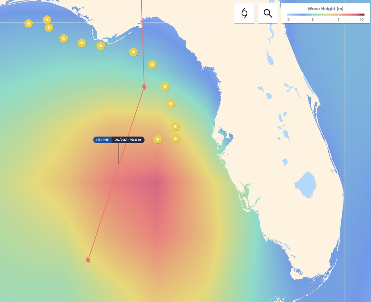
8 Spotter buoys were airdropped ahead of #HurricaneMilton today. The buoys will make real-time observations of extreme conditions generated by the storm before landfall. 12 Spotters deployed ahead of Hurricane Helene remain active to the north.
Updates: https://t.co/fxzY7qEMoH
Spotters airdropped ahead of #HurricaneHelene made real-time observations of extreme conditions in the Cat 4 storm.
Here we overlay satellite imagery w/Spotter drift tracks. SPOT-31995C (southernmost track) observed max wave heights of 70+ feet.
Updates: https://t.co/fxzY7qEez9
13 Sofar Spotter buoys were airdropped ahead of #HurricaneHelene to make real-time observations of the storm.
The buoys will measure the most extreme conditions generated by Helene later Thu. One buoy has already seen max wave heights of 45+ feet.
Updates: https://t.co/fxzY7qEMoH
The @USNRL Scientific Development Squadron VXS-1 deployed the Spotters on Tuesday in the Gulf of Mexico, along with microSWIFTs and A-DWSDs, as part of the @thenopp Hurricane Coastal Impacts Project (NHCI).
Updates: https://t.co/fxzY7qEez9
📹: Sofar Ocean/NOPP
#HurricaneHelene
Sofar was featured in @nytimes coverage of #HurricaneHelene, which made landfall as a Cat 4 storm in NW Florida. @AustynGaffney details how Spotter buoys were airdropped in the storm’s path to collect real-time data, which is leveraged by @NHC_Atlantic.
https://t.co/ufZFzstsdM