The most successful and reasonable drone regulations in the world are those from Transport Canada for sub250g craft: Don't endanger people, property or aviation. End of story! How many injuries deaths or even incidents have resulted from these regs? None that I'm aware of.
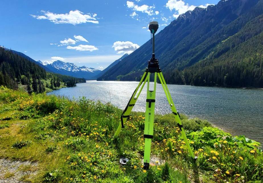
Look at these cinematic shots! Aeria Data Analytics collected ground control points with Reach RS2 to conduct avalanche research in British Columbia, Canada.
We are delighted to announce today that the complete ANAFI range is now approved by @Transport_gc for you to conduct safe advanced operations in controlled airspace and near people!
#parrotanafi#regulations
https://t.co/0c8NO0Ujaj
Terrain Awareness was the most requested item in our pilot survey. Learn more about this highly-anticipated new feature at the link here. https://t.co/i0VOvklXYY
Introducing the Freefly RTK!
Enjoy centimeter level precision on your Alta X with Multi-Band RTK system. The system uses the latest precision GNSS module (F9P) from Freefly partner u-blox. Freefly RTK covers GPS, GLONASS, Galileo and BeiDou.
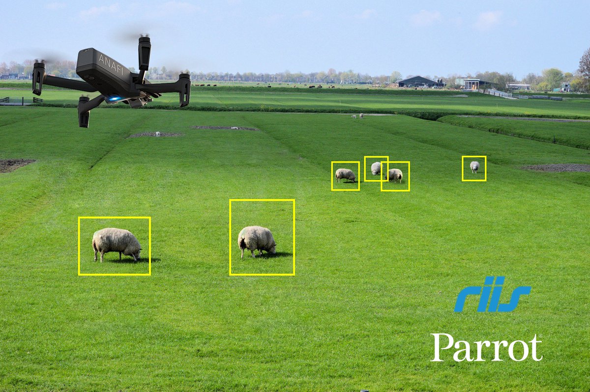
Happy to announce our new SDK partner @riisllc in developing custom applications for ANAFI like the “Cattle Counter” allowing farmers and agriculture professionals to effortlessly and accurately quantify the size of cattle herds to automate the monitoring and counting process!
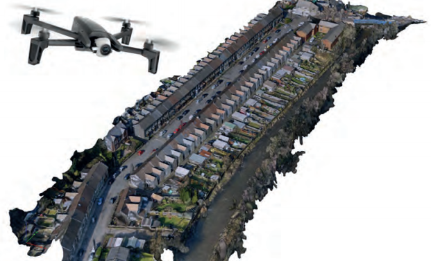
Find out how PDS Surveys used our ANAFI and @pix4d to perform a challenging limited access survey with “exceeded quality expectations”!
#parrotanafi#inspection
https://t.co/Zs4GeKqONx