1/ 200,000+ missions just went live across Southern US Cities!
Introducing the Open Capture Campaign: a massive rollout of RP-only missions (our largest launch to date) powered by @LayerDrone pilots.
It’s a big deal for proving network functionality at scale. Here’s why👇
Inspecting one overpass is straightforward. Inspecting a highway network is a data problem.
Every structure needs to be reviewed the same way — same perspective, same detail, same format — or comparisons break down and risk goes undetected.
Spexi delivers consistent datasets across complex infrastructure so inspection programs can scale without sacrificing accuracy.
Big news. @NianticSpatial is partnering with @SpexiGeospatial to take 3D reconstruction from building-scale to city-scale and beyond. Raw drone imagery in. High-fidelity 3D Gaussian splats out. One seamless workflow, grounded in real-world geometry, and ready for physical AI. This is the kind of spatial foundation needed to tackle some of the world's hardest problems.
Bridge joints fail gradually. Catching the change requires knowing what "before" looked like.
Spexi documents each joint with the same structure and level of detail across every inspection — so teams can compare condition over time and maintain records that actually hold up.
Consistent capture today means better decisions tomorrow.
Today marks a landmark partnership years in the making between Spexi and @NianticSpatial advancing the next generation of physical AI.
Niantic Spatial, a leading innovator in spatial intelligence for physical AI, is building the foundational models for the next era of robotics and spatial computing.
By combining Spexi’s global drone imagery network with Niantic Spatial’s world-class reconstruction technology, we’re enabling a seamless drone-to-3D pipeline for customers seeking high-fidelity Gaussian splat reconstructions and spatial intelligence at scale.
Spexi has also been selected as a preferred drone imagery provider for training Niantic Spatial’s real-world foundation models for physical AI—further validating Spexi as a best-in-class source of high-quality training data for the emerging ecosystem of precise world models.
Together, we’re enabling:
• City-scale 3D Gaussian splats
• Geo-referenced digital twins
• Standardized high-resolution drone imagery for AI training
• Real-world intelligence for simulation and spatial computing
The physical world is complex and constantly changing. Now there is infrastructure built to keep up with it.
Read more: https://t.co/6sdYlg0DAG
Standardized imagery matters when infrastructure teams need to assess elevated asset condition and structural integrity where top-down views fall short.
Spexi captures assets like highway sign gantries from multiple angles in a high-resolution, standardized format so inspections remain consistent across crews and systems.
Earlier risk detection. More accurate condition assessment. Better maintenance planning.
Vegetation encroachment on power lines is rarely apparent until it's a problem.
Monitoring risk across urban distribution networks means capturing each span consistently: proximity can be assessed the same way, every time, regardless of who's reviewing it.
Spexi gives utility teams the standardized imagery to catch encroachment early and plan maintenance before it becomes an outage.
When you buy data from @SpexiGeospatial, you’re accessing a globally standardized aerial dataset captured the same way everywhere on Earth.
We use standardized drones, software, and automated flight plans in 25 acres hexagons across the @LayerDrone network to produce a consistent, high-quality imagery layer that simply hasn’t existed before at this scale.
Every capture is authenticated and verified on-chain, creating a trusted foundation for the next generation of physical AI models and spatial intelligence systems.
Standardized imagery matters when transportation teams need to assess guardrail condition, alignment, and damage where top-down imagery lacks the required perspective.
Spexi captures multiple angles in a high-resolution, standardized format so inspections remain consistent across routes and regions.
Faster damage detection. More accurate repair planning. Safer roads.
Standardized imagery matters when city teams need to assess sidewalk safety and accessibility where top-down imagery can't capture elevation and surface detail.
Spexi captures sidewalks from multiple angles in a high-resolution, standardized format so inspections remain consistent across departments and workflows.
Earlier issue detection. Improved compliance. Safer cities.
Managing roads or other infrastructure?
Join us May 19 at 11am PT to learn how standardized drone imagery within ArcGIS can help!
https://t.co/DPpgqTV1nD
@SpexiGeospatial and @LayerDrone data coverage is in now in most major cities and many smaller cities/towns across North America. We pushed hard to extend coverage in 2025 so that customers would have confidence in the networks ability to capture data at continent scale using off-the-shelf drones (a feat previously not possible).
Now.. we are seeing that effort pay off. Some of the largest #AI, #geospatial, #insurance, and #AEC companies in the world are now either actively consuming our data, or in proof of concepts because of our vast coverage.
We have proven its possible, now its time to distribute! We have some big partnerships to announce in the coming weeks, so stay tuned.
https://t.co/kMPStBk9zL
We're in Ottawa for GeoIgnite!
Pop by our booth to learn how geospatial data is infrastructure, how AI uses it in workflows, and what that this all means for data sovereignty.
This 25-acre hexagon was mapped autonomously by the Spexi app and a DJI Mini 3 or 4 in about seven minutes.
It was uploaded to the @LayerDrone network a few minutes later, earning the pilot a some USDC.
The resulting data was used to make this.
When a pilot creates a Spexi account, a username is automatically created for them, like...
silly-goose
obstinate-donkey
Get started with the app to discover your Spexi handle!
Surface-level condition tells you a lot if you're capturing it the right way.
Spexi gives wastewater and asset management teams high-resolution, standardized imagery for every manhole in their network, so inspections don't vary by crew, route, or review system.
Better data in the field means fewer surprises underground.
For drone pilots, each Spexigon is a mission where they monitor an autonomous drone flight for 7-8 minutes, often receiving USDC after uploading their mission data.
For customers, each Spexigon is 25-acres of data that's cheaper, faster, and 30x the resolution of a satellite.
How do you describe your drone work to others?
@Dylang_1 suggested "solutions engineer" on his episode of @DroneOn
Here's how the @LayerDrone community answered 👇
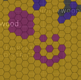
JUST ANNOUNCED: Over 850 missions in LA awarding $20 USDC per mission on the @layerdrone network.
LA pilots, that's over $17,000 USDC in total rewards waiting to be flown right now.
Just download the Spexi app to start flying those missions!