5:05pm: Thunderstorms have started to fire over the western end of Lake Erie. Showers and storms will increase in coverage across northern Ohio over the next few hours.
Severe Thunderstorm Warning for parts of Venango, Forest, Mercer, Clarion County until Jun 06 2:15PM. Strong winds and/or large hail are occurring with the storm.
1:18pm: This warned storm over Crawford County, PA is producing some small hail and the northernmost communities in Mercer County can get grazed by this storm.
11:16a | The U.S. Storm Prediction Center has highlighted our entire five-county viewing area with a probable chance to be under a severe thunderstorm watch this afternoon.
#PAWx#OHWx
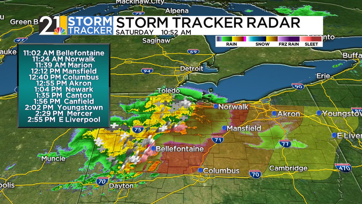
10:55a | A strong, but sub-severe cluster of thunderstorms is currently making its way through NW Ohio, with pea-sized hail and ~50 mph gusts reported. An arrival in our area is becoming more likely. Here's our best guess of timing:
After a cold front passes overnight, fog will become commonplace for those waking up early tomorrow morning. Some fog may be dense at times; stay alert if you're planning on driving near sunrise. #PAWx#OHWx
This round of rain & t-storms near Fort Wayne, IN represents our first chance for thunderstorms locally; a direct pass over our area would mean severe weather this afternoon/evening is subdued, while the opposite would become likely with a glancing blow/miss.