Stay weather aware Saturday, as there can be a few heavy, gusty storms capable of producing severe weather...mainly between 4-7pm. A nice afternoon Sunday, and another winner Monday. Unsettled and steamy after that....muggy!
Saturday Storm Timing: 2 district "rounds" of showers and storms will be possible. The first, at midday, could bring strong winds....but confidence that the midday round even occurs is on the lower end.
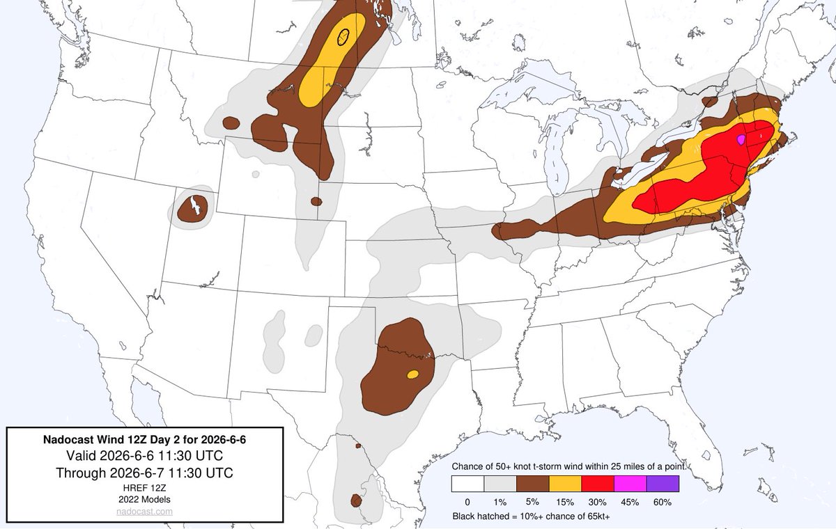
Both traditional forecasting techniques and machine learning suggest about a 2% chance of a tornado and a 30% chance of a damaging wind gust within 25 miles of any given location Saturday.
Another fine summer day Friday with even warmer afternoon temperatures. While Saturday could start with a shower, gusty storms capable of producing severe weather will become increasingly likely in the afternoon. Fog, then sunshine and lower humidity Sunday.
@EricWFMJ Didn’t see the northern lights yet, but Jupiter and Venus are closing in on their conjunction on June 9th, sitting just below the “twins” of Gemini, Castor and Pollux. Mercury will be joining the group next week as well.
Small chance of seeing the Northern Lights tonight, especially between about 10:15pm (when it is completely dark) and say 3:00am. If you can't see anything on the northern horizon with your eyes, try a camera as they can sometimes "see" the aurora when we can't.
Saturday's thunderstorm chance will come with a severe weather risk as well. Storms will be capable of producing strong winds and hail, mainly late in the afternoon.
Even warmer and just as dry Thursday and Friday. Saturday could start with a passing shower, but raindrops will be more likely later in the day and early Saturday night. After a more humid Saturday, Sunday will bring an increase in sun + decrease in humidity.
Wednesday, Thursday, Friday: all dry with building warmth. The most numerous weekend raindrops will probably be Saturday evening into early Sunday. We are back to dry and sunny weather early next week.