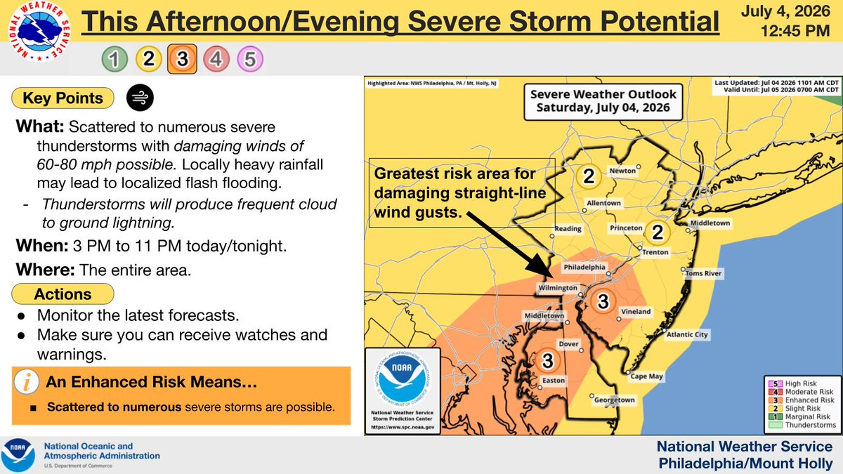
⚠️⛈️Showers and thunderstorms will develop this afternoon and evening. Main concerns are heavy rain/flash flooding with a Flood Watch issued for portions of the Delaware and Lehigh Valley. Damaging wind gusts are also possible, with the strongest storms focused south of Philly.
Good afternoon! The severe thunderstorm risk has increased for some areas later this afternoon & evening. Damaging straight-line winds are the main threat, however frequent cloud to ground lightning will occur with any stronger storms. Stay weather aware! #mdwx#dewx#njwx#pawx
💯🥵 Similarly very hot & humid conditions are expected today, with triple digit highs and heat indices 105-115° for most. This will likely be the hottest day south of I-78. Isolated severe storms possible this afternoon/evening, but most remain dry. (1/2) #PAwx#NJwx#DEwx#MDwx
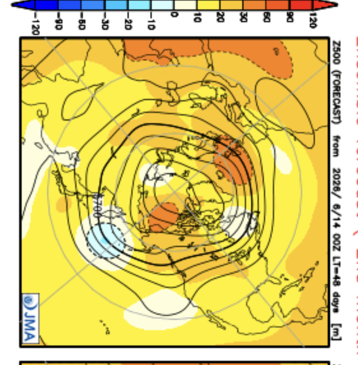
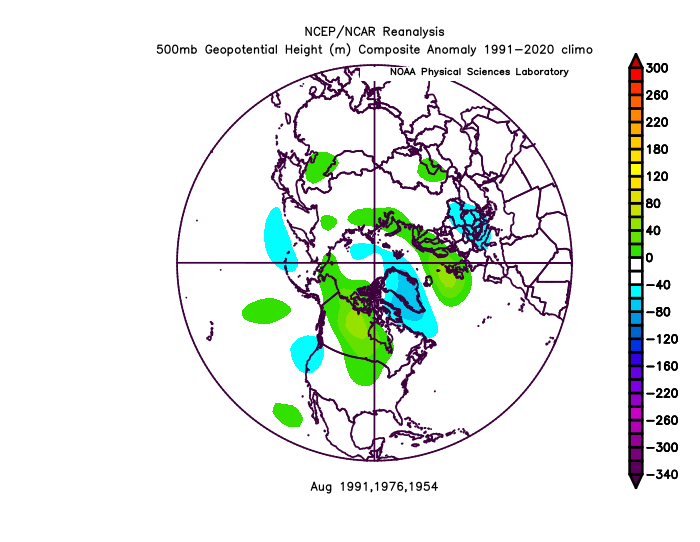
https://t.co/VDPx6GPjEP. Shows impact areas in our hurricane forecast; the NW Atlantic is the only place with expected above-average ACE for an area, while overall it's below ave. JMA 500 mb supports us. Similar Aug anomalies to 1954,1976,1991 all with New England hits
I’m looking for a software engineering internship in NYC or remote.
I’m studying CS + ORIE at Cornell, and I’m ready for real experience building software.
Portfolio: https://t.co/hkGZuZ5akF
If you’re hiring, building, or know someone who is, I’d love to connect!
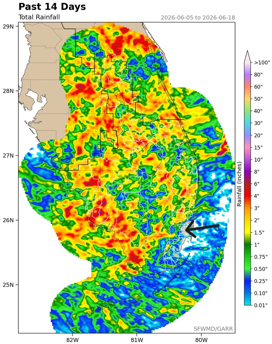
Only a trace of rainfall has been observed in Miami over the past 14 days. How rare is that during the wet season? The last time Miami went 14 days with a trace or less of rainfall during the wet season was 2004 when only a trace fell from May 20th through June 2nd. #FLwx
We're still looking at a threat for severe weather later today though the timing looks to be slightly later than previous thinking as the best chance for severe storms will be during the evening period. #PAWX#NJWX#MDWX#DEWX
Quick edit showing some of the intense moments today while documenting 8 tornadoes in northern Illinois into Indiana. Massive shoutout to @skydrama for nailing the forecast in the warm sector. Hands down the craziest tornado outbreak I've ever documented.
Full video will be released in the near future on the @thestormreel YouTube page.
#ilwx #inwx #tornado #outbreak
I really don't think enough people fully comprehend the worlds that are about to collide here.
You already have people in geopolitical circles warning about the threat of famine based on surging prices / availability of fertilizer components, and you also have long-term weather modeling all converging on a worst case scenario for a building El Nino event, which will peak near the end of the year. These are two slow moving but entirely predictable disasters that when coupled together will each make the other orders of magnitude worse. (This will take months to fully unfold, but at this point, the die is cast.)
There's no event in our history books that combines the current global population with the impending fertilizer shortage and the strength of the El Nino that's coming. We are about to witness an unprecedented event that will push crops around the globe to their limit.