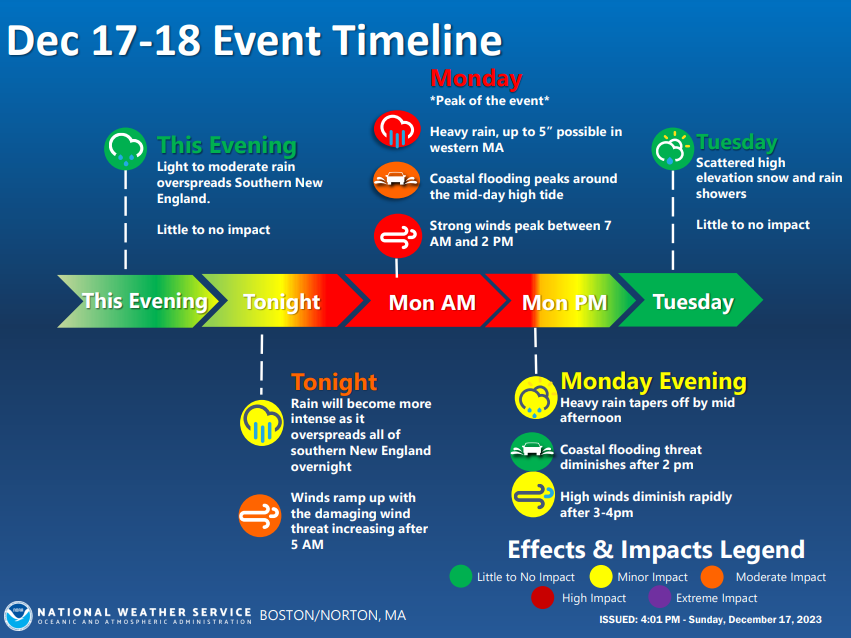
Good morning! I hope you had a nice weekend. We've got a stormy start to the work/school week with heavy rain and strong winds. Here are this morning's weather headlines.
Here's a look at what to expect over the next 24-36 hrs across SNE. Heavy rain will ramp up overnight. The greatest threat for damaging winds will be between 7 am and 2 pm tomorrow. Rapid improvement tomorrow evening will give way to scattered flurries and showers on Tuesday.
The main risk for strong to damaging wind this morning will be across Cape Cod and the Islands where S winds will gust to 50-60 mph before shifting to NW and diminishing. Elsewhere, expect NW winds gusting to 25-35 mph today.
Humans aren’t the only animals that hum while they eat. This extensive study documents that gorillas compose happy songs they hum during meals. These are gorillas singing while eating
[full paper: https://t.co/8GJzJ9MySy]
https://t.co/NociK8OXkm
Everyone needs nutritious food to thrive. People are working hard to provide for themselves and their families. Yet, 1/3 households, & 41% of households with children, are food insecure in RI.
This #HungerActionDay, join the movement to end hunger. https://t.co/Ld6nr5WVY3
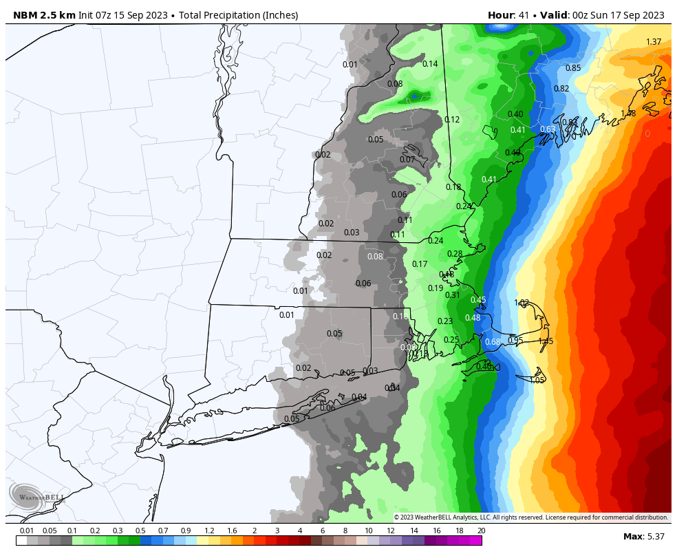
And, finally, this continues to look like a minimal rain maker for most of us with the potential of 1" or more of rain confined to the mid/outer Cape. Thankfully the rain soaked areas of RI and Bristol County Mass from earlier in the week look to get very little.
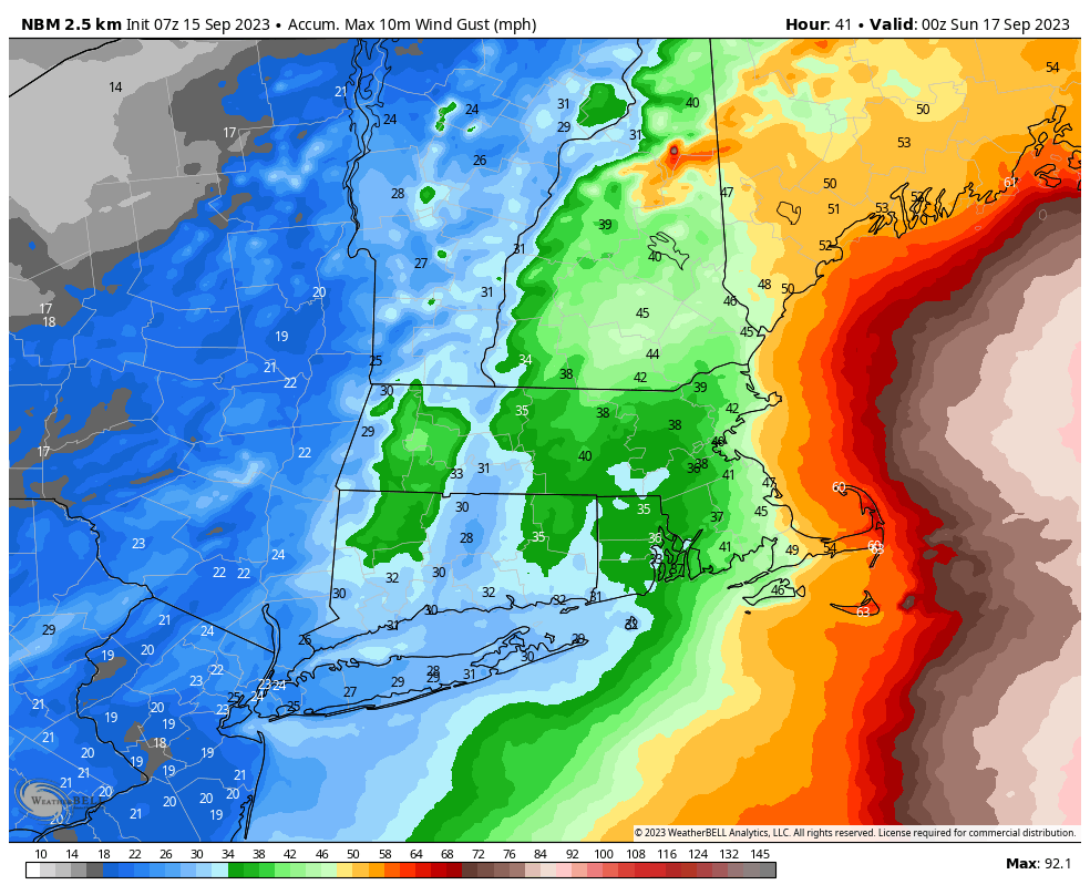
The wind gusts early Saturday morning will be strongest across the mid to outer Cape where 50-60mph gusts continue to be likely. 30-45mph gusts likely for the majority of the rest of our area.