As you begin your commute this morning be mindful that there are still many areas without power including the major intersections of S Church St at University Dr and N Church St at Sellars Mill Rd. Treat all intersections with out operating signals as 4 way stops #bpdcomm
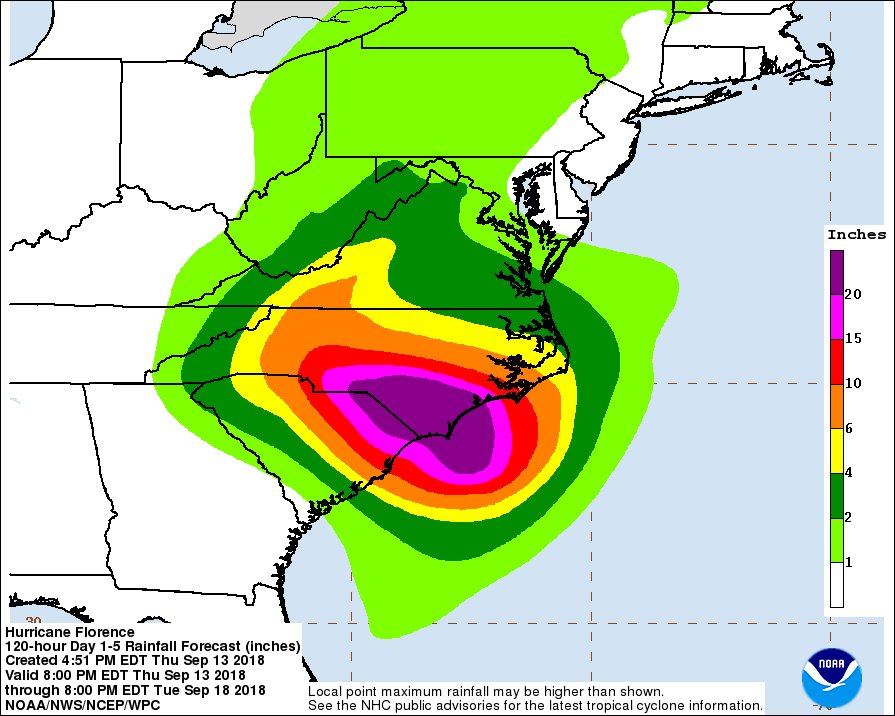
Here are the 3-day rainfall forecast totals from @NWSWPC for this evening through Tuesday evening. An additional 10-15" of rain are expected across portions of North Carolina. https://t.co/BIir1dPyMc
Hurricane #Florence is producing a life-threatening storm surge and hurricane conditions over portions of eastern North Carolina. The threat of freshwater flooding will increase and spread inland over the next several days. https://t.co/tW4KeGdBFb
#Florence is likely to produce a life-threatening storm surge along the
coastlines of South Carolina, North Carolina & Virginia, and a
Storm Surge Watch is in effect for a portion of this area. Full zoomable map: https://t.co/g7mGZdhZLS