Every defense focused event has a DJ in a cybertruck giving out B12 shots after talking about asymmetric systems, hypersonics, drone warfare, autonomous systems, and maximizing life experiences, right?!?
A resource that might be helpful:
Once it is safe to do so and smoke has cleared, @SkyfiApp and @vexcel_imaging are going to be flying a plane to capture aerial imagery of the entirety of damage from the fires
If you want to get imagery of your home, business, etc DM @SkyfiApp
What is feasible and what is not.
That's what we will be talking about on this webinar with @makepathGIS. You should come.
Sign up here: https://t.co/Sysa2hRIeV
@TJ_Cooney@lukefischer We've heard time and again from commercial and gov-adjacent customers that they end up under purchasing in order to avoid the SURPRISE of overspending. It's like an extra click -- one more thing your brain has to convert.. why? Why not just be transparent about pricing?
🏟️ Introducing SkyFi Castalia
✍️ The leading US-based, @SkyfiApp, satellite imagery and analytics platform will be the new naming sponsor of the stadium.
ℹ️ https://t.co/6tJJHdnhsd
#PPO👂
At SkyFi, our satellite imagery analysis can now automatically detect and quantify swimming pools across urban landscapes, sports courts (pickleball anyone 🏓), and count cars. Find them here: https://t.co/EJQDRO8Xrx
This capability offers valuable insights for sectors like urban planning, real estate assessment, and infrastructure management. By leveraging AI and high-resolution imagery, we're turning satellite data into actionable intelligence. What applications do you see for this technology?
I took this picture in Kenya a couple of months ago, and it's probably my favorite picture ever. We also just wrote a blog about using Earth observation technology to help with elephant conservation. Check it out here: https://t.co/VsvsOLpcbR
While African countries and conservation groups have designated vast areas for elephant protection, including vital wildlife corridors, a significant portion of elephant habitat remains vulnerable. We're now using satellite imagery to monitor habitats, identify new protected areas, track vegetation changes, and even spot signs of poaching from space. Help us safeguard these majestic creatures and disrupt illegal wildlife trade.
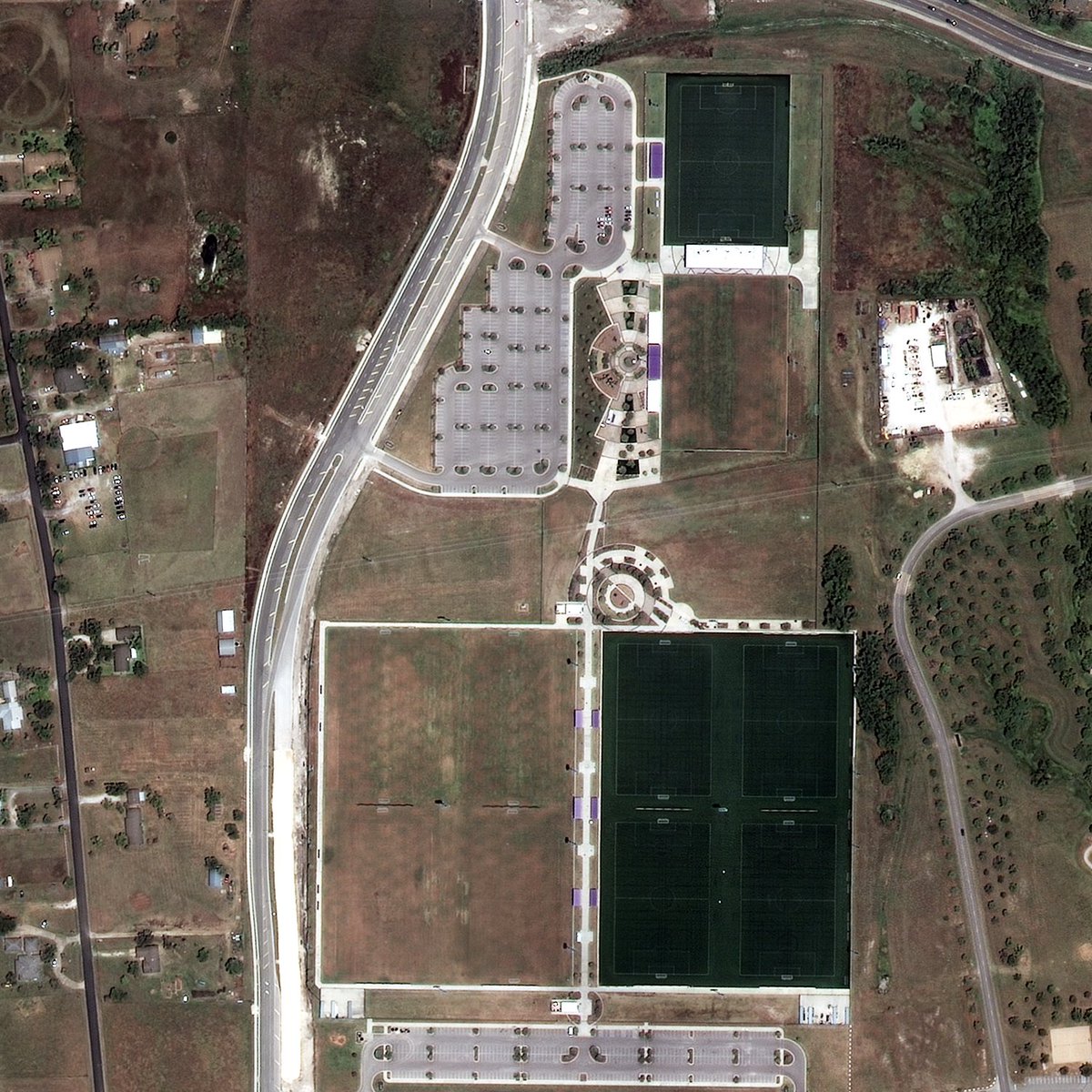
Can you spot Grass vs Turf?? 🟩👀
You can with SkyFi.
Vegetation indices, called "NDVI", & satellite imagery can be used to accurately identify & quantify turf fields, providing valuable market insights.
🧵 = costs broken down on this order ($50) & full images: https://t.co/Mu146BKN87
@tmoindustries@lukefischer Yes. It merely depends on what ecological data you're looking for (growth, disease, etc) and if the HSI/MSI imagery contains the appropriate bands that coorelate with the data you're looking for. Thus, it is merely a sensor limit and not that of the analytic capability