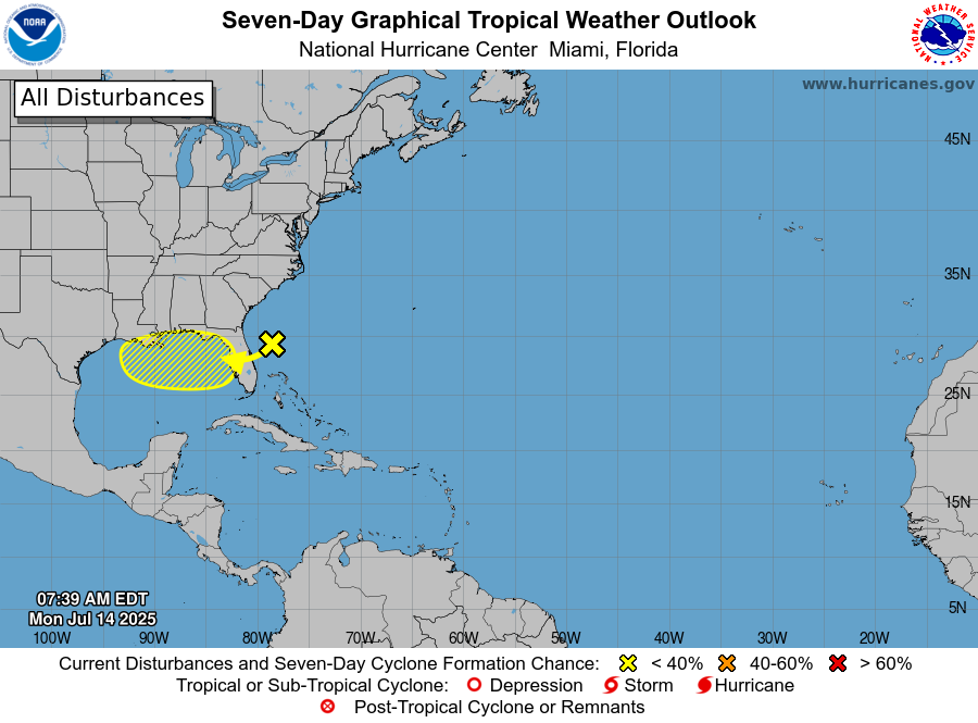
July 14 8AM EDT: An area of low pressure located offshore the east coast of Florida is producing disorganized showers and thunderstorms this morning. This disturbance is forecast to move westward across Florida during the next day or so, and into the northeastern Gulf by late Tuesday. Some gradual development of this system is possible while it moves westward to west-northwestward across the northeastern and north-central portions of the Gulf during the middle to latter part of this week. Stay up to date at https://t.co/Wq6ZtKfHp9
Regardless of development, heavy rainfall could produce localized flash flooding over portions of Florida and the north-central Gulf coast through the middle to latter portion of this week. Visit https://t.co/zJDnFUKPfU for your local area forecast.