We are the UK’s leading geospatial data sharing company. We believe that geospatial intelligence can unlock the potential of data to solve real-world problems.
🗺️ We were approached to deliver for a project that involved a wide range of stakeholders, including telecommunications suppliers, businesses, politicians, local authorities, government agencies, community groups and members of the public.
👉 Read: https://t.co/A21MTwFSmx
💻 theMapCloud gives you on demand access to over 300 up-to-date third-party datasets, showing you information such as environmental constraints, historic features, forestry and more….
👉 Read more: https://t.co/ZyB0bFfPbX
#geographicdatasets
🗺️ groundMapper provides access to datasets throughout @ConsultingSAC , providing one source of up-to-date information and a platform for sharing and collaboration. It allows the SAC Consulting teams to view, query and work with all location data. https://t.co/8pUzljBic9
😎 Improve workforce agility and support workflows with powerful geographic data solutions. groundMapper gives you geographic information to make more informed business decisions.
🌍 Find your solution by scheduling a call with us: https://t.co/7lMGbDyZRP
#geodata
✅ We’re more than just another geospatial advantage company - we’re the solution to your business’ needs.
✅ Don't just take our word for it, take a look at our success stories here 👉https://t.co/A7MkmVwm07
#geodata#geospatialadvantage#geospatial#successstories
🙌 When you’re looking for data and solutions for your unique needs - it should be built unique to you too!
🗺 We create solutions for *your* business, not everyone's business.
👉 Take your projects to the next level https://t.co/6gJXxNvdCi
#geospatialdata#businesssolutions
🎆 When you have a dream, and then you find the perfect partner - magic. We’re so excited that we got to work with (and continue to) such an incredible organisation The National Collection of Arial Photography! 🗺
👉 https://t.co/MSKZiPOTZy
#datacataloguing#arialphotography
📰 Sign up to our regular thinkWhere newsletter
✉️ Get the latest updates, events and articles from the thinkWhere team delivered straight to your inbox
Click here to get your copy 👉 https://t.co/jPLd2ziH6f
#newsletter#GISnews#locationdata#updates
📈 Long term projects rely on processes and solutions that are reliable and sustainable. 🗺️ We’re transforming the way organisations use data - more effectively, quicker and more reliably.
So, join the network and partner with thinkWhere 👉 https://t.co/CeYqS75QS7
#geospatial
🌍 Want to know how to find better, deeper geographic data? Well, groundMapper gives you geographic data - faster. It gathers location information from dispersed sources into one source.
Contact us 👉 https://t.co/DNJtcWqro3
🗺️ @britishlibrary has partnered with us to offer users of their service the opportunity to view current and historical geographic data.
🔗 You can read the full success story here 👉 https://t.co/eR7Q9IIyQS
#geospatialdata#historicmaps#geodata
🚧 The road to an all the more personalised groundMapper is on the horizon.
We’re focusing on four key areas:
🖨️ Printing Enhancements
🗺️ Cartography Enhancements
📊 Data Editing Enhancements
🔗 Integration Enhancements
👉 Read more: https://t.co/c2Umc1jnEq
🗺️ thinkWhere brings you groundMapper - the better way to analyse geospatial data.
📊 Based on over 300 data sets, groundMapper helps you make better, more informed business decisions, using the power of location data.
👉 Find out more https://t.co/DNJtcWqro3
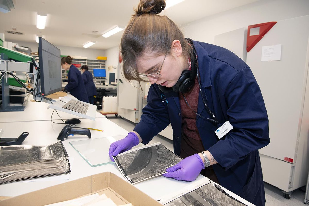
✈️ We have been working with NCAP over the last few years to help catalogue and publish the extensive holdings of historic aerial imagery they preserve. Here's what they had to say...
🔗 https://t.co/MSKZiPOTZy
#geospatial#geospatialdata#gis#data
Transform scattered geographic data into a unified source of truth with groundMapper. Seamlessly gather location information from various sources, empowering your team and partner organizations to collaborate more efficiently.
Learn more: https://t.co/aezFEl9fIc
Today is the day!
Our Geospatial Product Director, Alan Moore, is taking to the stage this afternoon alongside the Head of The National Collection of Aerial Photography, Dr Allan Williams at @GEOBusinessShow
Find out more here 👉 https://t.co/ARLvbTqsxV
#GEOBusiness
📣 Not long to go until our very own Geospatial Product Director, Alan Moore, will be joining the Head of the National Collection of Aerial Photography, Dr Allan Williams @GEOBusinessShow 🙌
Find out more about the session here 👉 https://t.co/OezYF4T7Nb
#GEOBusiness#GIS
We're proud to support Scotland's R100 programme, extending superfast broadband across the country.
Our cloud-based GIS platform facilitates seamless data access, empowering stakeholders and the public.
Find out more: https://t.co/A21MTwFSmx
#R100#DigitalConnectivity#GIS