Sad news. It has come to our attention that the @NOAA weather station moored at 0º, 0º (nicknamed @NullIslandBuoy) no longer exists! Check out the update at the end of @mapppingmashups's @nullisland blog post for more details of the buoy's untimely demise. https://t.co/CxzHSMNmSQ
#EsriUC2024 PSA: complete the Esri passport activity in the Expo and get this really fun patch. I’ve been asking for patches for a few years and loved that they finally made them!
Here's another receipt printer #map; this time of the Boston Marathon and contained in an enduro route sheet holder. (Thanks Eric Seitz for the suggestion). The map includes distances, landmarks, uphill segments, and more.
🎉It's time to reveal our year-long project
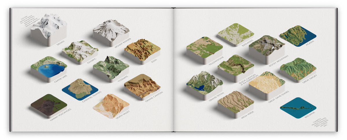
“Delicious Parks”
A collaboration with @infowetrust.
5×5-mile sections of 20 famous US Nat'l Parks, depicted above sea level w/o vertical exaggeration. This project will be featured in the Atlas of Design v.7 soon.
more in the 🧵
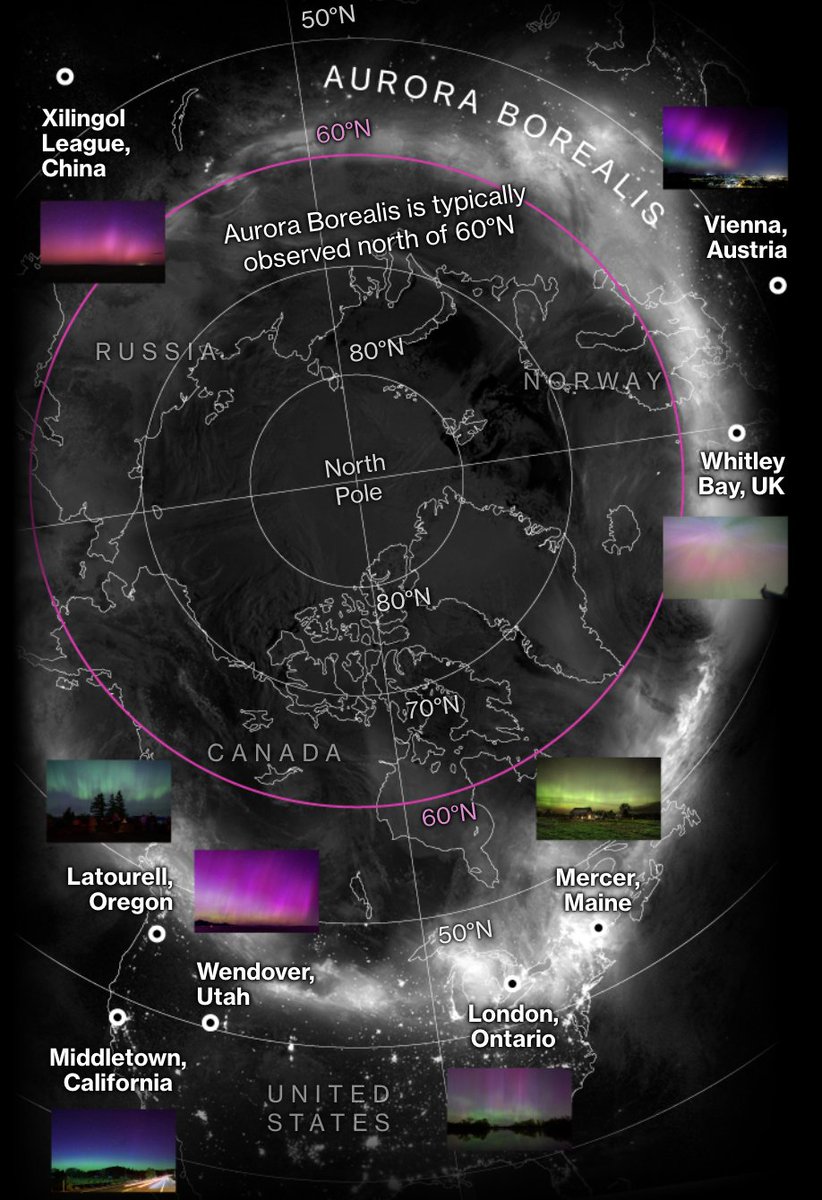
The largest geomagnetic storm since 2003 occurred last Friday, delivering rare views of the aurora to areas far from the Earth’s poles.
The solar storm affected power grids and more storms could be coming.
gift link: https://t.co/2PPonKnac1
w/ @hellococomo@naurtorious
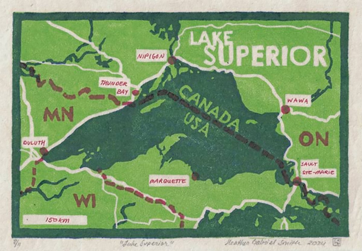
Want to make art with ArcGIS? Learn how to make a woodcut print (or linocut), using ArcGIS Pro. Esri cartographer Heather Smith shows you how. https://t.co/Lk8gATbQS7
#ArcGISPro#Maps
@Huber099 I revisit this thread time to time for Justin's coverage and noticed that they've implemented some changes ICYMI! I see that the stark greenery has been scaled back, and visual hierarchy has been added to streets at different zoom levels
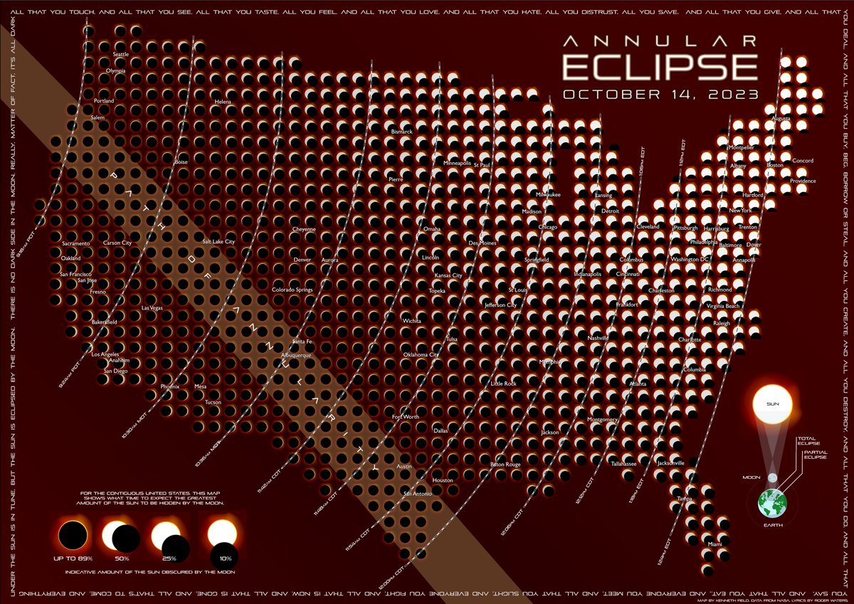
Just in time for tomorrow's #AnnularEclipse in the USA here's my map showing time of maximum eclipse, by location, and what extent you might expect to see (assuming no cloud cover). Use solar viewing glasses!!! #map#cartography#AnnularSolarEclipse#Eclipse