Finding Truth. Creating impact.
Explore. Find. Document. Impact.
Real People. Real places. Real stories.
TRACE goes where the story is. We explore remote places, find what's been overlooked, document it honestly, and turn it into impact.
Follow for more.
@SaltySierraDog For anyone bringing dogs, only a few Crater Lake trails allow pets: Lady of the Woods, Godfrey Glen, Grayback Road and the Pacific Crest Trail. Your dogs look well behaved, enjoying the amazing view.
@Cichlidsrock Those spires formed when hot ash from Mount Mazama's eruption filled the valley. Gas escaping up through it hardened the ash around the vents, and erosion later washed away the softer ash. Pinnacles Road is closed for the winter now, so this one waits for summer.
@YellowstoneNPS Former firefighter and park ranger here. Thank you to that whole team. With 1,100 miles of trail, a lot of those calls are a long way from a road, so have necessary supplies with you, medical kit, signaling devise, water, and tell someone your route before you head out.
@Interior@Brewers Fun fact: Audubon named the bird after his friend Thomas Mayo Brewer, a Boston ornithologist. Easy to spot out West, the males are glossy black with bright yellow eyes.
@Interior Crater Lake shows how remote it can get. There are no cell towers in the park, so there's a 24-hour emergency phone outside the "snow tunnel" entrance at park headquarters. The rim averages more than 40 feet of snow a year.
Wizard Island at sunrise from Watchman Peak. The island is the top of a cinder cone that grew on the caldera floor after Mount Mazama collapsed. Best viewpoint: Watchman Peak, a 1.6-mile round-trip climb to a fire lookout right above Wizard Island and the park's busiest sunset spot.
Photos: NPS, Sunrise from Watchman Peak
Read my full article on the history of Crater Lake National Park. Full story: #5 of 64, Crater Lake 👉 https://t.co/c47F5VEPSL
Wizard Island in winter, seen from near North Junction on the north rim. The island is the top of a cinder cone that grew on the caldera floor after Mount Mazama collapsed. Best viewpoint: Watchman Peak, a 1.6-mile round-trip climb to a fire lookout right above Wizard Island and the park's busiest sunset spot. West Rim Drive is closed to cars for the winter now, so the easy view this time of year is Rim Village, where the road stays open, and the 2-mile round-trip Discovery Point Trail along the rim.
Photos: NPS, Wizard Island in winter
Read my full article on the history of Crater Lake National Park. Full story: #5 of 64, Crater Lake 👉 https://t.co/c47F5VEPSL
1. Wizard Island from the West Rim, near the Lightning Spring Picnic Area, in summer. Photo: NPS
2. The lake from the Cleetwood Cove Trail, the only trail down to the water (closed now for a rebuild). Photo: Vulturesong
3. Sunset over the caldera in mid-October. Photo: Vulturesong
4. A snow squall moving across the lake, seen from near Rim Village. Photo: NPS
Reply photo: The caldera rim in fall. Photo: Vulturesong
Read my full article on the history of Crater Lake National Park. Full story: #5 of 64, Crater Lake 👉 https://t.co/c47F5VEPSL
Crater Lake quick facts:
-Became a national park: 1902, the sixth in the country.
-Known for: The deepest lake in the United States at 1,943 feet, sitting inside Mount Mazama, a volcano that collapsed after a huge eruption. No rivers flow in or out. Rain and snow fill it, and the rim averages more than 40 feet of snow a year. People come to drive Rim Drive, hike to viewpoints like Watchman and Garfield Peaks, ride the boat tours to Wizard Island (paused during the Cleetwood rebuild), and snowshoe and ski at the rim in winter.
-Seasonal closures: Rim Drive and the North Entrance Road close to cars on Nov. 1, or earlier if it snows. The North Entrance Road and West Rim Drive usually open in early June, East Rim Drive in early July. Highway 62 and the road to Rim Village stay open all year.
Best time to visit: July through September for open roads and trails, and winter for snowshoeing and the quietest views of the lake.
-Tip: There's no gas and no cell tower in the park. Fill up before you come (Prospect, Crater Lake Junction or Diamond Lake), and tell someone your plan.
-Sources: NPS Crater Lake conditions, alerts, hiking and operating hours pages
Photo: NPS, the view from Garfield Peak toward the Phantom Ship and Mount Scott
https://t.co/PvukxP91ox
National Weather Service
https://t.co/bfLH2SBfcK
Read my full article on the history of Crater Lake National Park. Full story: #5 of 64, Crater Lake 👉 https://t.co/c47F5VEPSL
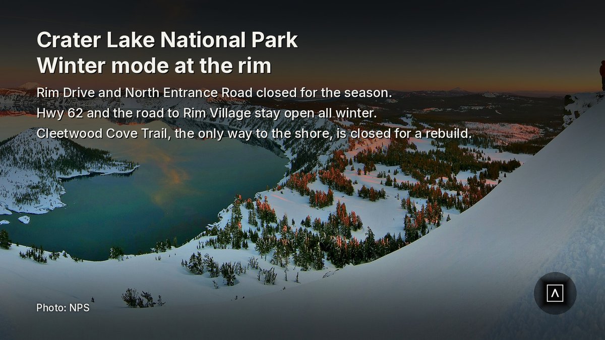
Crater Lake National Park. The park has switched to winter mode. Rim Drive and the North Entrance Road are closed for the season, and the road up to Rim Village is the way in. The National Weather Service has partly sunny skies at the rim today with a high near 41, lows in the mid-20s tonight, and a high near 37 tomorrow.
Roads: Highway 62 through the park and the 7-mile Munson Valley Road from the Annie Spring Entrance up to Rim Village are open all year, though sections can close for heavy snow. Rim Drive, the North Entrance Road, Cloudcap Overlook and Pinnacles Road are closed to cars and won't reopen until mid-June or early July, depending on the snowpack. The park is a snow zone, so chains or traction tires are required in winter. There's no gas in the park.
Trails: The Cleetwood Cove Trail, the only trail to the lakeshore, is closed for a multi-year rebuild, so there are no boat tours. All other trails are open but may be snow-covered or cut off by the road closures. Most high trails are under snow and unmarked from December into June.
Camping and fees: Mazama and Lost Creek campgrounds are closed for the season. The Steel Information Center is open 9 to 5 daily, then 10 to 4 starting Monday, Nov. 2. The Rim Cafe and Gift Shop are open. Entrance is $30 per vehicle for 7 days through Oct. 31, then the winter rate of $20 starts Nov. 1.
Best hike: Garfield Peak, 3.6 miles round trip, 1,010 feet of gain, moderate to strenuous. The park's most-used trail, Cleetwood Cove, is closed, and Garfield starts right at Rim Village, behind Crater Lake Lodge. It's known for switchbacks through meadows to one of the best high views of the lake, the Phantom Ship and Mount Scott. Tip: you can still reach it because the road to Rim Village stays open, but once snow buries it the trail isn't marked, so check with the Steel Information Center first.
TRACE take: Crater Lake in winter is simpler: one road up, one village on the rim, and the lake at its best right after a storm clears. Fill your tank before you come, carry traction, and plan the day around Rim Village.
Sources: NPS, Cleetwood Cove Trail and Marina Rehabilitation https://t.co/D0ELA1dwTm
Rogue Valley Times, Crews make progress on Crater Lake projects https://t.co/OKFw9SqjHW
NPS, Crater Lake partners (Trust, Natural History Association) https://t.co/UR1ihk5huW
Crater Lake National Park Trust (Annie Creek bridges grant, per its IRS filing) https://t.co/UTvjLfGPSM
Reply photo: The lake from the Cleetwood Cove Trail. Photo: Vulturesong (CC0)
Read my full article on the history of Crater Lake National Park. Full story: #5 of 64, Crater Lake 👉 https://t.co/c47F5VEPSL
Crater Lake National Park. The only trail down to the water is being rebuilt from top to bottom.
The Cleetwood Cove Trail is the park's most heavily used trail and the only permitted route to the lakeshore: 1.1 miles and 700 feet down the caldera wall on loose pumice. Erosion wore away its switchbacks and undermined the retaining walls, rockfall threatened the route, and the old dock at the bottom failed.
This summer, crews knocked loose rock off the cliffs above the trail, started installing mesh and rockfall fencing, built rock-filled gabion walls and armored the shoreline at the marina. A silt curtain kept construction runoff out of the lake's famously clear water, and a temporary dock let research boats keep working. Still to come are a new floating dock, a viewing pier and new restrooms at the shore. The work season up there only runs from July to September, so the job takes three summers, and the trail stays closed until it's done. Crews are also finishing the last phase of the East Rim Drive rebuild: retaining walls.
Nonprofits help year-round. The Crater Lake National Park Trust, an independent 501(c)(3), raises money for park projects, the Classroom at Crater Lake school program and the Science and Learning Center, and gave a grant toward new bridges on the Annie Creek Trail. The Crater Lake Natural History Association, the park's official cooperating association, runs the park stores and supports education, science and ranger programs.
TRACE take: Three summers is a long wait for the shoreline, but the rest of the park is open and the rim views haven't changed. If Crater Lake matters to you, the Trust and the Natural History Association are direct ways to help.