Freeze columns 💅
If you've worked with a dataset that has 20+ columns, you know the horizontal scroll nightmare.
Now you can pin any column to the left so it stays visible while you scroll. right-click a column header, hit "Freeze column," done. Setting saves per dataset, so it's there next time you open it.
NEW: Sharepoint Excel Connection
Atlas can now connect to Excel and CSV files stored in OneDrive and SharePoint via Microsoft Graph. An in-app file picker lets you browse your drives, preview the data, detect geometry, and configure smart-sync merge settings. Files sync on schedule just like any other connection.
Introducing Atlas Field 👋
The companion app to Atlas — your maps and workflows, now in the field.
→ Perform tasks and register inspections
→ Capture new data
→ Works fully offline
→ Report issues that sync to the web map in real time
10 free datasets every city planner should bookmark 👇
A curated list for anyone building, analyzing, or planning cities — from urban morphology to land use to population.
1. Microsoft Global Building Footprints — 1.4B+ AI-extracted building footprints worldwide. → https://t.co/ZE6EDzwcNa
2. Overture Maps — quarterly-released open data combining buildings, places, transportation, and base layers from Microsoft, Meta, Amazon & TomTom. → https://t.co/r2OzX37DSL
3. OpenStreetMap (OSM) — the backbone of open urban data. Streets, sidewalks, transit, buildings, addresses. → https://t.co/ggqK39MKC9
4. Global Human Settlement Layer (GHSL) — EU JRC gridded data on built-up area, population and settlement classification, 1975–2030. → https://t.co/zkioQppQ1I
5. WorldPop — 100m gridded population estimates with age and sex breakdowns, every country, every year. → https://t.co/XVCW36HLDJ
6. Copernicus Urban Atlas — detailed land use and land cover for 790+ European functional urban areas, 27 urban classes. → https://t.co/nUETaOzbDr
7. Atlas of Urban Expansion — historical urban footprints for 200 cities (1990–2015) from NYU Marron & UN-Habitat. → https://t.co/WVEp9cVUDn
8. OpenCellID — open database of cell tower locations, a proxy for connectivity and mobility patterns. → https://t.co/73VNjgxluy
9. Global Power Plant Database (WRI) — 30,000+ power plants worldwide with location, capacity and fuel type. → https://t.co/zfhjO34g8B
10. Copernicus Land Monitoring Service — imperviousness, tree cover density, street tree layers, urban heat data. → https://t.co/AEaOi8qkt5
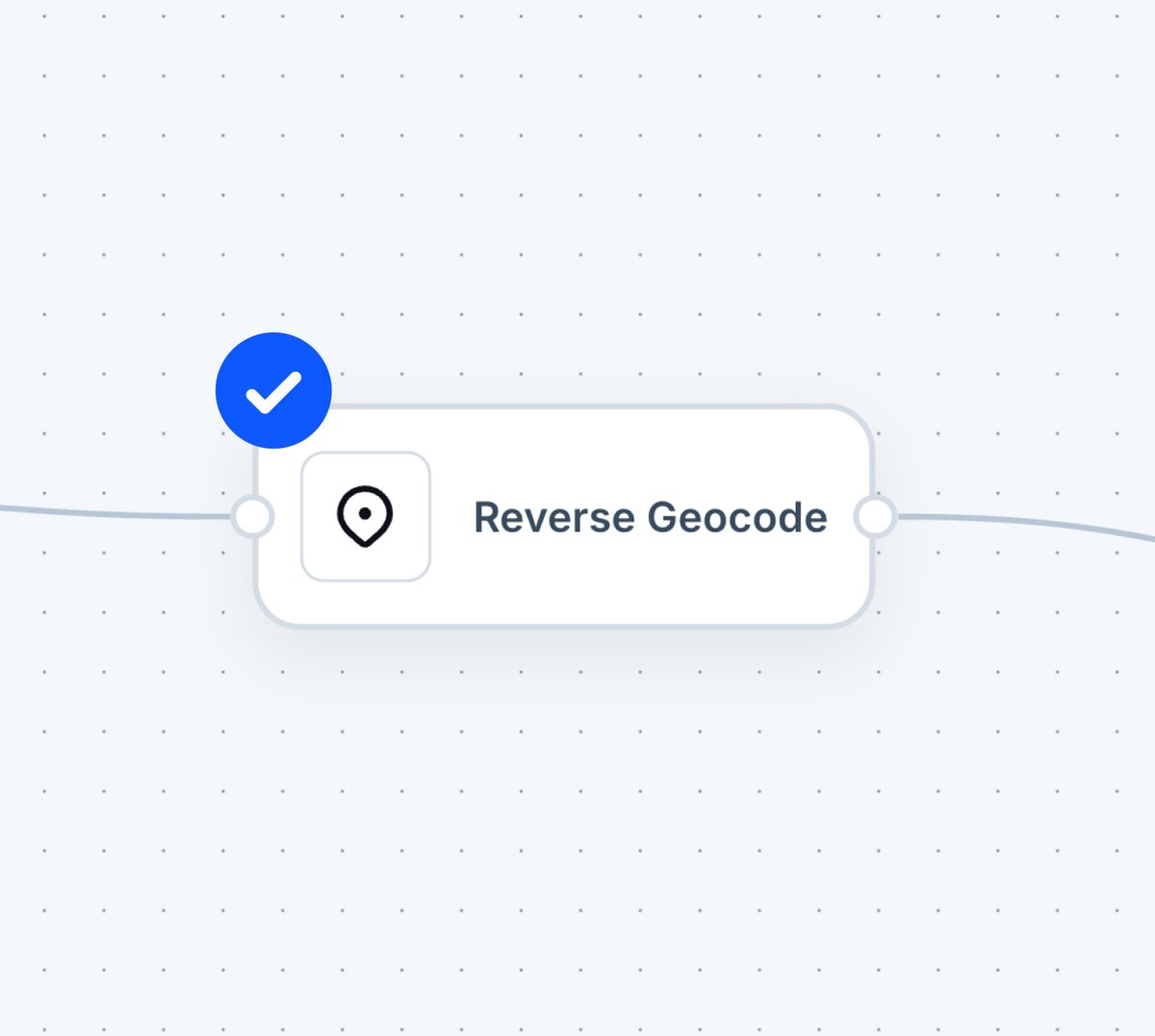
New workflow node in Atlas: Reverse Geocode 🌍
Point it at a column of coordinates — it returns a readable address for every row.
Useful when you have:
◆ GPS tracks from field devices
◆ Form submissions with lat/long coordinates
◆ Imported datasets with coordinates but no address column
Add it to any workflow, connect it to your coordinates column, and get readable location names without leaving Atlas
Progress indicator ✅
A new popup element lets you display phase or status information directly on feature popups. Choose between two visual styles — badges or progress phases — to show where a feature stands in a workflow.
Navi now has access to US Census data ✨
Ask questions like "What's the median household income within 5 miles of this site?" or "Show me population density by county in Texas" — and get answers instantly.
This is what AI-powered GIS should look like: ask a question about a place, get the answer. The data is just there.
Filtering substations with AI ⚡
With just one prompt, Navi — the AI agent for spatial data — filters all substations on the map. Just type what you need, and it shows up.
Fetching Overture Maps data just got easier 🤝
With Navi – our AI agent for spatial data – you can extract features like supermarkets and parks in seconds
Just ask for what you need and it will appear in the map directly. Some of the data you can ask for:
◆ Places (POIs) – Supermarkets, parks, schools, restaurants, and more
◆ Buildings – Global building footprints
◆ Transportation – Roads, railways, paths, ferry routes
◆ Addresses – Clean, deduplicated address points
◆ Divisions – Administrative boundaries (countries, regions, cities)
◆ Base Geography – Land, water, land use, infrastructure features
🚨 INTRODUCING https://t.co/Y0awuDcJNO 🚨
A way for anyone to build with location data — without the complexity that's held this industry back for decades.
https://t.co/yLZ8JuGfd9 is the fastest way to go from idea to spatial app.
Describe what you need. Navi, our AI agent, builds it.
→ Field inspection apps
→ Data insights dashboards
→ Site selection tools
→ Asset management systems
→ Custom maps and analysis
No code. No GIS expertise. No six-figure dev projects.
Just tell Navi what you want. Get a working app in minutes.
Available for all users today