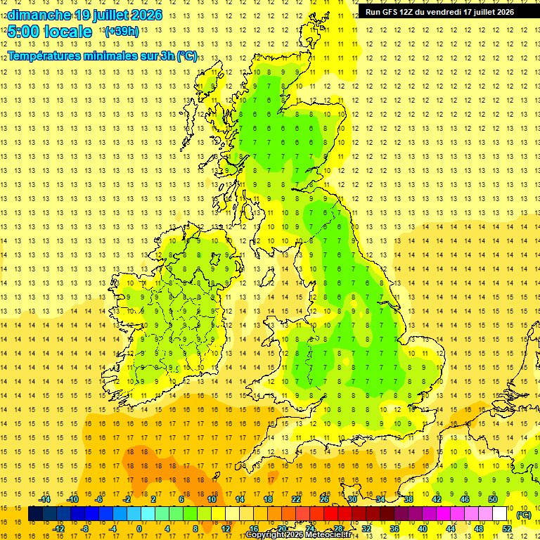
Uncharacteristic of this summer Saturday night has the potential to be quite nippy. With some cooler northern air being dragged down east flank of Atlantic ridge.
Dry soils bake quickly in sun but also cool rapidly at night in right pattern. Water retains heat well, in this case the absence of water likely a contributing factor…
The tension building up to the reveal of Pirate Clark was just perfect - the redhead suddenly bolting, Clark and Mary looking around confused, the sound of those footsteps getting closer with that eerie music underneath it. And then the actual shot composition during his entry and the conversation with Clark leading right up to him devouring Clark. Everything about this scene was amazing
BREAKING NEWS: UKWXC Board of Directors confirm Met4Cast has applied to rejoin the UK Wx Community, his sixth rejoin application within the last 4 years. Sources report the process could take "some time" as the high frequency has been flagged up as "suspicious behaviour".
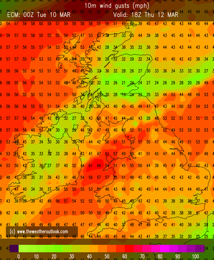
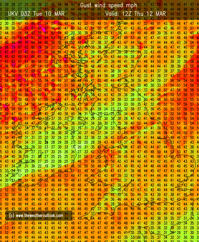
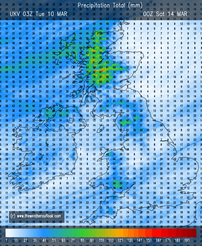
Looks like we'll avoid a severe windstorm on Thursday, with peak gusts generally in the 40-50 mph range inland & 50-60 mph for western coasts.
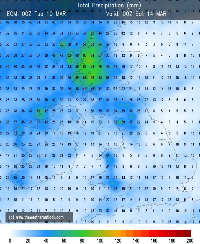
Rainfall mostly unremarkable too, so I'm not expecting this to be a named storm.
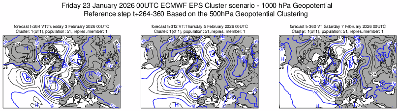
In a highly unusual move, the ECMWF Clusters in the 11-15 day period show just ONE cluster. Highly unusual
All showing a cyclonic SW'ly in the South and an Easterly or SE'ly in the north . OR a continuation of the current pattern .
Very unusual to see only 1 cluster at this long range.
This implies higher than usual confidence in the weather pattern / regime over the coming 2 weeks.
As reported in The Times, we can sadly confirm we are in early talks to sell off the UK Wx Community due to ongoing financial issues. Interest so far has come from various places including; Elon Musk, the UK Labour Party and the Glazer family.
As reported in The Times, we can sadly confirm we are in early talks to sell off the UK Wx Community due to ongoing financial issues. Interest so far has come from various places including; Elon Musk, the UK Labour Party and the Glazer family.
Need to keep a little eye on Thursday's low, has been trending a little bit more developed, and some of the ECMWF and GFS Ensemble Members are supportive of an even deeper centre. Risk is that if a deeper centre can develop there is the risk of Gales/ Severe Gales developing along the Southern /Eastern flanks of the depression as it moves NNE. That area happens to be the S/SE of England.
Depression develops in a slightly confluent upper trough as which delivers an area favorable for a wave to develop along the trailing cold front. warm advection pushes NE and an area of ascent is created giving rise to an area of fairly heavy rain pushing NE on Thursday across the South.
Now whether there is a further enhancement of vorticity advection in the trough to deepen the low combining with its position in the Jet which may find itself to be favorable for Divergence aloft ( The Jet speeds up ahead of the surface low - which would favor some steady deepening.
Risk 60-70mph gusts developing if the storm centre is more developed.
Some very exciting things planned for the future of @Gen_Weather
Join us on this journey and come and join our discord for real time updates and a great weather community !
Link is here: https://t.co/9GL6fb6HIJ