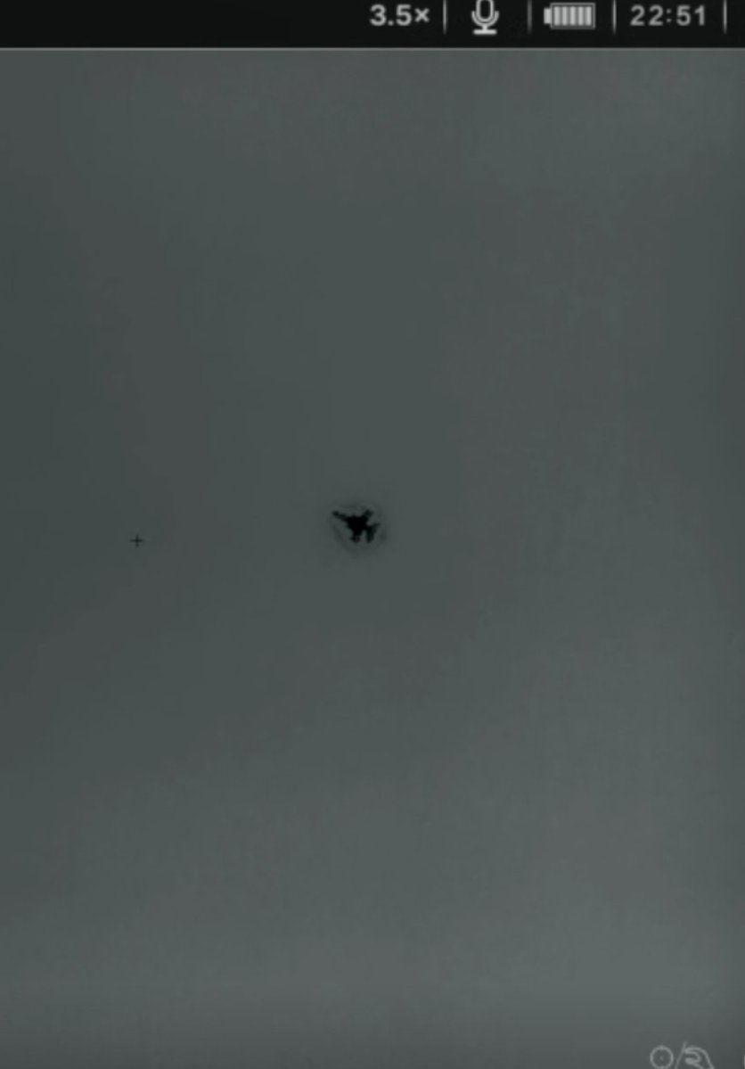
@chrisschmitz@thenewarea51 Here's a shot of another fighter from a few nights ago on the same thermal model used here. Not much of an exhaust plume, granted it is higher up. Just another data point to look at. I suspect there are some crazy thermal management improvements too
@thenewarea51 Tikaboo was never the best place to see a test flight (26 miles away, at night.) You want to position yourself where you can get a low flyover, which involves a good amount of luck. I get the skepticism, but I can stand behind the authenticity of this thermal clip
@WeirdShitShed I don't think the UFO files will shed any light on current classified programs there. The land seizure was done to stop people from viewing the base and I believe we'll be seeing an increase in various black projects there.
New video up from Reveille Peak, a mountain almost 50 miles away from Area 51. With the Tikaboo seizure, I wanted to see what could be seen from this angle and distance, and was actually surprised!
https://t.co/uqtkZbVOY9
Massive 22,000 acre land seizure around Area 51 that now removes access to Tikaboo and the less well known viewpoints. The stated reasoning is for "safety" because the terrain is rocky and remote. May as well just seize the entire state of Nevada if that's the case.
Tikaboo Peak, Legendary Area 51 Viewing Spot, Closed by U.S. Government
From 1995 until now, Tikaboo Peak – 26 miles from Groom Lake – offered the closest and best public vantage point with a complete view of Area 51.
Story: https://t.co/vGUi7mebU8
@Pixelmaster534 Well enforcement would be the job of BLM law enforcement. Still a logistical impossibility. They may use it as a mechanism to prosecute people who post videos from up there though. I have hours of footage I've never released that I'll probably drop here and there to troll them.
@g_knapp They didn't even bother to go through the formal withdrawal process like they did with Freedom Ridge in 1995. Literally just invented a bogus reason and grabbed 22,000 acres of our public land that belongs to ALL of us with the stroke of a pen.
@g_knapp They didn't even bother to go through the formal withdrawal process like they did with Freedom Ridge in 1995. Literally just invented a bogus reason and grabbed 22,000 acres of our public land that belongs to ALL of us with the stroke of a pen.
@UnitedWeWin1776@BoeingDefense@USNavy Haven't knowingly seen the MQ-25. It was a YFQ-42A and part of something I couldn't identify in the General Atomics hangar
Papoose Lake panorama from the south. Not claiming you should be able to see anything from this distance (46 miles), but it's a nice image IMO. Higher res: https://t.co/u4Jh2Z5YeR
@Chieftog@dubtor Yeah I'm becoming convinced it's not possible to see that side of the hill where the hangar doors are alleged to be. Doesn't look like even Reveille peak to the north of the NTTR will do it