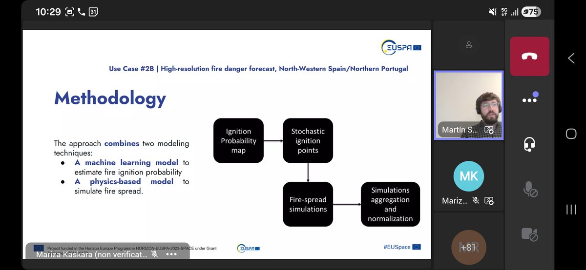
🎺🎺We presented the first version of UNICORN’s high-resolution fire hazard prediction system at the EGU General Assembly in #Vienna.
The poster was featured in the session “Spatial and Temporal Dynamics of Wildfires: Models, Theory, and Reality.”
During the event, we engaged with a broad audience from both the scientific community and other sectors interested in fire risk quantification, and received valuable feedback that will help guide further development of the system.
Flood hazard assessment in Attica using a high-resolution methodology developed by our team & @ntua , in the context of @unicornprojEU .
Applied in 5 river basins, identifying up to 200 critical points.
🔗https://t.co/7UvZAbbJ8q
🙏@FrontiersIn
‼️ In the framework of the UNICORN project, BEYOND Centre IAASARS/ NOA, National Technical University of Athens, EDGE in Earth Observation Sciences and POLIMI Graduate School of Management published an original research article entitled "Developing an integrated methodology for flood-hazard assessment: application to the Pikrodafni River Basin (Attica, Greece)".
It's actually the methodology which has been developed and implemented in the Mandra river basin, the first use case of the #Unicornproject.
We are proud to have now successfully transferred this important methodology to another river basin.
👉🏼👉🏼 Read this interesting paper here: https://t.co/ZcEHHBazAC
⭕ In the framework of the #UNICORNproject, Fondazione LINKS and Riscognition conducted the first workshop about #wildfires#LINKSFoundation presented progress on a wildfire management system that integrates multiple satellite sources to enable early fire detection, detailed burned area mapping, and short-term fire spread forecasting. By combining different data streams with AI techniques, the system improves the speed and accuracy of wildfire monitoring.
#Riscognition introduced the #UNICORN Knowledge Graph service concept to improve decision support and situational awareness during wildfire disasters. This technology is capable of connecting diverse datasets including hazard information, critical infrastructure, environmental conditions, and socio-economic insights into actionable information. The goal is to deliver interactive operational support to users to manage disasters and understand hazard impacts.
Consortium partners: #SIS2B
@edge_eo
#Riscognition #IstitutoNazionaleGeofisicaeVulcanologia #AlphaConsult
@beyond_center
#Mitigasolutios #FondazioneLINKS #EUSPA
💧💧Flood events in urban and peri-urban areas pose significant risks to lives, infrastructure, and economic stability, particularly in flash flood prone regions like Mandra in Attica, Greece, which was affected by a deadly flash flood in 2017 with 24 recorded fatalities.
Therefore, accurate #floodforecasting is crucial towards efficient emergency response and disaster risk reduction.
In the framework of the #UNICORNproject, BEYOND Centre IAASARS/ NOA and EDGE in Earth Observation Sciences conducted the first workshop about #floodforecasting integrating #Copernicusdata and #weatherforecast fusion in the Mandra river basin.
During the webinar, which took place on March 23th:
✅ BEYOND Centre IAASARS/ NOA and EDGE in Earth Observation Sciences #analysed the methodology behind the first prototype, #demonstrated the operational flood forecasting and #mapping web platform, and #presented ideas for the next development steps.
✅ The Region of Attica provided valuable feedback for further improvements to serve their specific user needs. Their important insights on the visualisation of the platform and their suggestion to issue alerts will directly shape the upcoming versions.
The workshop was highly interesting and interactive, with exchanges that pave the way for an enhanced platform which fully meets the pressing needs of the decision makers and the emergency responders.
Many thanks to everyone who has contributed so far and will further contribute!
Want to learn more?
The system provides flood extent and depth mapping for the next two days without requiring real-time hydrological and hydraulic modelling execution. This approach ensures rapid matching of pre-run scenarios, enabling civil protection agencies and first responders to make data-driven decisions during flood events.
The fusion of COPERNICUS Earth Observation data, real-time hydro-meteorological measurements, and advanced computing improves flood prediction accuracy and provides critical insights for early warnings, infrastructure protection, and emergency response in flood prone areas.
Consortium partners: #SIS2B @edge_eo #Riscognition #IstitutoNazionaleGeofisicaeVulcanologia #AlphaConsult @beyond_center #Mitigasolutios #FondazioneLINKS #EUSPA
🌋 #Lava flows are among the most destructive hashtag#volcanic hazards. During an eruption, fast, reliable information on potential damage is essential for emergency managers, decision‑makers, and the insurance sector to act quickly and effectively.
#UNICORNProject reached an exciting milestone:
Mitiga Solutions conducted the first workshop for the Lava Flow #Emergency Management Platform, developed as part of the project.
During the workshop:
✅ #Mitiga Solutions presented the methodology behind the first prototype, demonstrated the platform, and outlined plans for upcoming versions.
✅ #INGV Istituto Nazionale di Geofisica e Vulcanologia provided valuable feedback, both on the scientific setup and from an end‑user perspective. Their insights on UI usability and the usefulness of hazard maps and impact forecasts (shared through operational reports) will directly shape the next development steps.
The session was highly collaborative, with rich discussions that will help ensure the platform meets the real needs of emergency responders and stakeholders.
A big thank you to everyone who contributed!
Want to learn more?
You can join Karen Strehlow, PhD’s presentation at #EGU2026:
📅 Thursday, May 7
⏰ 09:25
🧭 Session: ITS4.24/NH13.8 — Early Warning Systems (EWS): From Science to Action for Effective Disaster Risk Reduction
📝 Talk: “Impact-based forecasting for volcanic eruptions: science driving financial preparedness”
🔗 Abstract: https://t.co/jlBK8ICXRC
Consortium partners: #SIS2B @edge_eo #Riscognition #IstitutoNazionaleGeofisicaeVulcanologia #AlphaConsult @beyond_center #Mitigasolutios #FondazioneLINKS #EUSPA
📣 UNICORN is now officially part of the CMINE - The Crisis Management Innovation Network - RTC - Responder Technology Cluster of Projects
https://t.co/g96cuPSuJO
#CMINE is a Community of Practice in the field of #CrisisManagement, an umbrella network aimed at fostering innovation and exchanges between diverse stakeholders who have a role to play in crisis management in various domains.
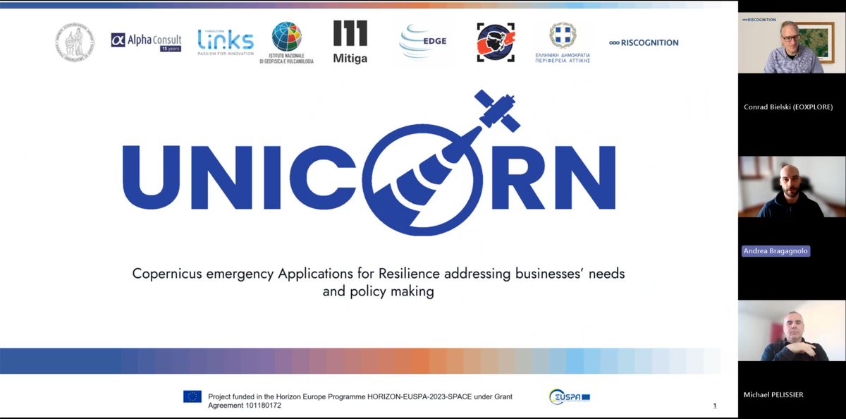
UNICORN develops advanced Earth Observation applications using Copernicus data to enhance early warning systems and hazard monitoring for extreme events like floods, fires, and volcanic activity. By providing timely, actionable insights, the project empowers local authorities and industries to improve disaster preparedness and accelerate community recovery across Europe.
More 👉 https://t.co/5rgiVvGbta
Consortium partners: @beyond_center@edge_eo@perattikis
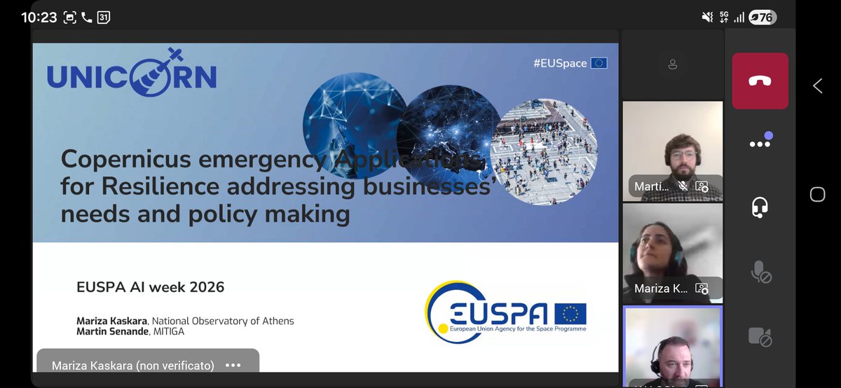
#UNICORN project EUSPA - EU Agency for the Space Programme #AIWeek#UNICORN was presented (by Mariza Kaskara and Hélder Martins Fontes) during the "AI for crisis management" session at EUSPA - EU Agency for the Space Programme #AIWeek (19-23 Jan 2026), EUSPA's virtual event highlighting AI-powered Horizon Europe and Fundamental Elements projects transforming the space downstream sector.
#UNICORN develops Earth Observation-powered tools for early warning, forecasting, and hazard monitoring of floods, wildfires, and volcanic eruptions, empowering businesses, authorities, and citizens to build climate resilience.
➡️ Learn more: https://t.co/XHUtbP0Isz | https://t.co/XfBN1eGi1f
@MarizaKaskara@beyond_center@edge_eo@perattikis@EU4Space
🤝 COMBINE, COORDINATE, COOPERATE
Advancing collective Earth Intelligence
#OneEuroGEO
Our partners from @beyond_center , @LinksFoundation and #Riscognition are presenting the #UNICORNproject during the #EuroGEO Workshop 2025.
EuroGEO - European contribution to GEO is the regional coordination mechanism that aims to consolidate and coordinate activities throughout #Europe that contribute to GEO (Group on Earth Observations) initiatives.
The EuroGEO Workshop 2025 aims to accelerate the delivery of Earth Intelligence by strengthening Europe’s contributions to the GEO Work Programme, reinforcing the links to #Copernicus, and aligning research, innovation, and national coordination with global and European priorities.
This year’s EuroGEO workshop, which took place in The Hague, #Netherlands from 13th hto 15t October, was jointly organized by the @eucommission , the EuroGEO Secretariat and the NSO – Netherlands Space Office.
💫 We were proud to see #UNICORN contributing to this collective effort!
🌋 Thanks to our partner #INGV Istituto Nazionale di Geofisica e Vulcanologia, we can observe visible and thermal #drone images.
All the images were recorded by the #UNICORNproject staff during the #Etna#eruption on August 24.
As part of the Etna Observatory's monitoring activities, drone surveys were conducted to assess eruptive vent activity, measure the altitude of lava fronts, and sample lava flows.
This activity is crucial to carry out accurate and precise #lavaflow #mapping and #quantification.
In the thermal images, the colours orange, yellow, and white indicate progressively hotter areas, while pink, fuchsia, and purple represent colder areas.
for more 👉 https://t.co/Hd5iVF8k7S
Consortium partner: @beyond_center@edge_eo@perattikis
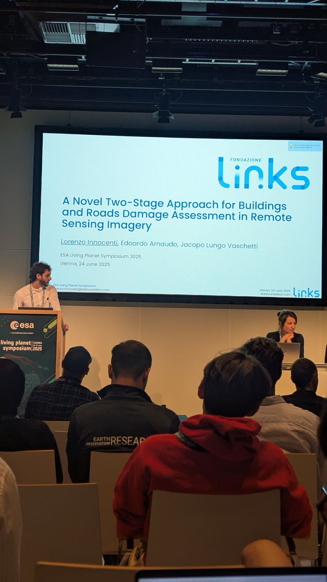
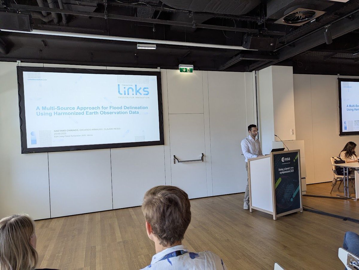
#UNICORNproject at European Space Agency - ESA #LivingPlanetSymposium 2025 🛰️
https://t.co/LzR4T7HvSP
We're excited to share highlights from our participation at #ESA's Living Planet Symposium 2025 in #Vienna.
The #AI, Data & Space team from Fondazione LINKS Foundation presented several research works demonstrating how AI and machine learning can be applied to #EarthObservation for environmental monitoring and #disaster #response.
(Edoardo Arnaudo Gaetano Chiriaco Lorenzo Innocenti)
Our Contributions:
🔥 #Wildfires Meet Multitask Learning: Enhancing #Burned #Area #Delineation With Land Cover Classification - Making burned area delineation more robust to geographical changes through multitask learning approaches.
🌊 A Multi-source Approach for Enhanced #Flood #Delineation Using Harmonised #Satellite #Data - Improving flood mapping accuracy by integrating both Sentinel-1 and Sentinel-2.
🔥 A Multi-Sensor Approach for #Early #Wildfire #Detection Through Automated Hotspot Monitoring in #Europe - Enabling faster wildfire detection across European landscapes, using a combination of multiple satellite sensors.
Congratulations to the team behind hashtag#UNICORN for the impactful work.
for more 👉 https://t.co/5rgiVvGbta
Consortium partner: @beyond_center@edge_eo@perattikis
UNICORN in numbers |
Sometimes numbers say more than words. #UNICORN is a European project based on the integration of #Copernicusdata and the potential of #EarthObservation technologies to improve risk management.
We’re currently active in four countries (Greece, Italy, Spain, Portugal, France), each with a dedicated use case. Our survey involved 17 participants from across Europe, 60% of whom are directly involved in emergency response. The data we collected has guided the development of operational services that support all phases of disaster management: before, during, and after the event.
#UNICORN is more than a project: it’s an investment in knowledge, innovation, and collective safety.
#ProjectImpact #EOdata #Copernicus #UNICORNproject
for more 👉 https://t.co/wMAbQOB4a1
Consortium partner: @beyond_center@edge_eo@perattikis
TOWARD A NEW GENERATION OF EO SERVICES|
With #UNICORN, we are building a new generation of #EOservices designed to tackle the environmental challenges of today and tomorrow. Scalable, adaptable solutions that are co-designed with users, integrated with existing infrastructures, and grounded in real-world needs.
The added value comes from the direct involvement of all actors: institutions, research centers, local authorities, civil protection, and private sector partners. Together, we are designing more effective and replicable tools, ready to support emergency management in a variety of territorial contexts.
True resilience starts from the ground up — but looks far ahead.
#FutureOfEO #CopernicusInnovation #DisasterPreparedness #StakeholderEngagement
for more 👉 https://t.co/wMAbQOAwkt
Consortium partner: @beyond_center@edge_eo@perattikis
WHAT USERS REALLY WANT |
To design useful services, we must start with a simple question:
what do users actually need?
Thanks to #UNICORN’s survey, we’ve gathered meaningful data. Most respondents require a continuous and systematic flow of information, ideally accessible via web interfaces. It’s not just about having data — it’s about getting it in time: many users request daily or even sub-daily feeds and consider a forecasting window of at least two days before an event to be ideal.
These insights are helping us develop more responsive tools that can support timely decision-making. Because every minute matters.
for more 👉 https://t.co/wMAbQOB4a1
Consortium partner: @beyond_center@edge_eo@perattikis
ONE PROJECT, 4 USE CASES ||
Every technological solution needs to be tested in the field to prove its effectiveness. #UNICORN does this through four concrete use cases across different European countries, each focused on a specific risk type.
In Greece, we are working on flood forecasting and response systems by integrating weather and satellite data. In Spain, France, and Portugal, our focus is on wildfires, using tools for early detection and hazard prediction. In Italy, we’re addressing volcanic activity with services that combine satellite observations and numerical models to monitor and forecast lava flows.
In each context, we directly engage local stakeholders to validate the solutions and ensure operational effectiveness. This is how we build resilience: through collaboration.
#EOusecases #NaturalHazards #ClimateResilience #CopernicusServices
for more 👉 https://t.co/wMAbQOAwkt
Consortium partner: @beyond_center@edge_eo@perattikis
Mount #Etna: eruption updates 🌋
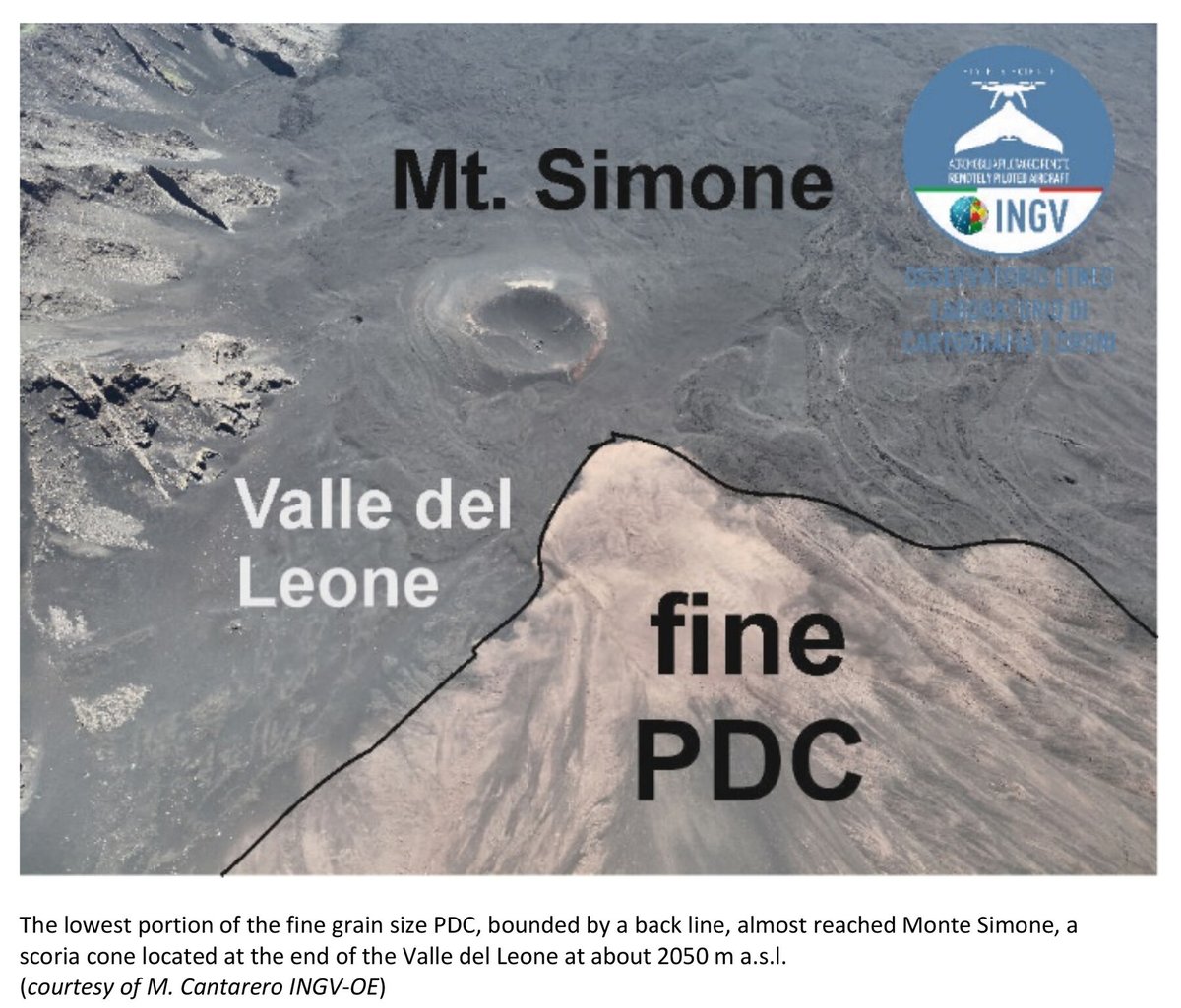
On 2 June, a #fire fountain accompanied by several #lava#flows towards the northeast, east and southwest, as well as a pyroclastic density current (PDC), occurred on Etna.
The PDC was triggered by a flank collapse of the upper north-eastern flank of the South East cone (SEC). It flowed through the Valle del Leone (a lateral valley of the Valle del Bove) for over 2.5 #UNICORN staff (of the Istituto Nazionale di Geofisica e Vulcanologia), were in the field performing a drone survey. The synergistic use of #satellite and #drone #data enabled more accurate #mapping and quantification of both the lava flow and the PDC.
about the project 👉 https://t.co/Hd5iVF8k7S
Consortium partner: @beyond_center@edge_eo@perattikis
FROM USER NEEDS TO ACTION |
One of #UNICORN’s key strengths lies in its user-driven approach. We believe that every service should start by listening closely to the needs of those working on the front lines of emergency response. That’s why the first phase of the project focused on collecting and analyzing real user needs, from mapping existing EO solutions to launching a multilingual survey with a qualified panel of users across Europe.
This process allowed us to define clear requirements for next-generation services: solutions that are not only technically advanced, but also usable, timely, and seamlessly integrated into operational workflows. For us, innovation begins with reality.
#UserCentric #ServiceDesign #DisasterManagement #Innovation
for more 👉 https://t.co/wMAbQOB4a1
Consortium partner: @beyond_center@edge_eo@perattikis
THE CONTEXT: WHY UNICORN matters
In recent years, Europe has been facing increasingly frequent and intense #naturaldisasters: floods, wildfires, landslides, volcanic eruptions.
Although we have access to advanced technologies, there is still a critical gap between the availability of data and the ability to use it in time to manage emergencies.
The #UNICORNproject was created to respond to this very need. By leveraging Copernicus services and Earth Observation technologies, we aim to develop operational solutions that improve our capacity to predict, monitor, and respond to natural disasters. Our goal is to strengthen the resilience of both territories and communities, by complementing existing tools with new, effective, and easily accessible services.
#DisasterResilience #Copernicus #EarthObservation #ClimateAdaptation
for more 👉 https://t.co/wMAbQOAwkt
Consortium partner: @beyond_center@edge_eo@perattikis