Anyone know where I can get 2019 per-stop @VTA ridership data? OpenData portal has Feb 2020, but it is not what I'd call a typical year. VTA github has data of an unspecified vintage uploaded in 2018...
"the degree of behavioural change and modal shift away from motorised travel tends to be proportional to the level of disruption to the existing car traffic network."
(make driving annoying and people will walk or take transit)
https://t.co/UL3YhFA7sg
@JeffSpeckFAICP@Stantec@HyannisMA Before the pandemic I was going Karaoke every Tuesday at the local dive bar. Confidence can cover a lack of talent...
I can do a reasonably good sketch, but these days I am more inclined to use GIS software
@alfred_twu I've read several books, including "Soft City", "Housing as if People Mattered", and "Happy City", which say a common area or entrance shared between 4-10 households creates more social connections and community.
Thinking how that could be applied to tower floorplans.
If the "community engagement" process of you local government is inadequate, community groups should engage in "constructive confrontation with government authorities"
James Martin Whelan
"Six Reasons not to Engage: Confrontation, Compromise and the Commons"
2005
Many places have removed parking requirements to lower the cost of building new homes. However many new buildings get built with parking even when none is required - even affordable housing.
To get the full savings from these new opportunities, we also need better transit.
Many places have removed parking requirements to lower the cost of building new homes. However many new buildings get built with parking even when none is required - even affordable housing.
To get the full savings from these new opportunities, we also need better transit.
Of all the harms traditional zoning has inflicted on communities, parking requirements are the easiest to fix. @Citizen_Cate for @landpolicy: https://t.co/AlKPlTJ4FN
If we count schools as parks a lot more area turns green. But this is contentions so I left as is.
Accounting for that the most parkless areas seems to be the triangle south of ECR, east of 85. It is isolated without any park.
Figured out how to calculate walking distance in QGIS!
Shown here: 10 minute walk to parks. Purple areas have no park within 10 minutes. I included parks under construction (orange) and approved this year (yellow)
"According to @NACTO analysis of 2019 federal crash data, more than half of fatal crashes in cities occurred on roads managed by states, beyond the reach of local leaders."
https://t.co/LHrnEsuz1P
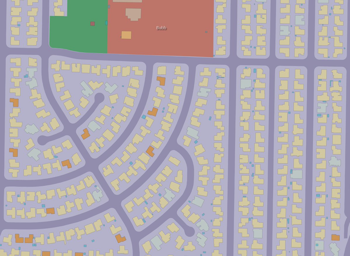
Comparing building footprint it is easy to see the monotony of typical suburban development (South MV) v. diversity and dynamism of older areas with a mix of housing types (Central MV)
Also note the narrower streets & smaller block sizes make the traditional area more walkable.
And with about 4x population per acre central MV is dense enough to support high quality public transit.
South of ECR not so much.