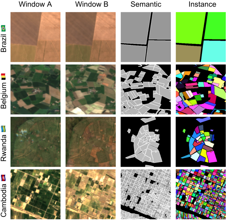
I'm so excited to finally introduce Fields of The World (FTW!) - the largest & most diverse ML dataset for field instance segmentation in satellite images. FTW has >70k samples from 24 countries (4 continents), with semantic & instance labels + Sentinel-2 RGB-NIR from 2 dates. 🧵
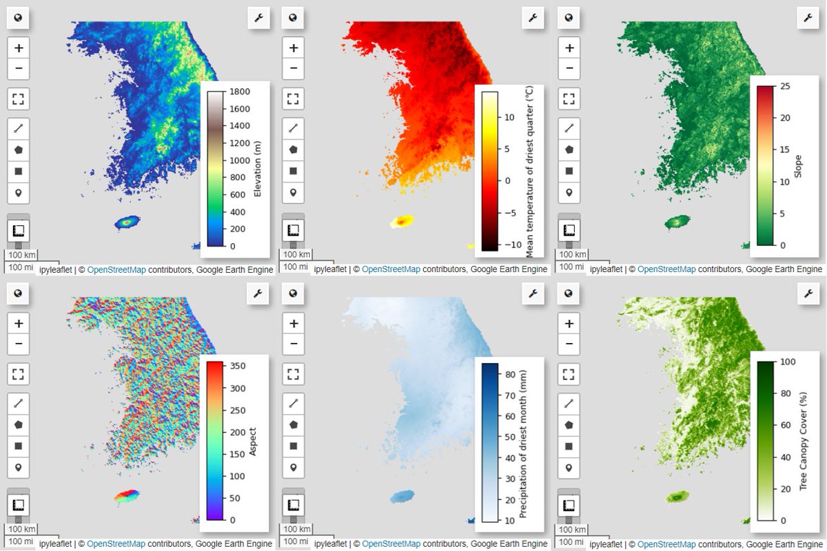
New #EarthEngine tutorial from the developer community just published – a workflow on species distribution modeling 🐦🦋🐯🏞️
👉 https://t.co/8YVfJ3tJTz
#python#geemap#habitat
❗️NEW PUBLICATION❗️ Check out UN-SPIDER’s flagship publication on Space Technologies for Early Warning Systems, which includes more than 80 case studies provided by experts, industry, and governments.
Satellites can save lives. 📖 Link to publication: https://t.co/nD83j11cZZ
Join Our Team to Explore the Use of Remote Sensing, Meteorological, and Hydrological Data for #Drought & #Yield Loss Risk Assessment in Germany!
Feel free to RT!
One nice benefit of #EarthEngine's integration with @googlecloud is greater reach – we made it into their Blog! 🤩
Here's a nice summary of Earth Engine news and updates from the last 6 months 👇
https://t.co/1BOs3FoWNw
🚨 We're hiring!🚨
Senior GIS Application Developer to design and maintain the server side of our GIS web applications.
Deadline: Monday, 5 February
#Geospatial#Python#Flask#Django
https://t.co/nRq8xn1bw2
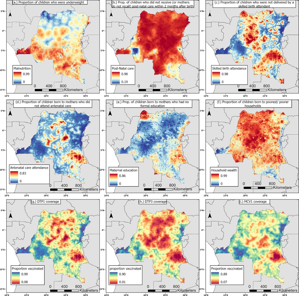
Following the recent paper on mapping zero-dose vulnerability indices (https://t.co/Fze95iWMqv) the full set of gridded risk factor & vaccination coverage datasets are now available for download: https://t.co/CeBApR9C8k
#vaccines#gis#statistics#demography#population#gavi
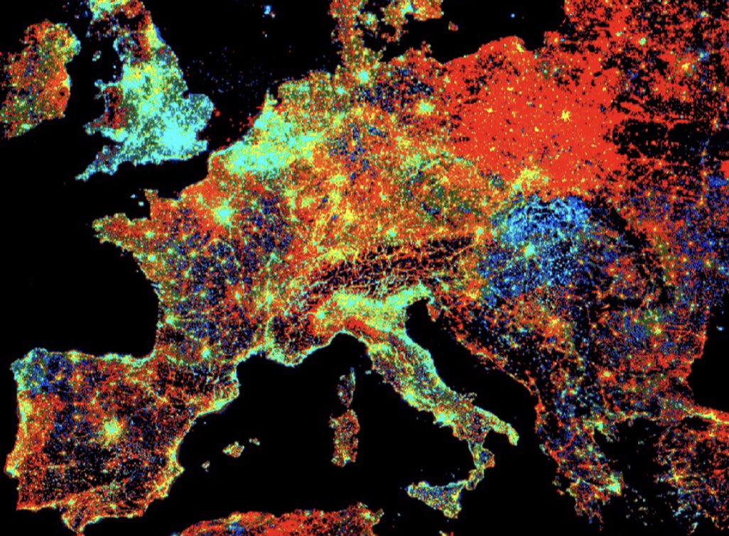
New! Detailed air quality estimates for public health research developed by Harvard researchers+released by #NASAsedac; for urban+non-urban areas of the US 2000‒2019. https://t.co/voiCG5RQi0 @columbiaclimate
The #GEE resource you have been waiting for! #GoogleEarthEngine
Cardille et al. 2022. Cloud-Based Remote Sensing with Google Earth Engine: Fundamentals and Applications.
>100 authors (well done all!)
>55 chapters, labs, >10,000 lines of code
#OpenAccess:
https://t.co/FjzEB4OByJ
🚨Hot off the press!!!🚨
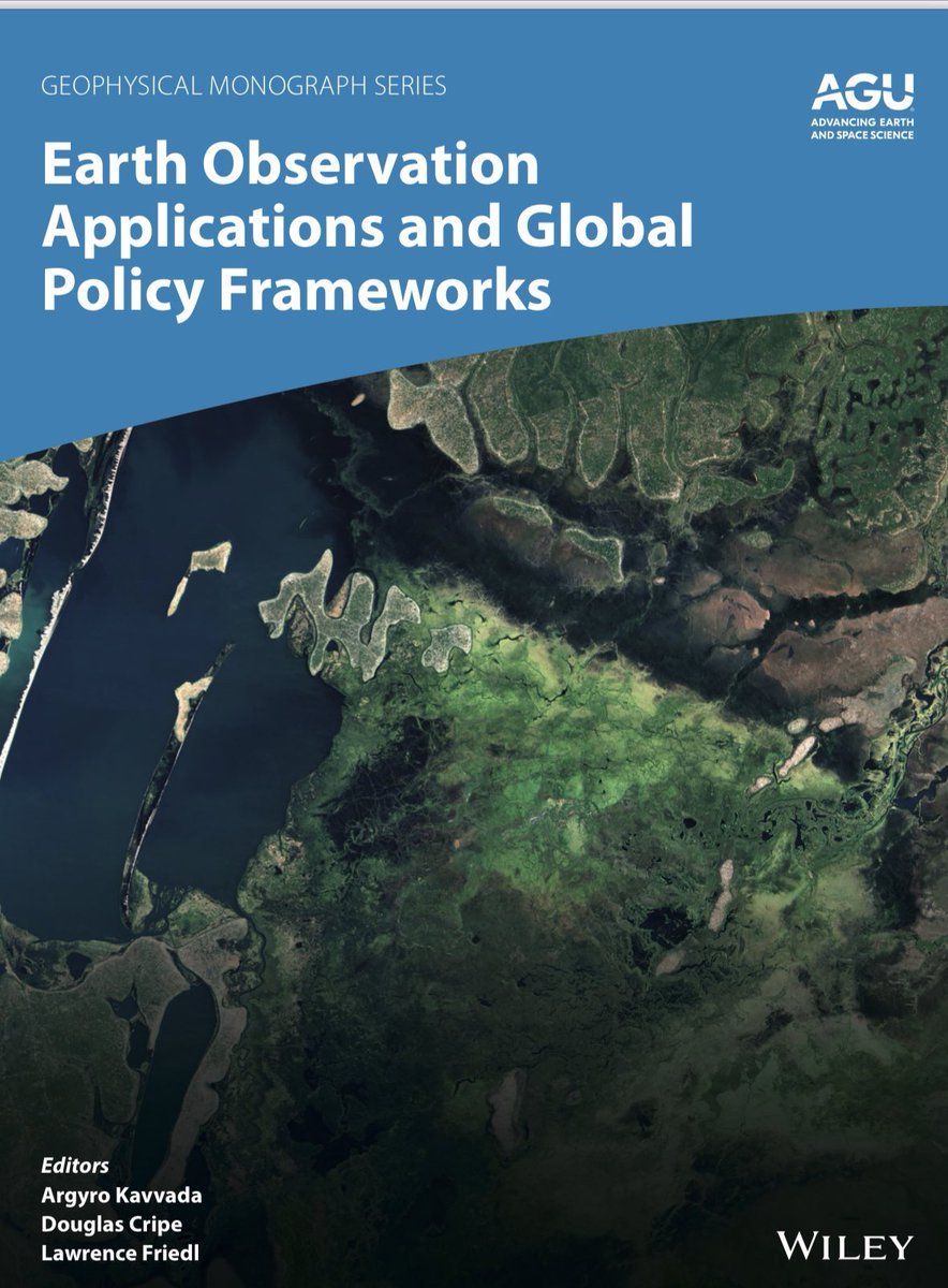
Our new @theAGU book “Earth Observations and Global Policy Frameworks” is published!👇👇👇
https://t.co/Q4L1E2FYtX
Super proud to have led this effort, working closely with 30+ interagency & international colleagues!
#eochat#ClimateAction#SDGs#DRR
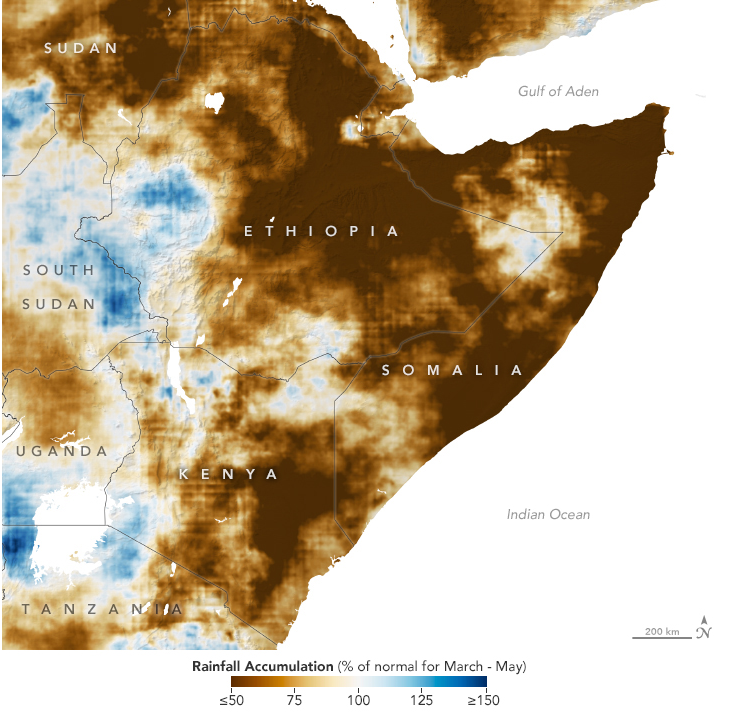
Modeling from @climatehazards and @FEWSNET shows "an unprecedented sequence of four dry seasons, capped by a driest-on-record March-April-May 2022 season, will very likely be followed by even-more-unprecedented rainfall deficits in late 2022."
https://t.co/Gm7dwgDNWP
🔴 Interested in helping us create a free textbook📗 for remote sensing courses? Find more information here ➡️ https://t.co/WU9OHgsqH0 #RemoteSensing#Education#scicomm
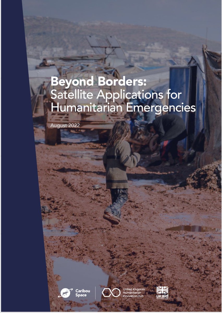
Satellite applications can provide environmental and situational data for more timely decision-making in humanitarian emergencies, increasing the chance of saving lives. Checkout this new report from @caribou_space here https://t.co/3aRaO0nnLi
A very interesting free online course by @nvidia:
https://t.co/T232EenRmi
A deep dive into #flood monitoring with #DeepLearning for people with existing knowledge in #python3.
Great to see that #EarthObservation is gaining more and more traction.
Just in time for #Landsat50, the #EarthEngine data team has finished ingesting MSS Collection 2. With these data, all of #Landsat Collection 2 is available (MSS, TM, ETM+, OLI, OLI-2).
https://t.co/WqNXTSmJw8