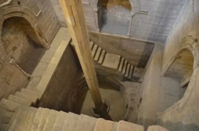
Ancient Egypt’s economy depended on the Nilometer, a giant stone measuring device that tracked the Nile’s annual floods—helping predict harvests, famine, and floods, while also guiding how much tax farmers owed.
Ancient Egypt’s economy depended on a remarkable stone measuring device known as the Nilometer. It was used to track the Nile’s annual flood, a natural event that determined whether the coming year would bring famine, prosperity, or destructive flooding. When the water reached the ideal level, farmers could expect rich harvests; if it rose too little or too much, crops often failed.
Priests carefully recorded the river’s height, while government officials used these measurements to forecast harvests, manage grain supplies, and calculate taxes. Some Nilometers were built inside temples, reflecting the belief that the Nile’s floods were a divine gift.
For over 3,000 years, this simple instrument helped sustain one of history’s most enduring civilizations.
Existe mais de 2 milhões de pessoas que usam o Google Maps.
Mas a maioria nem imagina todo o seu verdadeiro potencial.
Aqui estão 8 funções incríveis que o Google Maps pode fazer:
@jaoseupimenta Ah, para! Estas etiquetas bestas de não tocar na comida com os dedos.
Mas pra enfiá-los noutros 'locais' sem luvas nem nada eles não pensam duas vezes, né?