Photogrammetry or LiDAR: Which mapping method fits your project?
Photogrammetry delivers high-detail, photorealistic models in open terrain, while LiDAR provides accurate point clouds through vegetation and complex surfaces.
Learn more: https://t.co/TtYeSRR3Hb
Secure. Compliant. Mission-ready.
As demand for NDAA-compliant & Blue UAS platforms grows, Volatus works with trusted manufacturers to deliver secure high-performance solutions across defense, public safety, energy & infrastructure.
Learn more: https://t.co/U4dbZMaTdf
Made in the USA, the Ascent Helius packs rugged performance into a compact coaxial design. With 30+ min endurance, 45 mph speed, & all-weather reliability, it’s built for first responders, security, & inspection.
Learn More👉 [email protected]#UAV#NanoDrone#Innovation
Every second counts in an emergency. The Centum LifeSeeker turns phones into rescue beacons, guiding teams to missing persons. Lightweight and UAV-ready, it helps SAR crews cover more ground and save lives faster.
Learn more 👉 https://t.co/NdVemRalwt
#SAR#UAV#LifeSavingTech
The Ascent Helius is an ultra-portable 249 g nano UAV, hand-launched in 30s and built for all-weather use. With a low-light 4K camera, swappable batteries, and quiet flight, it delivers situational awareness in tight spaces.
Learn More👉 [email protected]#NanoDrone#UAV
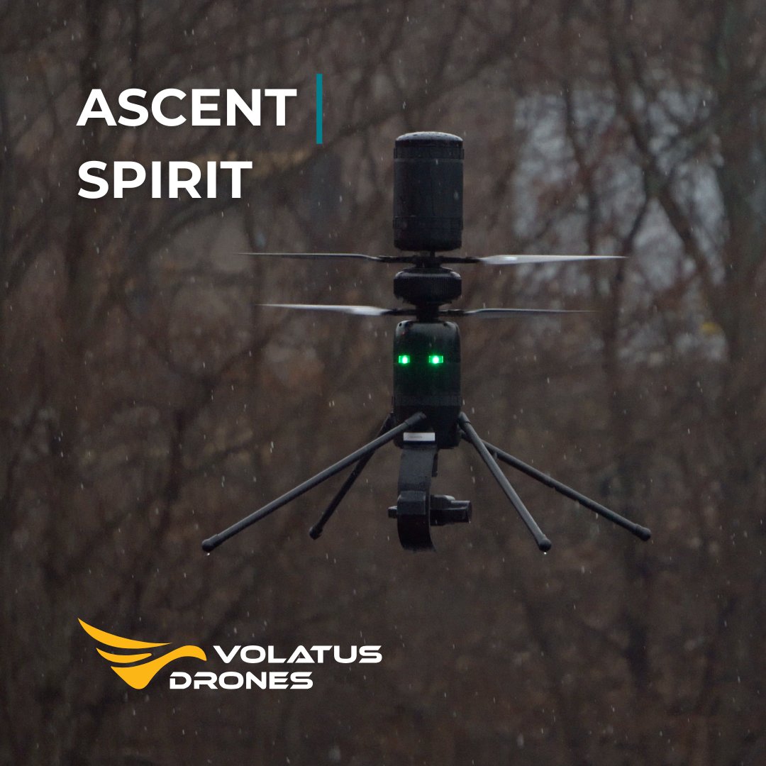
The Ascent Spirit UAV is built for demanding missions. With long endurance, modular payloads, and a rugged design that withstands extreme weather, it delivers reliable performance for SAR, public safety, and industrial inspection.
👉 https://t.co/BcaUMv057x
#UAV#PublicSafety
When time is critical, agility matters. The NETRA V4 PRO deploys fast with thermal,optical, & mapping payloads. Rugged & reliable,it’s built for demanding emergency response, inspection, & public safety missions.
👉 https://t.co/C3Rw5hEQik
#UAV#EmergencyResponse#PublicSafety
Volatus Academy’s 4-Day Advanced Drone SAR Course trains emergency teams for real-world rescue ops — with hands-on, mission-based exercises near Syracuse, NY.
Seats are limited → https://t.co/ntZg9MLjRi
#VolatusAcademy#SearchAndRescue#PublicSafety#DroneTraining
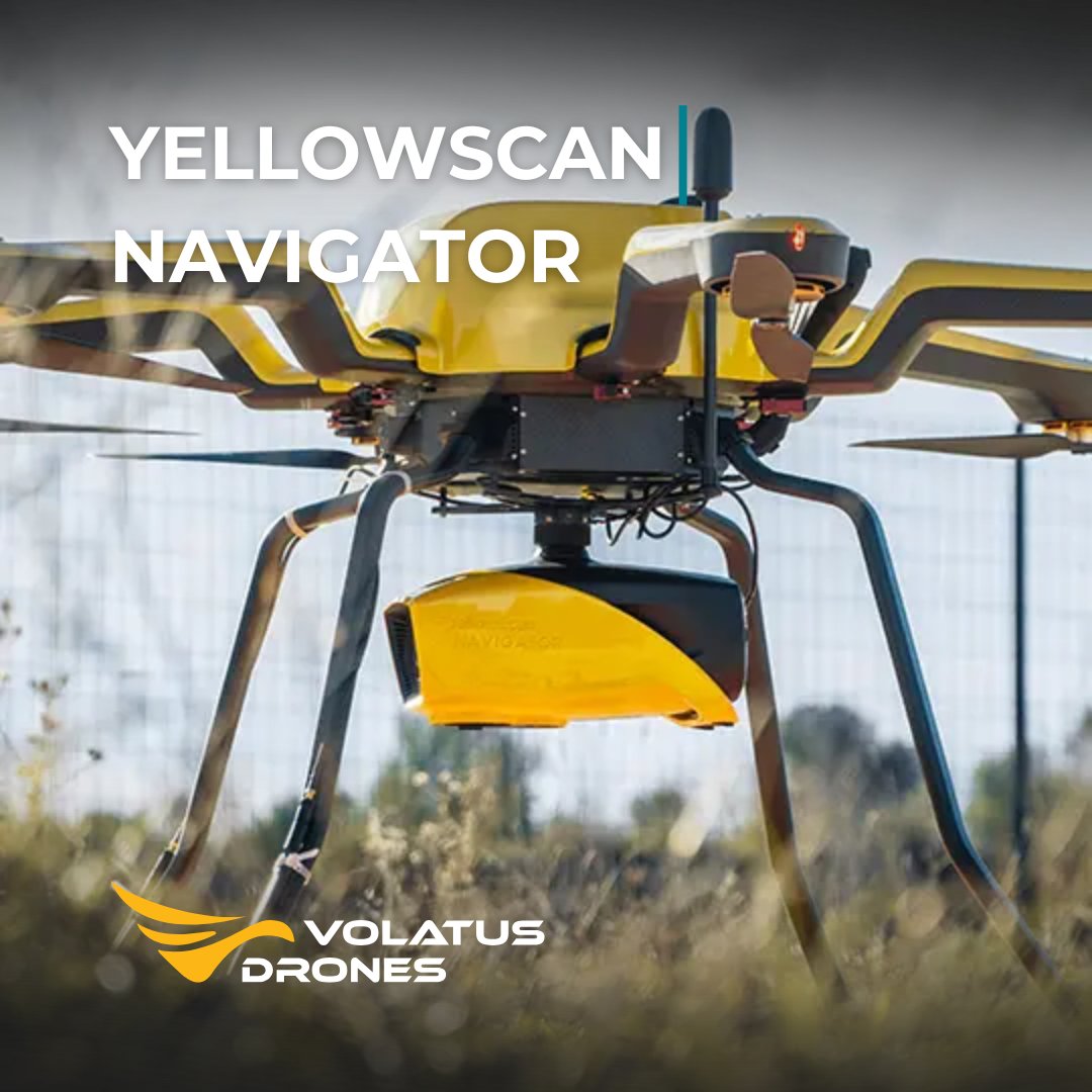
The YellowScan Navigator maps land and underwater features in a single flight. Its LiDAR system delivers precise, reliable results for surveying, environmental monitoring, and infrastructure projects.
👉 https://t.co/dGpuRBzgUZ
#UAV#LiDAR#Mapping#Innovation
The ideaForge SWITCH UAV delivers endurance and adaptability. Lightweight, rugged, and quick to set up, it supports multiple payloads for surveying, mapping, security, and more across any terrain.
Learn more here👉 https://t.co/YnGvBHWhi7
#UAV#Surveying#Mapping#Security
Your drone can do more.
Drone Mapping Fundamentals: Photogrammetry & LiDAR is now $499.
Gain survey-grade mapping skills with lessons in GNSS corrections, LiDAR capture, and mission planning.
Pre-register today → https://t.co/ADMC6npvnU
#DroneMapping#LiDAR#Photogrammetry
Night missions demand reliable tech. The Autel EVO Max 4N delivers with starlight vision, thermal, and multi-sensor imaging for clear detail in low light. Built for 24/7 operations in public safety & inspections.
👉 https://t.co/57Xp8GCXdi
#UAV#NightOps#PublicSafety
When every mission counts, the Autel EVO Max 4T XE delivers. Switch seamlessly between thermal, zoom, wide & rangefinder in one powerful payload—perfect for inspections, mapping & emergency response.
Learn more👉 https://t.co/BR6nbbNfr4
#UAV#Inspection#PublicSafety
This isn’t theory—it’s real-world SAR training.
Master drone deployment, thermal imaging & live field ops in our 4-day Advanced Drone Search & Rescue Course near Syracuse, NY.
Register 👉 https://t.co/If7R4fIvYu
#EmergencyResponse#DroneTraining#VolatusAcademy
The ideaForge NETRA V4 PRO is compact, rugged, and fast to deploy. With 90 min flight time and flexible payloads, it’s built for public safety, inspection, and surveillance in tough conditions.
Learn more here👉 https://t.co/C3Rw5hEQik
#UAV#PublicSafety#Inspection#Mapping
The YellowScan Navigator unites bathymetric & topographic LiDAR in one payload. Capture terrain + underwater data with precision for hydrographic surveys, flood monitoring & environmental studies.
Learn more here👉 https://t.co/hqY5Aiwbnm
#UAV#LiDAR#Surveying#Mapping
The Spirit UAV is compact, rugged, and mission-ready. With high payload capacity, IP56 weather protection, and resilience in strong winds, it’s built for inspection, public safety, and tactical operations.
Learn more👉 https://t.co/78iXy7D8IO
#UAV#PublicSafety#Innovation
The LifeSeeker turns phones into emergency beacons, helping SAR teams locate missing people even without network coverage. Compact, fast, and reliable, it gives rescuers the edge when every second counts.
Learn more👉 https://t.co/ToXTvclNyI
#DroneTech#SAR#UAV#LifeSavingTech
The ideaForge SWITCH UAV delivers 2+ hours of endurance with a hybrid fixed-wing VTOL design, offering wide coverage and vertical takeoff flexibility. Perfect for surveillance, mapping, and security missions.
Learn more👉 https://t.co/gMBhGhLPP7
#UAV#Surveying#PublicSafety
The EVO Max 4N is built for night ops. With a starlight camera, thermal sensor, wide cam, and laser rangefinder, it delivers clear visibility in low light for public safety, inspection, and security teams.
Learn more👉 https://t.co/okYA4A2ajd
#UAV#NightOps#Innovation