It is very unfortunate but VortUK will sadly be shutting down operations as of today it has been a great run thank you for all the support.
Oscar Hayter - CEO and Founder of VortUK
As #StormÉowyn is approaching, the team at vortuk has set up a fundraiser to help people affected by this upcoming storm. Any donation will help! https://t.co/GXUSoeKkw0
STATUS RED RAIN WARNINGS ISSUED BY MET ÉIREANN!
These warnings have been issued just now for Cork and Galway. We might see historic flooding in those areas. Begin preparations ASAP and those preparations should be rushed to completion by tonight.
#StormBert
Status Yellow Rainfall Warning
Areas: Leinster, Ulster and Connaught
Timing 6pm today to 12pm tomorrow Comments: Storm Bert will bring in a spell of heavy rain tonight and Tomorrow.
#stormBert#rainfall#irelandweather
Status Orange rainfall warning
Areas: Cork and Kerry
Timing: 6pm today- 10am tomorrow
Comments: #stormBert will bring in a spell of very heavy rain overnight tonight and tomorrow morning. Up to 60 millimetre’s possible.
Good Morning everyone,
We at VortUK have decided to Name tomorrow’s storm (#stormBert) storm Cathal our 3rd named storm of the season.
Main risk I would say is Torrential rainfall overnight tonight and tomorrow morning with some strong winds as well.
Stay tuned for warnings
Check with your local transport providers for the latest updates.
Emergency Services: Local authorities are responding to reports of flooding and downed trees. If you see emergency vehicles, give them space to operate.
Road Conditions: Many roads in western counties, particularly Kerry and Mayo, are experiencing closures due to flooding and debris. Drivers are advised to avoid unnecessary travel.
Public Transport: Disruptions reported on several train and bus services across the affected areas.
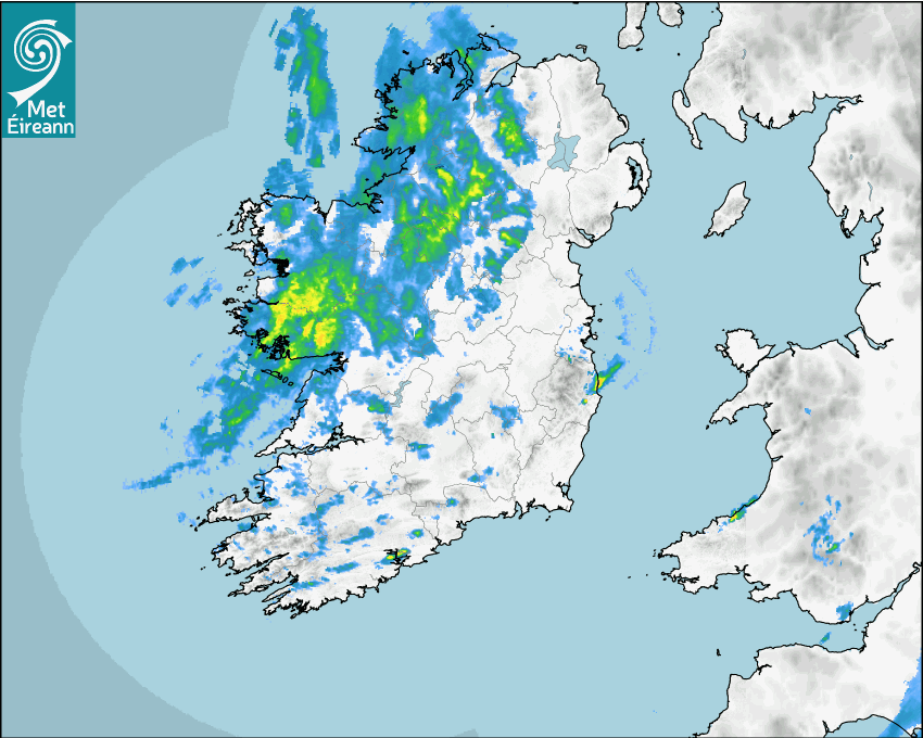
Radar Update:
Rain is moving into Connaught and Ulster making it very difficult with winds up to 130km/h in some places in Galway.
Stay Safe out there!
#StormAshley
🌪#StormAshley - Top Wind Gust Update (1 PM) 🌪
As we continue to monitor Storm Ashley, here are the highest recorded wind gusts so far:
Mace Head,Mayo Sustained: 90km/h gust: 130km/h
Belmullet,Mayo Sustained: 79km/h Gust: 112km/h
Valentia,Kerry Sustained: 65km/h Gust 108km/h
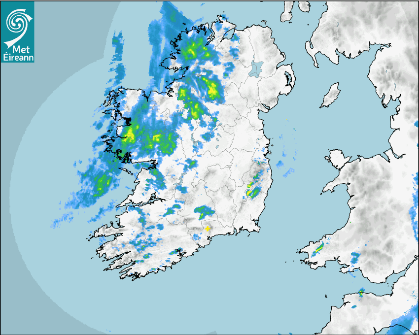
Radar Update:
Not a lot rainfall thankfully just some rain in Connaught main threat is wind.
Stay Safe and keep up to date with latest Information
#StormAshley
⚠️ Stay safe, avoid non-essential travel in affected areas, and keep following for live updates throughout the day.
More updates coming soon as the storm evolves! 🌬️💨
#StormAshley#IrelandWeather#WindWarnings#WeatherUpdates
🌪 Storm Ashley - Midday Update (12 PM) 🌪
The second phase of Storm Ashley is in full swing now, with 🟠 Orange Wind Warnings for counties Kerry, Limerick, Clare, Galway, Mayo, Sligo, Leitrim, and Donegal. Winds have significantly intensified across those regions.
Rest of Ireland: 🟡 Yellow Wind Warning remains active, with gusts around 80-100 km/h in many regions.
Impacts so far:
Coastal roads affected by debris and high winds
Power outages across the country.
Disruption to ferry services and exposed roads.
🌪 Storm Ashley - Overnight Update 🌪
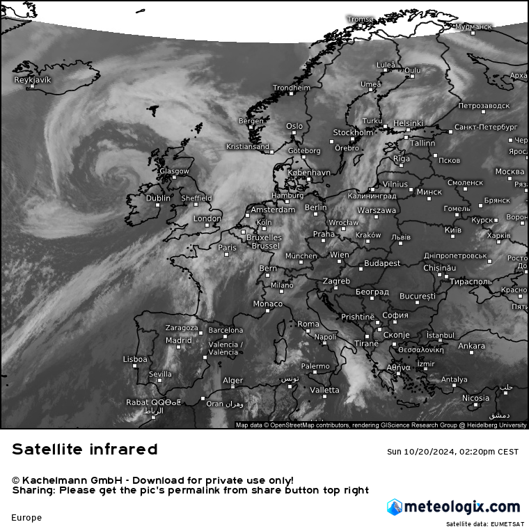
The first phase of Storm Ashley brought intense conditions overnight, particularly across western and southern parts of Ireland. Here’s a breakdown of the key developments
Thankfully, the strongest winds eased after 3 AM, but this storm is far from over.
The second phase of Storm Ashley will hit later this morning with 🟠 Orange Wind Warnings in place for counties Kerry, Limerick, Clare, Galway, Mayo, Sligo, Leitrim, and Donegal.
🌪 LIVE STORM COVERAGE 🌪
I’m now LIVE covering Storm Ashley! 🚨 Stay tuned for real-time updates, wind warnings, and expert analysis as the storm unfolds.
⚠️ Current Warnings:🟡 Yellow Wind Warning for all of Ireland (until 3 AM, Monday) 🟠 Orange Wind Warning for parts of Kerry, Limerick, Clare, Galway, Mayo, Sligo, Leitrim, and Donegal (10 AM - 9 PM Sunday)