Here's are the peak winds as of Noon today. This shows a typical Santa Ana wind profile where the strongest winds stretch from the Highway 14 corridor in the LA County mtns southwest through the western San Fernando Valley, and eastern and central Ventura County. #CAwx#LAWind
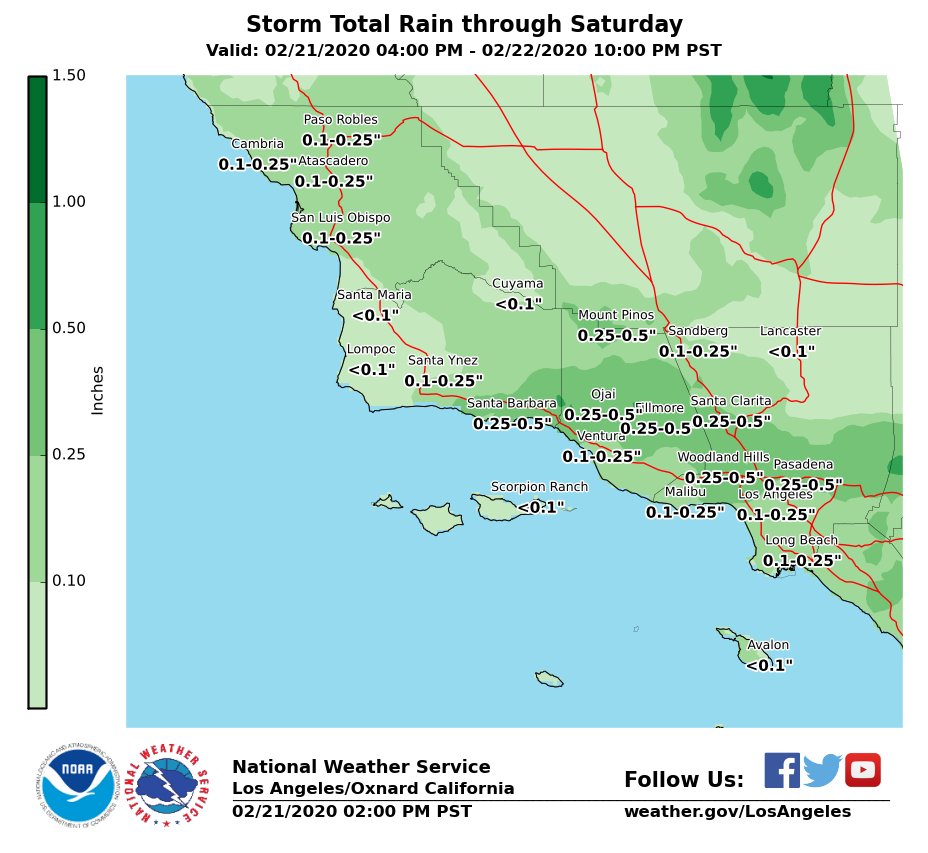
Here are latest rainfall projections for upcoming storm system. Most areas expected to receive between 0.10-0.50" with locally higher amounts possible near heavier showers or thunderstorms. #LAWeather#LArain#cawx#Socal
What a difference a year makes! Left: 2019, Right: 2020. Sierra snow pack is below normal for this time of year, at about 58% statewide. Dry weather is expected to continue. #CAwx
🌾Although we had a wet start to our winter, 2020 has been very dry. We are not expecting that to change in the next two weeks, so if we don't receive any more rain in Feb, many of these locations will be nearing the driest combined Jan/Feb on record. #LArain#cawx#CArainfall
The 8 to 14 day precipitation outlook (February 18-24, 2020) from the NOAA NWS Climate Prediction Center favors below-normal precipitation across California.
#LArain#LAweather#SoCal#CAwx
@NWS celebrates its 150th Birthday today! Few Federal agencies have been in existence as long; even fewer with one enduring mission. Our heritage provides the context for where we are today and provides inspiration for the future. Learn more: https://t.co/fsbTjRG2wx #NWS150#OTD
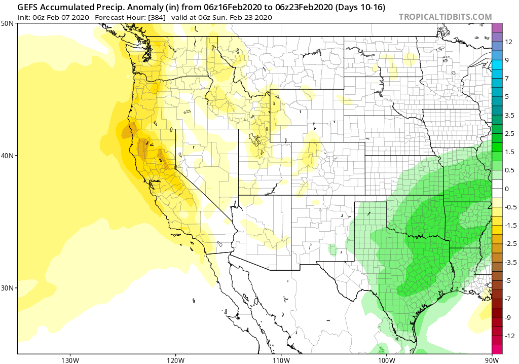
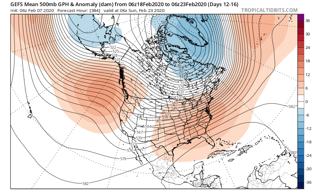
Outside of the chance of scattered showers in parts of SoCal this weekend, conditions look quite dry for California over the next 2+ weeks. In fact, a strong & persistent North Pacific ridge may keep conditions much drier than average along the entire West Coast... #CAwx#ORwx
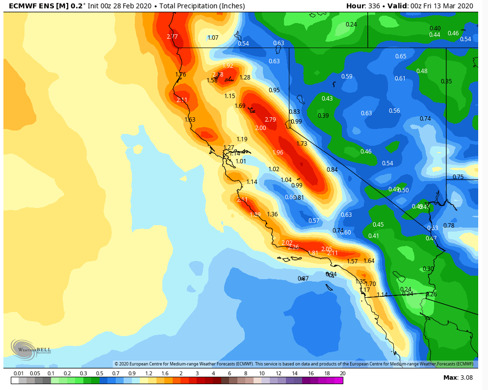
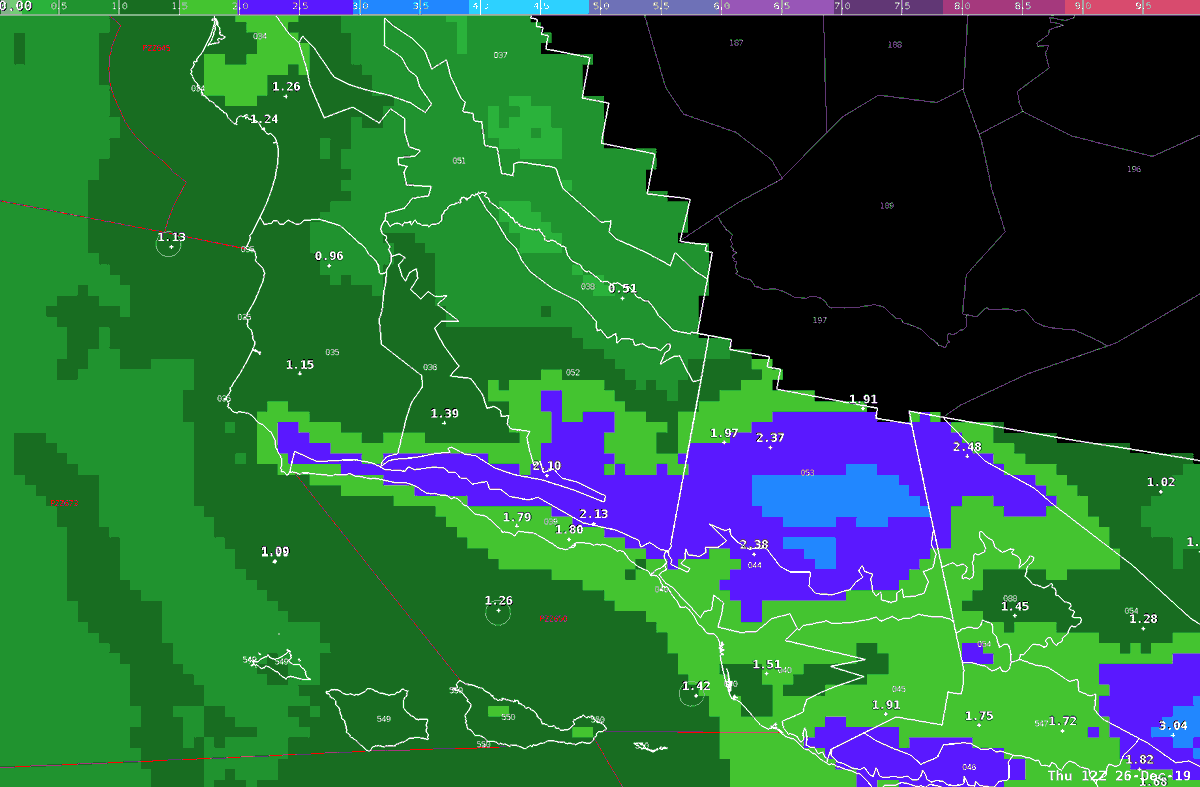
Latest precipitation forecast for the storm tonight. Close to 2" most areas south of Pt Conception. Up to 4" in foothills and mountains. Very heavy rain tonight. Snow levels around 3000' with a foot of snow possible on the higher peaks. #SBweather#VTUweather#cawx#SBrain
Latest precipitation forecast for the storm tonight into Thursday. Close to 2" most areas south of Pt Conception. Up to 4" in foothills and mountains. Very heavy rain tonight. Snow levels around 3000' with a foot of snow possible on the higher peaks.
The interactive map enables residents to type in their address to learn if they are in an area that could be affected by flooding or debris from the Cave Fire watershed above them. https://t.co/8HWyyp5m1s
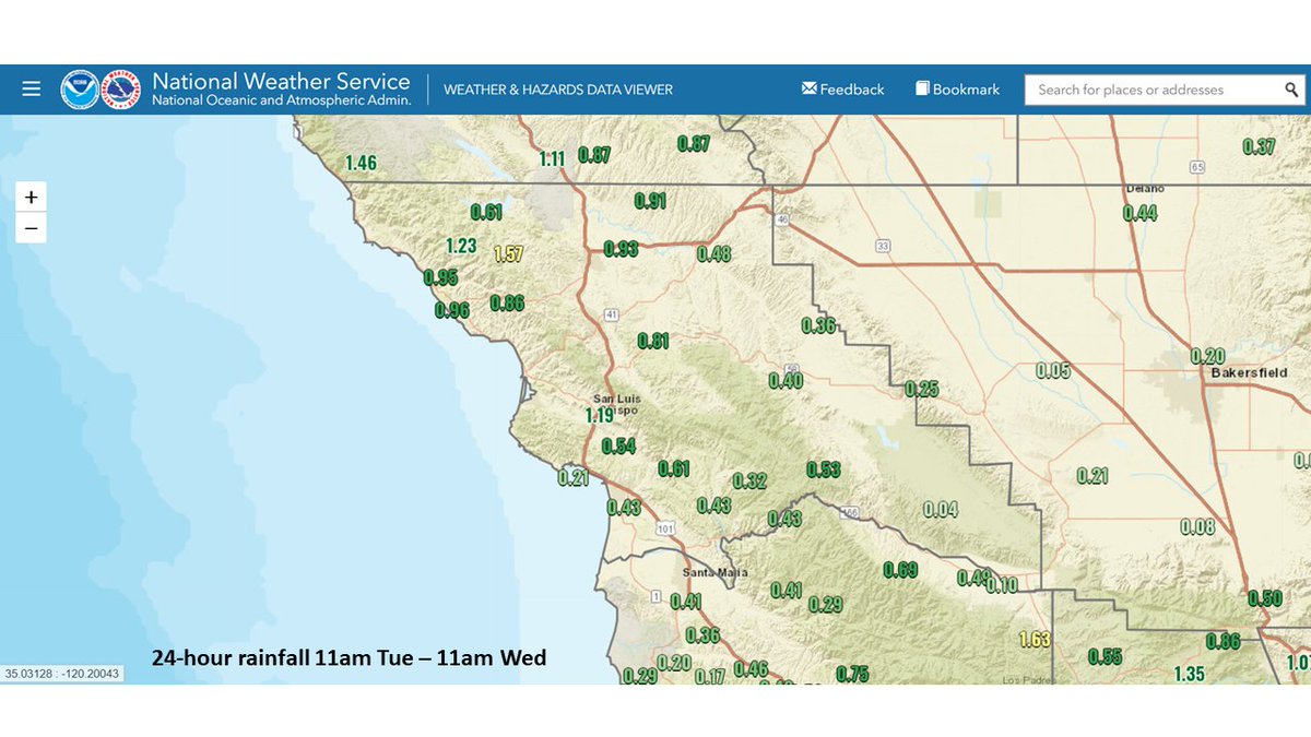
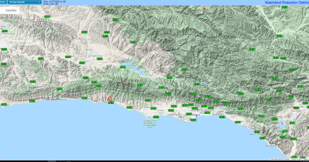
Here are rain gauge measurements of today's rainfall across southwest CA through 11am. Many areas received 1 inch, but less than 0.5 inch in western #SBACounty. Peak amounts 2-2.5 inches in the mountains. Additional showers are expected thru the afternoon. #LArain#CAwx
Even though the majority of the Western US had a cooler than normal October, our forecast area was actually warmer than normal, especially along the coast! The Santa Ana winds really had a strong grip last month! #SoCal#CAwx
Models continue to trend warm and dry through the long term forecast. It's becoming unlikely that we'll see any substantial rain until at least the middle of November. #CAwx
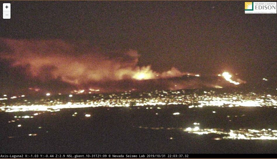
The #MariaFire from the air. Continues to burn in the hills along Hwy 126 in Santa Paula and the old 118 behind Camarillo in Somis and Saticoy.
•8,730 acres
•0% contained
•2 structures lost
•1800 homes remain under threat
•7500 people evacuated