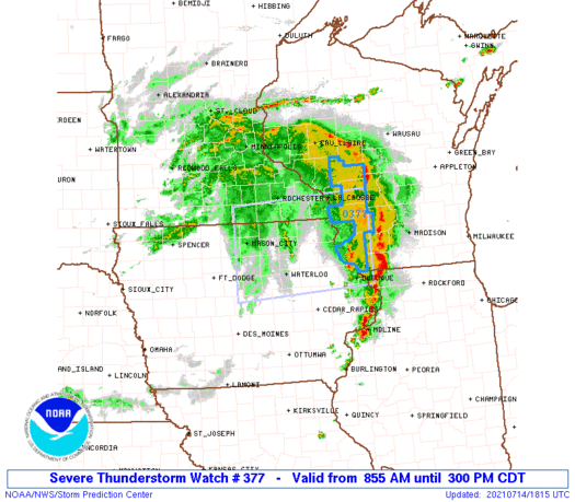
SPC Outlook for tomorrow: SLGT risk of severe thunderstorms for Illinois, Indiana, and Michigan. Summary: Damaging winds, as well as isolated large hail and a tornado or two, will be possible Tuesday afternoon/evening
Sunsets & supercells...this was the second of two supercells that traversed northwest SD last week, & this one meant business. As it dropped southeast, it gained speed - at the time of this pic, it was probably moving at about 40mph.
Faith, SD - 7.8.21
#sdwx#StormHour
The @NWSSPC has issued a Severe Thunderstorm Watch
* Primary threats include...
Scattered damaging wind gusts to 70 mph likely
Scattered large hail and isolated very large hail events to 2
inches in diameter possible
A tornado or two possible
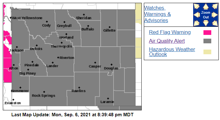
A red flag warning is in effect for much of eastern Washington - meaning conditions are ripe for rapid fire spread. Heed all burn bans and restrictions and avoid activities that create sparks. 🚩
Here is a video of a fire whirl from the #TennantFire on June 29th. After a survey from the IMET, this was likely the rotation our radar was picking up on the 29th. Credit to the US Forest Service for taking this video. #CAwx#fire#fireseason
Know folks in Dallas?
Morning forecasts were comparatively tepid. Now, rapidly-evolving conditions suggest large hailstorms will be present somewhere across the Metroplex this evening.
Keep in mind Ft. Worth saw a wicked hailstorm on April 28 – last Wednesday.
This has to be one of the most impressive debris signatures I've seen.
Enormous mass of debris carried 4 miles high – more than 20,000 feet. Significant debris signature on radar.
I wouldn't be surprised if peak winds in #Jonesboro or #Brookland exceeded 170 mph.
Unreal up close footage from Said Said in Jonesboro. He owns the Triple S Phones shop and stated the tornado came VERY quick.
Scary footage. I can’t imagine. @ReedTimmerAccu@JimCantore#arwx
This GOES-RGB product allows us to monitor convective development during the day.
This is crucial since colors change as cumulus clouds become cumulonimbus clouds (i.e., as the clouds are developing more ice particles).