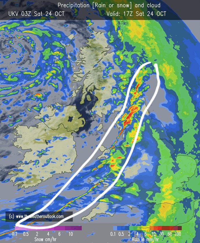
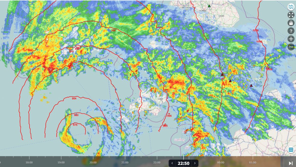
Today, 31st October, marks the 5th anniversary of the Halloween mesolow which carved a path of wind damage from Dorset to Lincolnshire, including as many as 14 possible tornadoes.
A summary of the event was published in the @RMetS journal "Weather": https://t.co/I7bP06dzfj
A weak tornado affected Portchester, Hampshire, just after midnight on 23 October, with a 1.6 km land track. It was associated with heavy showers that moved inland from the Channel, linked to Storm Austen. More details to follow after the analysis has concluded.
Hello,
We have seen a few reports of particularly intense, damaging winds, which occurred around midnight in Portchester and Gosport. If you have any information, including any photos of damage, we would like to hear from you.
https://t.co/4zfGQ5jp8B
~ Sarah
La tempête Austen se rapproche & poursuit son développement, avec des signes de creusement explosif. À l’entrée de la Manche (au large de la péninsule de Penwith🇬🇧), la station de Seven Stones enregistre une chute brutale de -16.4 hPa en seulement 6h. Le système arrive.
Centre of #StormAusten now evident as a circulation on rainfall radar from https://t.co/jdtDFLHhwh WSW of Cornwall, gust of 67mph recently at St Mary's on the Isles of Scilly
#StormAusten's strongest gusts along its southwestern flank will affect SW England and Wales soon, with gusts of 55-65 mph in places, locally 75-85 mph across exposed coasts and hills.
https://t.co/SQTGy3VdOh
Storm Austen’s cold front moves NNE this evening and overnight, with possible convective activity/lightning associated with it. Squally gusts possible over S Wales, S England, S Mids & E Anglia. A tornado or two can’t be ruled out, esp. S England, S Wales & Channel Islands.
Paul.
We are still looking at all the evidence and how this may tie into the wider picture of events; we encourage you to continue to send in reports to TORRO about any damage or what you may have seen.
You can do so at the link below:
https://t.co/4zfGQ5iRj3
~Jamie
We have been sent this incredible footage by Lisa Camp that appears to show a waterspout arriving on the seafront in Walton-on-the-Naze, Essex on Sunday (18th October) with several small vortices at the surface, all spinning anticlockwise inside one shared inflow.
Currently about 100-150 miles separating the tracks of #StormAusten between moving ENE along the English Channel or the Bristol Channel / M4 . Its 107 miles from St David's Head to St Michael's Mount. Almost impossible until Tomorrow late in the day to have a definate idea of exactly where this Storm is going. 06Z French ARPEGE and ICON have nudged a little further north with more of the SW of England at risk of damaging gusts.
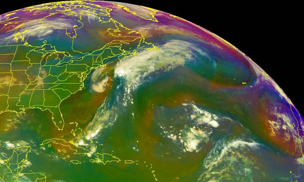
Our embryonic Storm is now just starting to develop to the SE of Newfoundland, and the Orange area to the North of the white cloud over Eastern Labrador is the upper trough which will skate east over the Atlantic and engage the Low. Above all of this sits a powerful 140 Knt Jet Stream.
The pieces are beginning to come together .......
The Met Office has issued a yellow wind warning for Friday across SW England, S Wales and parts of SE England.
Gusts of 50- 60 mph are possible, locally 70 mph.
This is footage from Walton Pier, kindly sent to TORRO by Shane Swan this morning from yesterday's event. We are still working to confirm exactly what may have occurred, but the last two clips could show the track of a waterspout that may have made landfall around 11:40 BST.
We have seen reports of wind damage in Frinton-on-Sea, Essex that appears to have occurred around 11:45 BST today with reported damage to roofs and trees.
Please do get in touch if you have any further reports, either below this post or through the form on our website.
Less than a week to go until the TORRO Autumn Conference 2026, Saturday 17th October at Oxford Brookes University — there are still some tickets available, more details on our website!
https://t.co/LxmuzvceoD
The northern lights are possible tonight and tomorrow night, cloud dependent
Weaker tonight, so most likely seen across Scotland
Then strengthen again on Monday night and could be seen further south into central areas
Long-exposure photos may capture them further south 📸