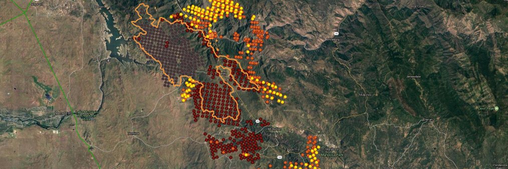
See fire spread thru GOES, VIIRS and MODIS NASA sensors. Wind speed and direction from NOAA. Red GOES polygons display detections from last hour. Pure data, simple cartography.
https://t.co/2NoChGK4V7
#MauiFires
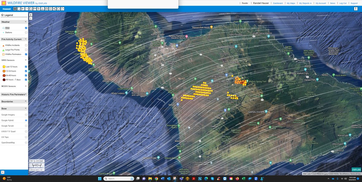
Predict fire spread thru GOES, VIIRS and MODIS NASA sensor feeds plus wind speed and direction from NOAA. Red GOES polygons display detections from last hour ahead of other sensors. Pure data and accurate, simple cartography.
https://t.co/RfUWMGJp7J
#CedarCreekFire
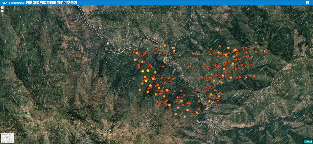
Predict fire spread thru GOES, VIIRS and MODIS NASA sensor feeds plus wind speed and direction from NOAA. Red GOES polygons display detections from last hour ahead of other sensors. Pure data and accurate, simple cartography. https://t.co/UefMgat6A6
#rumcreekfire
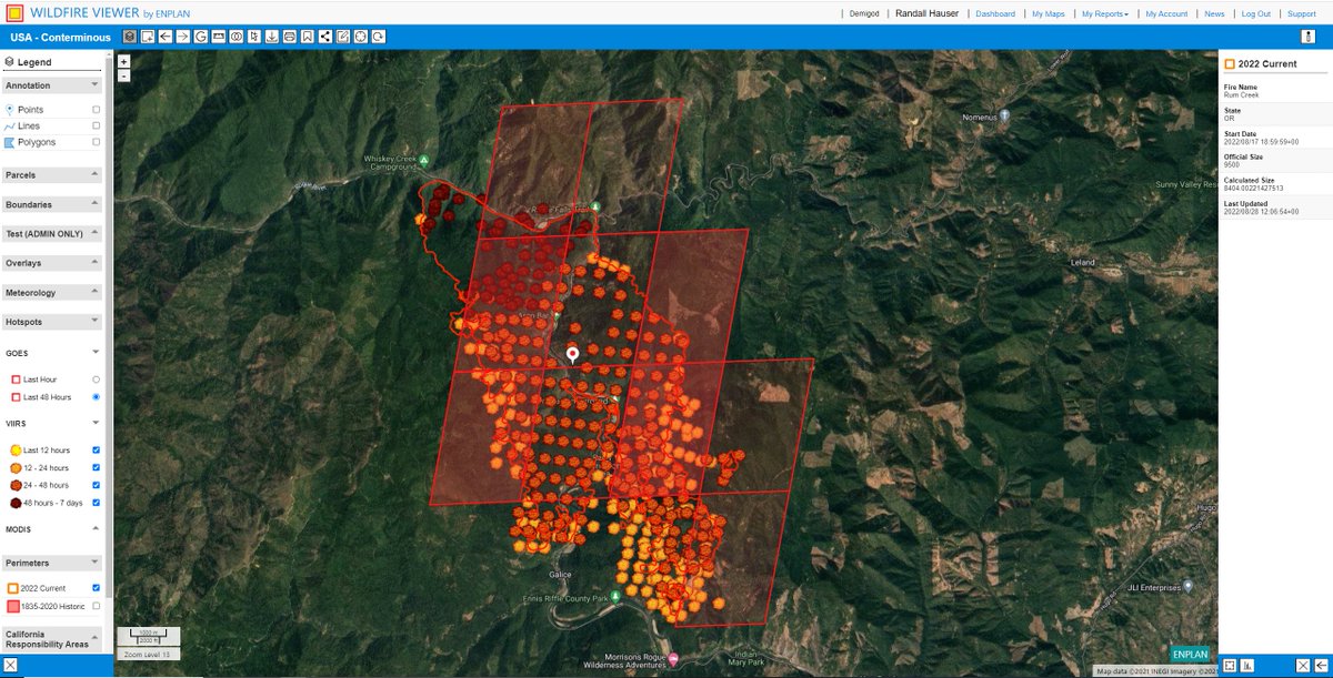
Predict fire spread thru GOES, VIIRS and MODIS NASA sensor feeds plus wind speed and direction from NOAA. Red GOES polygons display detections from last hour ahead of other sensors. Pure data and accurate, simple cartography.
https://t.co/Mgpv3csZli
#SixRiversLightningComplex
Try Purple Air for recent and possibly current wind direction assessment. https://t.co/hCSKRLMcB8
WV for fire progression: https://t.co/pVdxcgXrQF
#McKinneyFire
Link to WV :https://t.co/pVdxcgXrQF
Track using the GOES and MODIS sensors. VIIRS still down. Wind uses the NOAA default model ECMWF. Other models show different directions. On the ground smoke is moving north, I would go with that.
#McKinneyFire