1-9 Dec 2025
Accumulated Precipitation
Both percentage of the LTA for the whole month, or as a percentage of the first 9 days.
Either way a generally wet start to Dec.
#ukweather
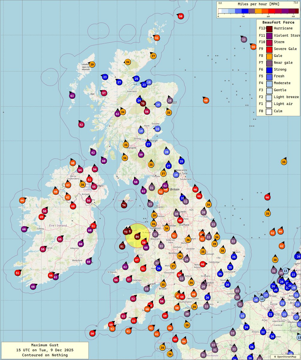
9 Dec 2025
15 UTC
Surface analysis
Apologies for the contouring over the NW.
Desperately in need of a background field.
A Shapiro-Keyser Cyclone 🤔
#ukweather#stormbram
10 Dec 2025
00 UTC
UKV Global
T+12
I found a forecast gust of 109 mph close to Bidein a'Ghlas Thuill at 528 M.
I wonder what winds will be like on the top (1062 M) 🤔
#ukweather#stormbram
10 Dec 2025
00 UTC
UKV Global
T+12
95 mph gusts close to Cape Wrath.
Now what did we do with all those weather stations at the lighthouses?
Close it.
Just like the ones at Fraserburgh & Butt of Lewis.
#ukweather#stormbram@metoffice
@metoffice As usual the Met Office show an animation that clearly shows forecast wind speeds of 90-99 mph across NW Sutherland & then directly contradict it by saying 'where gusts could reach up to 90 mph'.🤔
#ukweather#stormbram
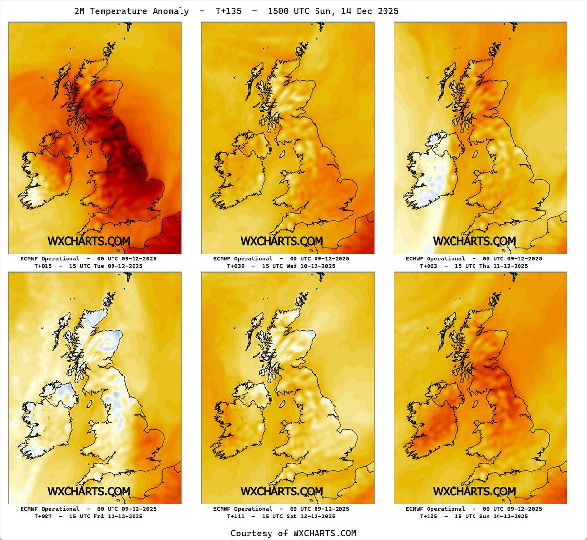
9 Dec 2025
12 UTC
Temps & Anomalies
Exceptionally mild with temps of 15°C within the warm sector.
Anomaly wise that's 6 to 9 degrees above the LTA for 12 UTC.
#ukweather#stormbram
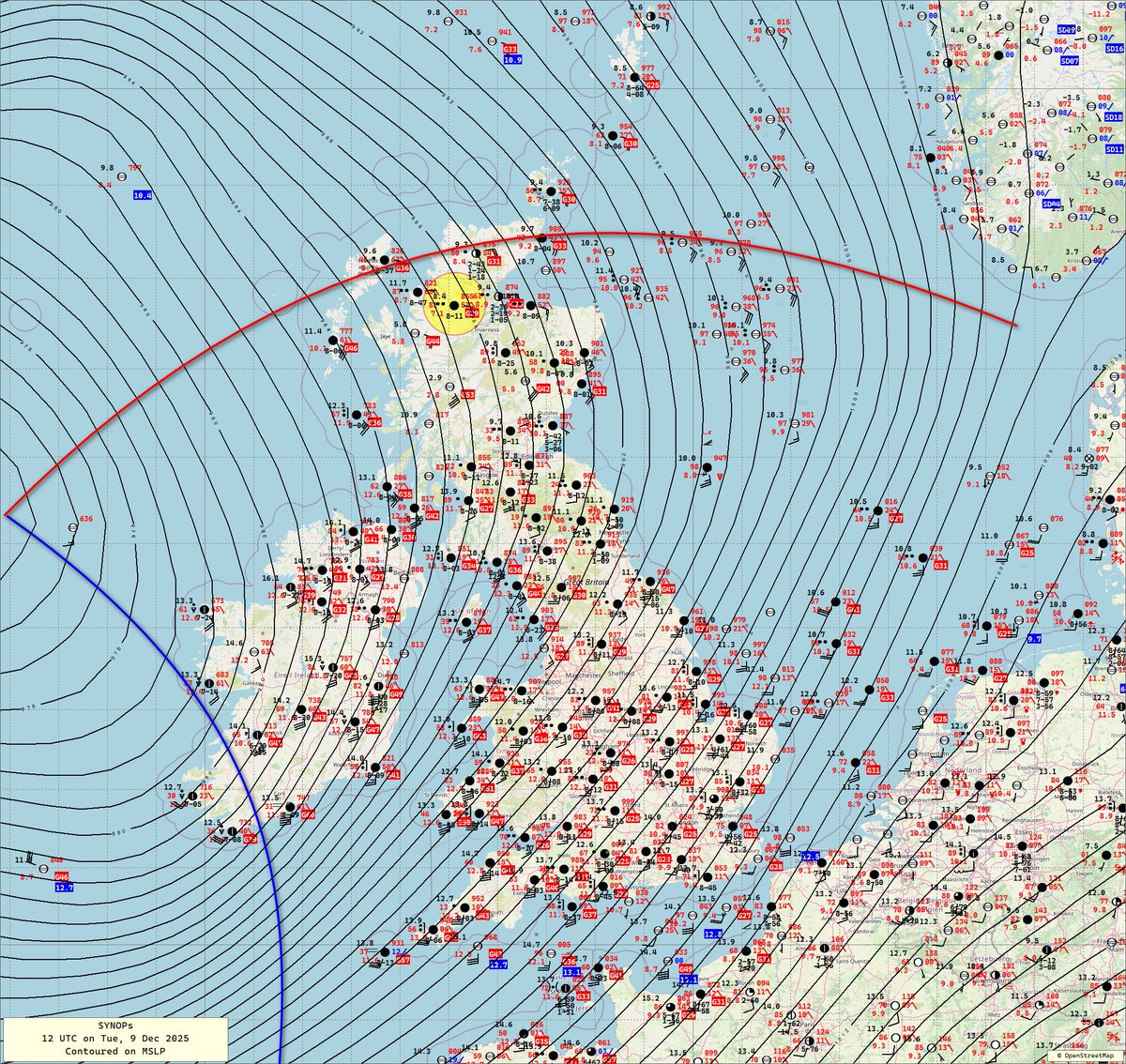
9 Dec 2025
12 UTC
Surface analysis
Cold front into the SW of Ireland
Don't take the contouring too literally to the W of Ireland the low is more elongated N-S.
#ukweather#stormbram
9 Dec 2025
09 UTC
Surface analysis
Cold front closing in on Valentia.
Gusts to 66 mph at St Mary's.
Add to add a few bogus obs to this chart...
I'm missing the background MSLP field I got from https://t.co/7KlUbhPqGd
#ukweather#stormbram
10 Dec 2025
00 UTC
T+24
Peak Wind Gusts (6hr)
Not too dissimilar to yesterdays 12 UTC run.
Gusts >80kts this evening in all models apart from GFS.
#ukweather#stormbram